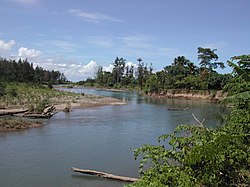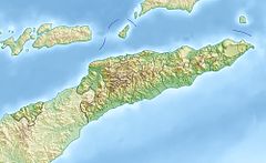
Lake Chad is an endorheic freshwater lake located at the junction of four countries: Nigeria, Niger, Chad, and Cameroon in western and central Africa respectively, with a catchment area in excess of 1,000,000 km2 (390,000 sq mi). It is an important wetland ecosystem in West-Central Africa. The lakeside is rich in reeds and swamps, and the plain along the lake is fertile, making it an important irrigated agricultural area. The lake is rich in aquatic resources and is one of the important freshwater fish producing areas in Africa.
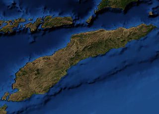
East Timor includes the mountainous eastern half of Timor, the Ocussi-Ambeno region on the northwest portion of the island of Timor, and the islands of Atauro and Jaco. The country is located northwest of Australia in the Lesser Sunda Islands at the eastern end of the Indonesian Archipelago. 'Timor' is a Portuguese derivation of 'Timor', the Malay word for "Orient"; the island of Timor is part of the Malay Archipelago and is the largest and easternmost of the Lesser Sunda Islands. East Timor is the only Asian nation to lie entirely within the Southern Hemisphere. The Loes River is the longest with a length of 80 km (50 mi). This river system covers an area of 2,184 km2 (843 sq mi). It is a small country with a land size of 14,919 km2 (5,760 sq mi). The exclusive economic zone is 70,326 km2 (27,153 sq mi).

Lautém is one of the municipalities of East Timor, at the eastern end of the country. It has a population of 64,135 and an area of 1,813 km2. Its capital is Lospalos, which lies 248 km east of the national capital, Dili.

The Rokel River is the largest river in the Republic of Sierra Leone in West Africa. The river basin measures 10,622 km2 (4,101 sq mi) in size, with the drainage divided by the Gbengbe and Kabala hills and the Sula Mountains. The estuary which extends over an area of 2,950 km2 (1,140 sq mi) became a Ramsar wetland site of importance in 1999.

The Peel-Harvey Estuarine System is a natural estuarine system that lies roughly parallel to the coast of Western Australia and south of the town of Mandurah.
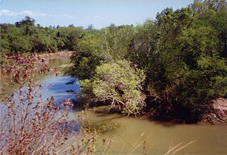
The Seiçal River is a major river in northeastern East Timor. It flows for the most part in a northerly direction from headwaters in Timor's central mountains; after running past the eastern edge of the Baucau Plateau, it discharges into Wetar Strait.

The Loes River is a river in East Timor and one of the few perennial rivers in its north. It combines with its tributaries to make up the country's largest river system, and its catchment or drainage basin extends into the province of East Nusa Tenggara in Indonesia.
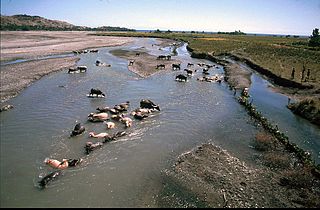
The North Laclo River is the longest river in East Timor. It flows northeast into Wetar Strait, reaching the coast near the city of Manatuto. It has no connection to the South Laclo River, which flows into the Timor Sea.

The Caraulun River is a river in East Timor. It flows for the most part in a southerly direction, forms the southern part of the border between Ainaro and Manufahi municipalities, and discharges into the Timor Sea.

The Sahen River is a river in East Timor. It originates in central Manatuto municipality, flows in a mostly southerly direction, and then discharges into the Timor Sea at the southern tip of the border between Manatuto and Manufahi municipalities.
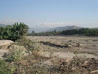
The Comoro River is a river in East Timor. It flows north into Ombai Strait, reaching the coast in the north western suburbs of the capital, Dili. In its lower reaches, it is the main and largest of Dili's four major rivers.

The Tono River is the principal river of Oecusse, an exclave of East Timor. The river and its major tributaries flow generally north, through the centre of the exclave, into the Savu Sea, reaching the sea near Lifau. Its alluvial flood plain in Pante Macassar administrative post is the main rice-producing place in Oecusse.
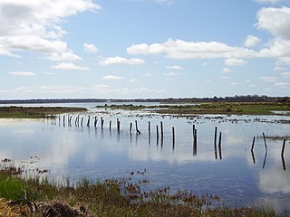
The Vasse-Wonnerup Estuary is an estuary in the South West region of Western Australia close to the town of Busselton. The estuary is listed with DIWA. It was also recognised as a wetland of international importance under the Ramsar Convention on 7 June 1990 when an area of 1,115 ha was designated Ramsar Site 484 as an important dry-season habitat for waterbirds. It is also the main part of the 2,038 ha (5,040-acre) Busselton Wetlands Important Bird Area.
Global mangrove distributions have fluctuated throughout human and geological history. The area covered by mangroves is influenced by a complex interaction between land position, rainfall hydrology, sea level, sedimentation, subsidence, storms and pest-predator relationships). In the last 50 years, human activities have strongly affected mangrove distributions, resulting in declines or expansions of worldwide mangrove area. Mangroves provide several important ecological services including coastal stabilization, juvenile fish habitats, and the filtration of sediment and nutrients). Mangrove loss has important implications for coastal ecological systems and human communities are dependent on healthy mangrove ecosystems. This article presents an overview of global mangrove forest biome trends in mangrove ecoregions distribution, as well as the cause of such changes.

Lake Ira Lalaro is a freshwater lake in Mehara, Subdistrict Tutuala, Lautém District, East Timor. It is the largest of the island of Timor, and thus too of the country. The lake is part of the Mount Paitchau Important Bird Area. The lake waters and that of Irasiquero River are a closed aquatic system; they lie within a huge polje. It covers between 10–55 square kilometres (3.9–21.2 sq mi) while the authigenic catchment basin covers 406 square kilometres (157 sq mi).

Tibar Bay is a bay on the north coast of East Timor near Dili, its capital city. The bay forms part of the south shore of Ombai Strait, which separates the Alor Archipelago from the islands of Wetar, Atauro, and Timor in the Lesser Sunda Islands.

The South Laclo River is a river in the Manufahi municipality of East Timor. It flows southwards, and then southeastwards, into the Timor Sea.

The Laleia River is a major river in northeastern East Timor.
