Iraq Burin

Last updated
Iraq Burin
Arabic transcription(s)
   Arabic عراق بورن
IraqBurin5835.JPG
Iraq Burin
Palestine location map wide.png
Red pog.svg
Iraq Burin
Location of Iraq Burin within Palestine
Coordinates: 32°12′05″N35°14′20″E / 32.20139°N 35.23889°E / 32.20139; 35.23889 Coordinates: 32°12′05″N35°14′20″E / 32.20139°N 35.23889°E / 32.20139; 35.23889
Palestine grid 172/178
State State of Palestine
Governorate Nablus
Government
  Type Village council
Name meaningEl ’Arâk, the cliff, bank, or shore [1]

Iraq Burin is a Palestinian village in the Nablus Governorate of the State of Palestine.

Contents

History

A tomb on the flanks of the village, to the north side, contained Late Bronze II and IA I pieces. [2]

Remains from the Iron Age I (1200-1100 BCE) have been found here. [3]

The road leading to the village have revealed parts of a mosaic floor, which might have belonged to a shrine from the Byzantine era. [4]

Ottoman era

In 1838, in the Ottoman era, the village, called el Arak, was noted located in the Jurat Amra district, south of Nablus, [5] and was inhabited by Muslims. [6]

In 1870 Victor Guérin noted it located north-east of Tell, "perched like an eagle's nest on the summit of a very steep rocky hill." [7]

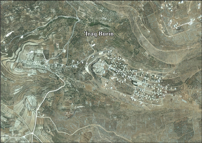
In 1882 the PEF's Survey of Western Palestine (SWP) noted that Arak "is named from the cliff on which it stands, on a spur of Gerizim; it is of moderate size and built of stone, with two springs beneath in the valley, one north, one south; olives are grown on the hill facing the village towards the north." [8]

British Mandate era

In the 1922 census of Palestine, conducted by the British Mandate authorities, Iraq Burin had 81 Muslim inhabitants, [9] decreasing in the 1931 census to 62, still all Muslim, in a total of 16 houses. [10]

In the 1945 statistics, Iraq Burin was counted with Burin, and together they had a population of 1,200, all Muslims, [11] with 19,096 dunams of land, according to an official land and population survey. [12] Of this, 1,797 dunams were plantations and irrigable land, 8,741 used for cereals, [13] while 106 dunams were built-up (urban) land. [14]

Jordanian era

In the wake of the 1948 Arab–Israeli War, and after the 1949 Armistice Agreements, Iraq Burin came under Jordanian rule.

Post-1967

Demonstration in Iraq Burin DemonstrationIraqBurin.jpg
Demonstration in Iraq Burin

Since the Six-Day War in 1967, Iraq Burin has been under Israeli occupation.

In 2009, the Israeli settlement of Har Brakha took control of 30 dunams of village land, west of the village, which formerly were used for grapes and almonds. In total, Israel has confiscated 291 dunams of land from Iraq Burin in order to construct Har Brakha, in addition to land taken from Burin and Kafr Qallil. [15]

In March, 2010, two brothers of the village, Mohammed and Osaid Qadus, 16 and 18 years old, were shot dead by Israeli soldiers, in an incident which the IDF said happened because the Israeli troops were "ill-prepared for missions." [16] [17] [18]

In January, 2011, 19 year old Oday Maher Hamza Qadous was shot dead by an Israeli settler from Har Brakha. The villagers said Qadous was farming in the village fields when he was shot, while the settlers said he was throwing stones. [19] [20]

Related Research Articles

<span class="mw-page-title-main">Immatain</span> Municipality type D in Qalqilya, State of Palestine

Immatain is a Palestinian village located in the northwestern West Bank, in the Qalqilya Governorate of the State of Palestine, about seventeen kilometers southwest of Nablus. The current mayor of Immatain is Haythem Sawan.

<span class="mw-page-title-main">Deir Ballut</span> Municipality type D in Salfit, State of Palestine

Deir Ballut is a Palestinian town located in the Salfit Governorate in the northern West Bank, 41 kilometers (25 mi) south west of Nablus. According to the Palestinian Central Bureau of Statistics, it had a population of 3,195 in 2007.

<span class="mw-page-title-main">Kafr ad-Dik</span> Municipality type C in Salfit, State of Palestine

Kafr ad-Dik is a Palestinian town located 9.5 kilometers west of Salfit in the Salfit Governorate, in the northern West Bank and eight kilometers east of the Green Line. According to the Palestinian Central Bureau of Statistics (PCBS), the town had a population of 4,453 in 2007.

<span class="mw-page-title-main">Bruqin</span> Municipality type D in Salfit, State of Palestine

Bruqin is a Palestinian town located 13 kilometers west of Salfit in the Salfit Governorate of the northern West Bank and adjacent to the Israeli settlement of Bruchin. According to the Palestinian Central Bureau of Statistics, the town had a population of 3,236 in 2007. Bruqin used to be on a camel-trading route. There is evidence of Roman rule in the city due to the presence of three ancient pools and a tomb.

<span class="mw-page-title-main">Deir al-Hatab</span> Municipality type D in Nablus, State of Palestine

Deir al-Hatab is a Palestinian village in the Nablus Governorate in the northern West Bank, located east of Nablus, near the neighbouring villages of Salem and Azmout. The village land extends over 12,000 dunams, of which 330 are built-up.

<span class="mw-page-title-main">Einabus</span> Municipality type D in Nablus, State of Palestine

Einabus is a Palestinian village in the northern West Bank, located 12 kilometers south of Nablus and a part of the Nablus Governorate. Nearby towns include Huwara and Beita to the east and Jammain to the south.

<span class="mw-page-title-main">Salim, Nablus</span> Municipality type D in Nablus, State of Palestine

Salim is a Palestinian town in the northern West Bank, located six kilometers east of Nablus and is a part of the Nablus Governorate. According to the Palestinian Central Bureau of Statistics (PCBS), Salim had a population of approximately 5,100 inhabitants in 2006.

<span class="mw-page-title-main">Asira al-Qibliya</span> Municipality type C in Nablus, State of Palestine

’Asira al-Qibliya is a Palestinian village in the Nablus Governorate in the eastern West Bank, located southwest of Nablus. According to the Palestinian Central Bureau of Statistics (PCBS), the village had a population of 2,336 inhabitants in 2007.

<span class="mw-page-title-main">Azmut</span> Municipality type C in Nablus, State of Palestine

’Azmut is a Palestinian village in the Nablus Governorate in the eastern West Bank, located five kilometers northeast of Nablus. According to the Palestinian Central Bureau of Statistics (PCBS), the village had a population of 2,724 inhabitants in mid-2006.

<span class="mw-page-title-main">Haris, Salfit</span> Municipality type D in Salfit, State of Palestine

Haris is a Palestinian town located in the Salfit Governorate of the State of Palestine, in the northern West Bank, 24 kilometers Southwest of Nablus. According to the Palestinian Central Bureau of Statistics, it had a population of 3,427 approximately in mid-year 2007.

<span class="mw-page-title-main">Rafat, Salfit</span> Municipality type D in Salfit, State of Palestine

Rafat is a Palestinian town located in the Salfit Governorate of the State of Palestine, in the northern West Bank, 38 kilometers southwest of Nablus. According to the Palestinian Central Bureau of Statistics, it had a population of 1,861 in 2007.

<span class="mw-page-title-main">Sarta</span> Municipality type D in Salfit, State of Palestine

Sarta is a Palestinian town located in the Salfit Governorate in the northern West Bank, 22 kilometers southwest of Nablus. According to the Palestinian Central Bureau of Statistics, it had a population of approximately 3,382 in 2017.

<span class="mw-page-title-main">Mas-ha</span> Municipality type D in Salfit, State of Palestine

Mas-ha is a Palestinian village located in the Salfit Governorate in the northern West Bank, 24 kilometers southwest of Nablus. According to the Palestinian Central Bureau of Statistics, it had a population of 2,003 in 2007.

<span class="mw-page-title-main">Yasuf</span> Municipality type D in Salfit, State of Palestine

Yasuf is a Palestinian village located in the Salfit Governorate of the State of Palestine, in the northern West Bank, northeast of Salfit, 37 kilometres (23 mi) southwest of Nablus and adjacent to the Israeli settlement of Kfar Tapuach. According to the Palestinian Central Bureau of Statistics, it had a population of 1,621 in 2007. About 87% of the population relies on agriculture for income, while the remainder work in the public sector.

<span class="mw-page-title-main">Burin, Nablus</span> Municipality type C in Nablus, State of Palestine

Burin is a Palestinian village in the Nablus Governorate of the State of Palestine, in the northern West Bank, located 7 kilometres (4.3 mi) southwest of Nablus. The town had a population of around 2,800 in 2008.

<span class="mw-page-title-main">Deir Sharaf</span> Municipality type D in Nablus, State of Palestine

Deir Sharaf is a Palestinian town in the Nablus Governorate in northern West Bank, located northwest of Nablus. According to the Palestinian Central Bureau of Statistics (PCBS), the town had a population of 2,759 inhabitants in mid-year 2006.

<span class="mw-page-title-main">Kafr Qallil</span> Municipality type D in Nablus, State of Palestine

Kafr Qallil is a Palestinian town in the Nablus Governorate of the State of Palestine, in the northern West Bank. According to the Palestinian Central Bureau of Statistics (PCBS), the town had a population of 2,491 inhabitants in mid-year 2006.

<span class="mw-page-title-main">Urif</span> Municipality type D in Nablus, State of Palestine

Urif is a Palestinian village in the Nablus Governorate in northern West Bank, located 13 kilometers south of Nablus. According to the Palestinian Central Bureau of Statistics (PCBS), the town had a population of 2,839 inhabitants in mid-year 2006.

<span class="mw-page-title-main">Rujeib</span> Municipality type D in Nablus, State of Palestine

Rujeib is a Palestinian town in the Nablus Governorate of the State of Palestine, in the northern West Bank, located 3 kilometers southeast of Nablus. According to the Palestinian Central Bureau of Statistics (PCBS), the town had a population of 3,915 inhabitants in mid-year 2006.

<span class="mw-page-title-main">Madama, Nablus</span> Municipality type C in Nablus, State of Palestine

Madama is a Palestinian village in the Nablus Governorate.

References

  1. Palmer, 1881, p. 179
  2. Bull and Campbell, 1968, p. 38; cited in Miller, 2003, p. 166
  3. Jaroš and Deckert, 1977, pp. 24, 33; cited in Miller, 2003, p. 166
  4. Bull and Campbell, 1968, p. 38
  5. Robinson and Smith, 1841, vol. 3, 2nd Appendix, p. 127
  6. Robinson and Smith, 1841, vol. 3, 2nd Appendix, p. 126
  7. Guerin, 1875, p. 178
  8. Conder and Kitchener, 1883, SWP III, p. 162
  9. Barron, 1923, Table IX, Sub-district of Nablus, p. 24
  10. Mills, 1932, p. 62
  11. Government of Palestine, Department of Statistics, 1945, p. 18
  12. Government of Palestine, Department of Statistics. Village Statistics, April, 1945. Quoted in Hadawi, 1970, p. 59
  13. Government of Palestine, Department of Statistics. Village Statistics, April, 1945. Quoted in Hadawi, 1970, p. 105
  14. Government of Palestine, Department of Statistics. Village Statistics, April, 1945. Quoted in Hadawi, 1970, p. 155
  15. The Expansion of the Colony of Brakha at the Expense of Iraq Burin Lands, October 1, 2009, POICA
  16. Two more Palestinian youths shot dead by Israelis in bloody weekend, 22 March 2010, The Independent
  17. Rebuke given to Israeli soldiers in West Bank deaths, 27 April 2010, BBC
  18. '4 Palestinians' death could have been avoided', 04.26.10, Ynet
  19. ‘Palestinian teen was shot dead after throwing rocks’, January 28, 2011, Jerusalem Post
  20. Two Palestinians shot by settlers in 24 hours, January 27, 2011, +972 Magazine

Bibliography