Bayt Umrin (unofficial)"},"type":{"wt":"[[Village council (Palestinian Authority)|Municipality type D (Village council)]]"},"image_skyline":{"wt":"UmrinCenter6174.JPG"},"image_caption":{"wt":"Beit Imrin, from the west"},"pushpin_map":{"wt":"Palestine"},"pushpin_map_caption":{"wt":"Location of Beit Imrin within [[State of Palestine|Palestine]]"},"image_map":{"wt":""},"map_caption":{"wt":""},"coordinates":{"wt":"{{coord|32|17|32|N|35|12|56|E|region:PS|display=inline,title}}"},"grid_name":{"wt":"[[Palestine grid|Palestine grid]]"},"grid_position":{"wt":"170/188"},"subdivision_type":{"wt":"State"},"subdivision_name":{"wt":"[[State of Palestine]]"},"subdivision_type1":{"wt":"[[Governorates of the Palestinian National Authority|Governorate]]"},"subdivision_name1":{"wt":"[[Nablus Governorate|Nablus]]"},"established_title":{"wt":"Founded"},"established_date":{"wt":""},"government_footnotes":{"wt":""},"government_type":{"wt":"[[Village council (Palestinian Authority)|Village council]] (from 1966)"},"leader_title":{"wt":"Head of Municipality"},"leader_name":{"wt":"Basheer Samarah"},"unit_pref":{"wt":"dunam"},"area_footnotes":{"wt":""},"area_total_km2":{"wt":"12.1"},"area_total_dunam":{"wt":"12100"},"elevation_footnotes":{"wt":""},"elevation_m":{"wt":""},"elevation_min_m":{"wt":""},"elevation_max_m":{"wt":""},"population_footnotes":{"wt":"{{cite report |date=February 2018 |title=Preliminary Results of the Population, Housing and Establishments Census, 2017 |url=https://www.pcbs.gov.ps/Downloads/book2364-1.pdf |department=[[Palestinian Central Bureau of Statistics]] (PCBS) |publisher=[[State of Palestine]] |pages=64–82 |access-date=2023-10-24}}"},"population_total":{"wt":"3323"},"population_as_of":{"wt":"2017"},"population_note":{"wt":""},"population_density_km2":{"wt":"auto"},"blank_name_sec1":{"wt":"Name meaning"},"blank_info_sec1":{"wt":"\"House of Princes\", \"The House of Imrin\"Palmer 1881, p. [https://archive.org/stream/surveyofwesternp00conduoft#page/180/mode/1up 180]"},"website":{"wt":""},"footnotes":{"wt":""}},"i":0}}]}" id="mwAg">Municipality type D in Nablus, State of Palestine
Beit Imrin | |
---|---|
Arabic transcription(s) | |
• Arabic | بيت امرين |
• Latin | Beit Imrin (official) Bayt Umrin (unofficial) |
Beit Imrin, from the west | |
Location of Beit Imrin within Palestine | |
Coordinates: 32°17′32″N35°12′56″E / 32.29222°N 35.21556°E | |
Palestine grid | 170/188 |
State | State of Palestine |
Governorate | Nablus |
Government | |
• Type | Village council (from 1966) |
• Head of Municipality | Basheer Samarah |
Area | |
• Total | 12,100 dunams (12.1 km2 or 4.7 sq mi) |
Population (2017) [1] | |
• Total | 3,323 |
• Density | 270/km2 (710/sq mi) |
Name meaning | "House of Princes", "The House of Imrin" [2] |
Beit Imrin (Arabic : بيت امرين, transliterated as "House of Princes") is a Palestinian village in the Nablus Governorate in northern West Bank, located 18 kilometers northwest of Nablus. According to the Palestinian Central Bureau of Statistics (PCBS), the village had a population of 2,821 inhabitants in 2007 and 3,323 by 2017. [1] [3]
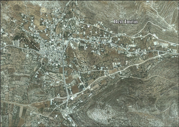
Beit Imrin is an agricultural village with the main products being pulses, grains, vegetables, olives, grapes, almonds and figs. There is a girls' primary school and a boys' secondary school in the village. Other public facilities include a health clinic, telephone and postal services.
Ceramics from the Byzantine and early Islamic periods have been found here. [4]
According to the Beit Imrin Village Council, Beit Imrin was founded by Arabs from nearby Burqa and the Bani Hassan tribe of Transjordan, whose members also populated Qarawat Bani Hassan. The town of Sebastia is located to the southwest, the villages of Ijnisinya and Nisf Jubeil to the south, Burqa to the northwest and Yasid to the east. [5]
In 1517, Beit Imrin was incorporated into the Ottoman Empire with the rest of Palestine. In 1596, it appeared in Ottoman tax registers as a village in the nahiya (subdistrict) of Jabal Sami in the Nablus Sanjak. It had a population of 19 households and 2 bachelors, all Muslim, and paid taxes on wheat, barley, summer crops, olive trees, occasional revenues, goats and beehives, and a press for olives or grapes; a total of 13,200 akçe. [6]
In 1667 there was a Greek Orthodox community in the village. [7]
In 1838 American Biblical scholar Edward Robinson noted that the village was on the road to Jenin. [8] He also noted that the village had a mixture of Greek Christians and Muslim inhabitants. [9] At this time the village had 50 Christians and a priest. [7]
In 1870, Victor Guérin estimated that Beit Imrin had 700 inhabitants. He further noted: "The houses are small and roughly built, except the Sheikh’s house, which is large and well-built. Below the village and to the west there is a fertile valley irrigated by a spring called Ain Dilbeh." [10]
In 1870/1871 (1288 AH), an Ottoman census listed the village in the nahiya (sub-district) of Wadi al-Sha'ir. [11]
In 1882, the PEF's Survey of Western Palestine (SWP) described it as "a village of moderate size in the valley at the foot of the Sheikh Beiyzid chain. It is built of stone, and has a spring in the valley to the south, and olives round it on the east and west. Some of the inhabitants are Greek Christians." [12]
In the 1922 census of Palestine conducted by the British Mandate authorities, Beit Imrin had a population of 527; 512 Muslims and 15 Christians, [13] where the Christians were all Orthodox. [14] The population increased in the 1931 census to 620, of whom 13 were Christians and 607 Muslims, in a total of 157 occupied houses. [15]
In the 1945 statistics, the population was 860, all Muslims, [16] with 12,094 dunams of land, according to an official land and population survey. [17] Of this, 1,442 dunams were for plantations or irrigated land, 6,819 for cereals, [18] while 53 dunams were built-up (urban) land. [19]
In the wake of the 1948 Arab–Israeli War, and after the 1949 Armistice Agreements, Beit Imrin came under Jordanian rule. It was annexed by Jordan in 1950.
In 1961, the population of Beit Imrin was 1,048. [20]
Since the Six-Day War in 1967, the village has been under Israeli occupation. A census that same year recorded the population as 1,100. [21]
After the 1995 accords, 97.7% of the village land was classified as Area A, 1.8% as Area B, and the remaining 0.5% as Area C. [22]
A village council to administer Beit Imrin's civil affairs was established in 1966, with the first mayor being Ayad Youssef Abdel-Rahman Ahsan. The council consists of nine members including the mayor, who currently is Basheer Samarah. [23]
The village had a Christian population, but most of them left. Some of the residents have their origins in Kafr Qaddum, Burqa and Ijnisinya. [24]
Beit Furik is a town located nine kilometers southeast of Nablus, in the Nablus Governorate of the northern West Bank, Palestine. According to the Palestinian Central Bureau of Statistics, the town had a population of 13,477 inhabitants in 2017.
Bizzariya is a Palestinian village in the northern West Bank, located 13.3 kilometers northwest of Nablus at the northernmost point of the Nablus Governorate. It is situated in a valley, having an altitude of 460 meters above sea level. According to the Palestinian Central Bureau of Statistics, Bizzariya had a population of over 2,252 inhabitants in 2007 and 2,794 by 2017.
Salim is a Palestinian town in the northern West Bank, located six kilometers east of Nablus and is a part of the Nablus Governorate. According to the Palestinian Central Bureau of Statistics (PCBS), Salim had a population of 6,266 inhabitants in 2017.
Beit Dajan is a Palestinian village in the Nablus Governorate in the north central West Bank, located 10 kilometers (6.2 mi) east of Nablus. According to the Palestinian Central Bureau of Statistics, it had a population of approximately 4,460 in 2017.
Beit Iba is a Palestinian village in the Nablus Governorate in the North central West Bank, located 7 kilometers northwest of Nablus. According to the Palestinian Central Bureau of Statistics (PCBS), the village had a population of 4,079 inhabitants in 2017.
Marda is a Palestinian town in the Salfit Governorate of the State of Palestine, in the northern West Bank, 18 kilometers Southwest of Nablus. According to the Palestinian Central Bureau of Statistics, it had a population of 2,375 in 2017.
Beit Sira is a Palestinian village in the central West Bank, located 22 kilometers west of Ramallah and is a part of the Ramallah and al-Bireh Governorate. The village is situated along the Green Line. During the 1948 Arab-Israeli War, around 4,000 dunams of its land became a part of the "No-Man's Land" strip between the north-central West Bank and Israel. Currently Beit Sira's jurisdiction is 3,120 dunams, of which 441 dunams are built-up areas and the remainder is open spaces for future construction or agricultural land.
Burqa is a village in the Nablus Governorate in the northern West Bank, Palestine, located northwest of Nablus. According to the Palestinian Central Bureau of Statistics (PCBS), the village had a population of 4,030 inhabitants in mid-year 2006 and 4,152 by 2017.
Beit Wazan is a Palestinian village in the Nablus Governorate of the State of Palestine, in the northern West Bank, located 4.5 kilometers west of Nablus. According to the Palestinian Central Bureau of Statistics (PCBS), the village had a population of 1,312 inhabitants in 2017.
Deir Sharaf is a Palestinian town in the Nablus Governorate in northern West Bank, located northwest of Nablus. According to the Palestinian Central Bureau of Statistics (PCBS), the town had a population of 2,949 inhabitants in 2017.
An-Naqura is a Palestinian village in the Nablus Governorate in northern West Bank, located 10 kilometers northwest of Nablus and adjacent to the Israeli settlement of Shavei Shomron. According to the Palestinian Central Bureau of Statistics (PCBS) census, the village had a population of 1,545 in 2007 and 1,786 in 2017. An-Naqura is administered by a ten-member village council headed by Muhammad Hashish.
Qaryout is a Palestinian village in the Nablus Governorate in the northern West Bank, located 28 kilometers (17 mi) southeast of Nablus.
Yasid is a Palestinian town in the Nablus Governorate in northern West Bank, located 15 kilometers northeast of Nablus. According to the Palestinian Central Bureau of Statistics (PCBS), the town had a population of 2,291 inhabitants in mid-year 2006 and 2,505 by 2017.
Sarra is a Palestinian town in the Nablus Governorate in northern West Bank, located 11 kilometers southwest of Nablus. According to the Palestinian Central Bureau of Statistics (PCBS), the town had a population of 3,384 inhabitants in 2017.
Zawata is a town in the Nablus Governorate in the northern West Bank, Palestine, located 6 kilometers northwest of Nablus. According to the Palestinian Central Bureau of Statistics (PCBS), the town had a population of 2,537 inhabitants in 2017.
Rujeib is a Palestinian town in the Nablus Governorate of the State of Palestine, in the northern West Bank, located 3 kilometers southeast of Nablus. According to the Palestinian Central Bureau of Statistics (PCBS), the town had a population of 5,964 inhabitants in 2017.
Odala is a Palestinian town in the Nablus Governorate in northern West Bank, located south of Nablus. According to the Palestinian Central Bureau of Statistics (PCBS), the town had a population of 1,566 inhabitants in 2017.
Zeita Jamma'in is a Palestinian village in the Nablus Governorate in northern West Bank, located 16 kilometers southwest of Nablus. The village is located just north of Jamma'in, from which the village receives its name. According to the Palestinian Central Bureau of Statistics (PCBS), Zeita Jamma'in had a population of 2,740 inhabitants in 2017.
Ijnisinya is a Palestinian village located six kilometres northwest of Nablus in the Nablus Governorate. Most of the working-age inhabitants live as farmers or governmental workers. It had a population of about 585 in 2017. Ijnisinya is governed by a village council.
Nisf Jubeil is a Palestinian village in the Nablus Governorate in the northern West Bank, located northwest of Nablus. According to the Palestinian Central Bureau of Statistics (PCBS) census, it had a population of 394 in 2007. There were a total of 83 households and 17 business establishments. By 2017, the population was 471.