Iskwao Creek,[1] formerly Squaw Creek,[2][3] is a river in the Canadian province of Saskatchewan.[4] It begins just north of Davidson and flows south into the Qu'Appelle River downstream and east of Eyebrow Lake. Much of the river's course is through a deep-cut valley that was formed by glacial meltwaters near the end of the last ice age.
Davidson is the only community on the river. There are two reservoirs along its course and two highways cross it. In 1949–50 Enbridge Line 1 was built through the river's valley.[5]
Description
The valley that Iskwao Creek flows through was carved out near the end of the last ice age. As the Wisconsinan Glacier was retreating, its meltwaters created spillways. In this case, a re-entrant was created around the Allan Hills with ice lobes extending down into present-day Last Mountain Lake to the east and along the eastern side of the South Saskatchewan River to the west. At that time, though, glacial Lake Milden filled the South Saskatchewan River Valley. Arm River and Iskwao Creek drained this re-entrant with Arm River flowing into Last Mountain River and Iskwao Creek draining into the Qu'Appelle River. At that time, the South Saskatchewan River followed the course of the present-day Qu'Appelle River as it flowed east into Lake Agassiz.[6]
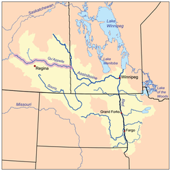
Iskwao Creek begins just north of the town of Davidson in the Rural Municipality of Willner No. 253 where it flows east into the Rural Municipality of Arm River No. 252 and crosses Highways 653 and 747. It then flows south into the Davidson Reservoir on the east side of town.[7][8][9] At the south end of the reservoir, the river exits at the dam and continues south crossing Highway11. From Highway 11 it continues its southward travel through the valley for about 19 kilometres (12mi) before emptying into Iskwao Lake.[10] Shortly after Iskwao Creek exits Iskwao Lake, it crosses Highway 732 and then flows in a south-westerly direction. As it nears the Qu'Appelle River, it makes a sharp right-angle turn to the south-east and flows down into Qu'Appelle Valley through a coulee to join the Qu'Appelle River in the Rural Municipality of Huron No. 223.[11][12]
↑ Edmunds, F. H. (1962). "Recession of Wisconsinan Glacier"(PDF). Department of Mineral Resources, Province of Saskatchewan. Retrieved 18 October 2025.
↑ "Three Rivers Trail Newsletter No. 3, No. 4, Summer 2004"(PDF), Three Rivers Trail Newsletter (Arm River – Qu’Appelle River – South Saskatchewan River), Three Rivers Trail Association (TRTA), Box 367, Craik, SK, 2004, archived from the original(PDF) on 24 February 2009, retrieved 29 December 2007
↑ "Iskwao Lake". Canadian Geographical Names Database. Government of Canada. Retrieved 18 October 2025.
This page is based on this Wikipedia article Text is available under the CC BY-SA 4.0 license; additional terms may apply. Images, videos and audio are available under their respective licenses.