Last Mountain Creek

Last updated

Last Mountain Creek
Aerial - Craven, Saskatchewan 01 - white balanced (10618015544).jpg
Confluence of Last Mountain Creek, Qu'Appelle River, and Wascana Creek
Quappellerivermap.png
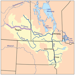
The Red River drainage basin, with the Qu'Appelle River highlighted
Canada Saskatchewan relief location map.jpg
Red pog.svg
Location in Saskatchewan
Canada relief map 2.svg
Red pog.svg
Last Mountain Creek (Canada)
Location
CountryFlag of Canada (Pantone).svg  Canada
Province Flag of Saskatchewan.svg  Saskatchewan
Physical characteristics
Source Last Mountain Lake
  coordinates 50°44′36″N104°52′04″W / 50.7432°N 104.8677°W / 50.7432; -104.8677
  elevation490 m (1,610 ft)
Mouth Qu'Appelle River
  location
Craven
  coordinates
50°42′24″N104°49′32″W / 50.70667°N 104.82556°W / 50.70667; -104.82556
Length6 km (3.7 mi)
Basin features
River system Red River
[1] [2] [3]

Last Mountain Creek is a river in south-central Saskatchewan. It is a tributary of the Qu'Appelle River [1] in a region called the Prairie Pothole Region of North America, which extends throughout three Canadian provinces and five U.S. states. It is also within Palliser's Triangle and the Great Plains ecoregion. [4]

Contents

The river is part of the Upper Qu'Appelle River watershed and starts at the southern end of Last Mountain Lake. It travels in a southerly direction for about 6 kilometres (3.7 mi) until it meets the Qu'Appelle River in the Qu'Appelle Valley, which was formed during the last ice age. During years in which the Qu'Appelle River is high, Last Mountain Creek naturally reverses direction and flows into Last Mountain Lake. [5] Craven Dam is located east of Last Mountain Creek's mouth on the Qu'Appelle River on the eastern side of the village of Craven. The gates of the dam are used to regulate water flows along the Qu'Appelle and can be closed to backflood water up Last Mountain Creek and into Last Mountain Lake. [6]

Description

At the southernmost point of Last Mountain Lake, [7] there is the Valeport Dam ( 50°43′45″N104°51′36″W / 50.7292°N 104.8601°W / 50.7292; -104.8601 ) and associated dykes that help control the lake's water levels. The dam was built in 1939, upgraded in 1958, and is 3.7 metres (12 ft) high. It is owned and operated by the Saskatchewan Water Security Agency. [8] Last Mountain Creek flows out of the lake at the dam and runs through Valeport Marsh following Highway 20 until it meets the Qu'Appelle River at the village of Craven and Highways 641 and 729. Wascana Creek meets the Qu'Appelle River just west and upstream from the mouth of Last Mountain Creek.

Tributaries

Other than Last Mountain Lake and Valeport Marsh, no named tributaries flow into Last Mountain Creek. Several tributaries flow into Last Mountain Lake, though, including Arm River, Lewis Creek, and Lanigan Creek.

Valeport Marsh

Valeport Marsh ( 50°43′23″N104°50′57″W / 50.7231°N 104.8491°W / 50.7231; -104.8491 ) is an extensive floodplain on the south-east corner of Last Mountain Lake at the point where Last Mountain Creek starts. The wetland is over 30 square kilometres (12 sq mi) in size and follows the course of the river towards Craven and the Qu'Appelle River for about 6 kilometres (3.7 mi). A 900-acre conservation project called Valeport Wildlife Management Area Trails protects the wetlands for migratory birds, ducks, grebes, and other wildlife. It was created by the provincial government with the assistance of Ducks Unlimited Canada and is an Important Bird Area of Canada called Valeport Marsh (SK 061). [9] At the head of the river and edge of the marsh, along Last Mountain Lake's south-eastern shore, is the 57-hectare (140-acre) Valeport Provincial Recreation Site ( 50°44′52″N104°52′15″W / 50.7478°N 104.8709°W / 50.7478; -104.8709 ). [10] The park offers canoeing, picnicking, hiking, and walking along the top of the dyke. [11] [12]

Along the west side of the Valeport Wildlife Management Area is a Nature Conservancy of Canada property called Big Valley ( 50°44′20″N104°53′19″W / 50.73889°N 104.88861°W / 50.73889; -104.88861 ). Big Valley is 552 acres of protected grassland and is managed for bird and wildlife habitat. [13] Valeport Marsh Wildlife Management Area is at the southern tip of Last Mountain Lake and Last Mountain Lake National Wildlife Area is at the northern end. [14]

See also

Related Research Articles

<span class="mw-page-title-main">Gardiner Dam</span> Dam in Saskatchewan, Canada

The Gardiner Dam on the South Saskatchewan River in Saskatchewan is the third largest embankment dam in Canada and one of the largest embankment dams in the world. Construction on Gardiner Dam and the smaller Qu'Appelle River Dam was started in 1959 and completed in 1967, creating Lake Diefenbaker upstream and diverting a considerable portion of the South Saskatchewan's flow into the Qu'Appelle River. The dam rises 64 metres (209 feet) in height, is almost 5 km (3.1 mi) long and has a width of 1.5 km (0.93 mi) at its base with a volume of 65,000,000 cubic meters. The dam is owned and operated by the Saskatchewan Water Security Agency.

<span class="mw-page-title-main">Qu'Appelle River</span> River in Western Canada

The Qu'Appelle River is a river in the Canadian provinces of Saskatchewan and Manitoba that flows 430 kilometres (270 mi) east from Lake Diefenbaker in south-western Saskatchewan to join the Assiniboine River in Manitoba, just south of Lake of the Prairies, near the village of St. Lazare. It is in a region called the Prairie Pothole Region of North America, which extends throughout three Canadian provinces and five U.S. states. It is also within Palliser's Triangle and the Great Plains ecoregion.

<span class="mw-page-title-main">Fishing Lakes</span> Chain of lakes in Saskatchewan, Canada

The Fishing Lakes, also called the Calling Lakes or the Qu'Appelle Lakes, are a chain of four lakes in the Qu'Appelle Valley cottage country about 40 miles (64 km) to the north-east of Regina in the Canadian province of Saskatchewan. The lakes are in a region called the Prairie Pothole Region of North America, which extends throughout three Canadian provinces and five U.S. states. It is also within Palliser's Triangle and the Great Plains ecoregion. The Fishing Lakes all follow the course of the Qu'Appelle River, which flows from the west to the east and is part of the Hudson Bay drainage basin. The lakes sit in the deep-cut Qu'Appelle Valley that was formed about 14,000 years ago during the last ice age. Meltwater from the glaciers carved out the valley and as water levels rose and fell, alluvium was left in the wake. These piles of alluvium are what created the separations between the lakes.

<span class="mw-page-title-main">Last Mountain Lake</span> Lake in Saskatchewan, Canada

Last Mountain Lake, also known as Long Lake, is a prairie lake formed from glaciation 11,000 years ago. It is located in south central Saskatchewan, Canada, about 40 kilometres (25 mi) north-west of the city of Regina. It flows into the Qu'Appelle River via Last Mountain Creek, which flows past Craven. It is approximately 93 km (58 mi) long, and 3 km (1.9 mi) wide at its widest point. It is the largest naturally occurring body of water in southern Saskatchewan. Only Lake Diefenbaker, which is man-made, is larger. The lake is a popular resort area for residents of south-eastern Saskatchewan.

<span class="mw-page-title-main">Wascana Creek</span> River in Saskatchewan, Canada

Wascana Creek is a river in the Canadian province of Saskatchewan. It is a tributary of the Qu'Appelle River.

Swan River is located in the Canadian provinces of Manitoba and Saskatchewan. The river, and several other features in the area, are named after the trumpeter swans found in the region.

<span class="mw-page-title-main">Last Mountain Lake 80A</span> Indian reserve in Saskatchewan, Canada

Last Mountain Lake 80A is a shared Indian reserve in Saskatchewan, used by the Day Star, George Gordon, Kawacatoose, Muscowpetung, Muskowekwan, Pasqua, and Piapot First Nations. It is in Township 21, Range 21, west of the Second Meridian.

Moose Mountain Upland, Moose Mountain Uplands, or commonly Moose Mountain, is a hilly plateau located in the south-east corner of the Canadian province of Saskatchewan, that covers an area of about 13,000 km2 (5,000 sq mi). The upland rises about 200 m (660 ft) above the broad, flat prairie which is about 600 m (2,000 ft) above sea level. The highest peak is "Moose Mountain" at 830 m (2,720 ft) above sea level. The area was named Moose Mountain because of the large number of moose that lived in the area. When it was originally used by fur traders, Métis, and the Indigenous peoples, the plateau was called Montagne a la Bosse, which is French for "The Mountain of The Bump or Knob."

<span class="mw-page-title-main">Pipestone Creek (Saskatchewan)</span> River in central North America

Pipestone Creek is a river in the Souris River watershed. Its flow begins in southeastern Saskatchewan, just south of the town of Grenfell and travels in a southeastern direction into Manitoba in the Westman Region where it empties into Oak Lake through the Oak Lake Marsh.

<span class="mw-page-title-main">Moose Mountain Creek</span> River in southern Saskatchewan, Canada

Moose Mountain Creek is a river in the Canadian province of Saskatchewan. Its source is the Chapleau Lakes near Montmartre and it is a tributary of the Souris River, which, in turn, is a tributary of the Assiniboine River. The whole system is part of the Red River watershed, which is part of the Hudson Bay drainage basin and in a region called the Prairie Pothole Region of North America, which extends throughout three Canadian provinces and five U.S. states. It is also within Palliser's Triangle and the Great Plains ecoregion.

<span class="mw-page-title-main">Moose Mountain Lake</span> Lake in Saskatchewan, Canada

Moose Mountain Lake is a reservoir in the Canadian province of Saskatchewan. It is located in the RM of Golden West No. 95 in the Prairies Ecozone of Palliser's Triangle at the western edge of Moose Mountain Upland. Moose Mountain Creek is both the primary inflow and outflow of the lake; it enters at the north end and leaves at the dam in the south end. A secondary inflow that comes from Gooseberry Lake enters on the western side near the south end.

<span class="mw-page-title-main">Lanigan Creek</span> River in Saskatchewan, Canada

Lanigan Creek is a river in the Canadian province of Saskatchewan. It is located in the south central part of the province in a region called the Prairie Pothole Region of North America, which extends throughout three Canadian provinces and five U.S. states. It is also within Palliser's Triangle and the Great Plains ecoregion.

<span class="mw-page-title-main">Arm River (Saskatchewan)</span> River in Saskatchewan, Canada

Arm River is a river in the Canadian province of Saskatchewan. It is located in the south central part of the province in a region called the Prairie Pothole Region of North America, which extends throughout three Canadian provinces and five U.S. states. It is also within Palliser's Triangle and the Great Plains ecoregion.

<span class="mw-page-title-main">Brightwater Creek</span> River in Saskatchewan, Canada

Brightwater Creek is a river in south central part of the Canadian province of Saskatchewan. It is a tributary of the South Saskatchewan River in a region called the Prairie Pothole Region of North America, which extends throughout three Canadian provinces and five U.S. states. It is also within Palliser's Triangle and the Great Plains ecoregion. Along the river's course there is a dam and reservoir and a regional park. There are no communities along its course.

<span class="mw-page-title-main">Moose Jaw River</span> River in Saskatchewan, Canada

Moose Jaw River is a river in the Canadian province of Saskatchewan. It is located in the southern part of the province in a region called the Prairie Pothole Region of North America, which extends throughout three Canadian provinces and five U.S. states. It is also within Palliser's Triangle and the Great Plains ecoregion.

<span class="mw-page-title-main">Thunder Creek (Saskatchewan)</span> River in Saskatchewan, Canada

Thunder Creek is a river in the Canadian province of Saskatchewan. The watershed of Thunder Creek is within the semi-arid Palliser's Triangle in south-central Saskatchewan. It begins at small, man-made reservoir near Lake Diefenbaker and flows in a south-easterly direction towards the city of Moose Jaw and the Moose Jaw River. The Moose Jaw River is a major tributary of the Qu'Appelle River For most of its course, Thunder Creek follows a valley called the Thunder Creek meltwater channel that was formed over 10,000 years ago near the end of the last ice age.

<span class="mw-page-title-main">Plum Creek (Manitoba)</span> River in Manitoba

Plum Creek is the primary outflow for the Plum Lakes and travels in an easterly direction for about 28 kilometres until it meets up with the Souris River, which is part of the Hudson Bay drainage basin, at the community of Souris in the Canadian province of Manitoba. Plum Lakes and the beginning of Plum Creek are in the Rural Municipality of Sifton and the mouth is in the Municipality of Souris – Glenwood.

<span class="mw-page-title-main">Mission Lake</span> Lake in Saskatchewan, Canada

Mission Lake, also known as Lebret Lake, is a lake in the Canadian province of Saskatchewan. It is one of four lakes in the Qu'Appelle Valley known as the Fishing Lakes. Echo Lake is upstream and Katepwa Lake is downstream. The lake was named Mission after the Catholic mission at Lebret. Highways 22 35, and 56 provide access to the lake.

Eyebrow Lake is a man-made marshy lake that parallels the Qu'Appelle River in the southern region of the Canadian province of Saskatchewan. Located in the RM of Huron No. 223, it is the first lake in a series of lakes along the Qu'Appelle River after Qu'Appelle River Dam and Lake Diefenbaker. The next lake downstream is Buffalo Pound Lake. The closest community is the village of Tugaske and while there are no public recreation sites at the lake, it can be accessed by Highway 627. The lake gets its name from the nearby Eyebrow Hills, which are shaped like an eyebrow. The nearby town of Eyebrow and RM of Eyebrow No. 193 are also named after these hills.

Craven Dam is at the confluence of the Qu'Appelle River and Last Mountain Creek and immediately east of the village of Craven on the Qu'Appelle River at LSD SW 24-20-21 W2. It is in the Canadian province of Saskatchewan in the RM of Longlaketon No. 219. The dam does not create a reservoir as its purpose is to regulate water flow along the Qu'Appelle River. The dam is operated by the Saskatchewan Water Security Agency and can be accessed on the north side by Highway 99.

References

  1. 1 2 Government of Canada, Natural Resources Canada. "Place names - Last Mountain Creek". www4.rncan.gc.ca.
  2. The Encyclopedia of Saskatchewan. "Qu'Appelle River". Archived from the original on 3 May 2012. Retrieved 2 August 2008.
  3. "Canada Drainage Basins". The National Atlas of Canada, 5th edition. Natural Resources Canada. 1985. Retrieved 24 November 2010.
  4. "Drought in Palliser's Triangle | The Canadian Encyclopedia". www.thecanadianencyclopedia.ca.
  5. "WSA working to raise low water levels in Last Mountain Lake ahead of summer | Globalnews.ca". Global News.
  6. Foster, Scott. "Water diverted to Last Mountain". Reginacity. Regina Leader Post. Retrieved 11 December 2021.
  7. Government of Canada, Natural Resources Canada. "Place names - Last Mountain Lake". www4.rncan.gc.ca.
  8. "Dams and Reservoirs". wsask. Water Security Agency. 27 January 2021. Retrieved 1 April 2024.
  9. "Valeport Marsh (SK061)". www.ibacanada.ca.
  10. "Valeport Recreation Site". Canadian Geographical Names Database. Government of Canada. Retrieved 1 April 2024.
  11. "Valeport Wildlife Management Area Trails | Tourism Saskatchewan". www.tourismsaskatchewan.com.
  12. "Valeport Recreation Site". Protected Planet. Retrieved 1 April 2024.
  13. "Big Valley". www.natureconservancy.ca.
  14. "Last Mountain Lake National Wildlife Area". Canadian Geographical Names Database. Government of Canada. Retrieved 7 January 2023.

Maple Leaf (from roundel).svg  Canadaportal