
The geography of Croatia is defined by its location—it is described as located at the crossroads of Central Europe and Southeast Europe, or within the wider region of Southern Europe. Croatia's territory covers 56,594 km2 (21,851 sq mi), making it the 127th largest country in the world. Bordered by Slovenia in the northwest, Hungary in the northeast, Bosnia and Herzegovina and Serbia in the east, Montenegro in the southeast and the Adriatic Sea in the south, it lies mostly between latitudes 42° and 47° N and longitudes 13° and 20° E. Croatia's territorial waters encompass 18,981 square kilometres (7,329 sq mi) in a 12 nautical miles wide zone, and its internal waters located within the baseline cover an additional 12,498 square kilometres (4,826 sq mi).

Zadar, historically known as Zara, is the oldest continuously inhabited city in Croatia. It is situated on the Adriatic Sea, at the northwestern part of Ravni Kotari region. Zadar serves as the seat of Zadar County and of the wider northern Dalmatian region. The city proper covers 25 km2 (9.7 sq mi) with a population of 75,082 in 2011, making it the second-largest city of the region of Dalmatia and the fifth-largest city in the country.

Zadar County is a county in Croatia, it encompasses northern Dalmatia and southeastern Lika. Its seat is the city of Zadar.

Murter is an island in the Croatian part of the Adriatic Sea.

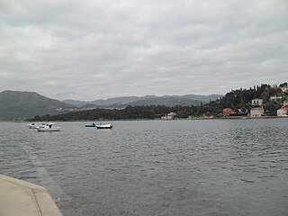
Lopud is a small island off the coast of Dalmatia, southern Croatia. Lopud is economically the most developed of the Elaphiti Islands, and can be reached by boat from Dubrovnik, Trsteno, Orašac and Zaton. The island is famous for its sandy beaches, in particular the bay of Šunj. Lopud is the second largest island of the Elaphiti islands, between Koločep and Šipan. It is famous as the "island in the middle". It has an area of 4.63 square kilometres and its highest point is Polačica, 216 metres above sea level. It has 11.5 km (7 mi) of coastline, of which 1.2 km (1 mi) is sandy.

Premuda is a small island in Croatia, off the northern Adriatic coast. It belongs to the north Dalmatian islands which are situated north-west from the county center Zadar. Premuda is approximately 9 km (6 mi) long, up to 1.6 km (1.0 mi) wide, and has an area of 9.2 km2 (3.6 sq mi). It is situated southwest of Silba and northwest of Škarda and as such it is one of the outermost Adriatic islands from the perspective of the Croatian coastline.

Dugi Otok is part of Croatia and the seventh largest island in the Adriatic Sea. It is located off the Dalmatian coast, west of Zadar. It is the largest and westernmost of the Zadarian Islands, and derives its name from its distinctive shape: it is 44.5 km long by 4.8 km wide, with an area of 114 square kilometres (44 sq mi). Its elevation reaches 300 m; and many of its higher portions contain stands of Maritime Pine.
Koločep is one of the three inhabited Elaphiti Islands situated near the city of Dubrovnik with an area of 2.44 square kilometres. Koločep is the southernmost inhabited island in Croatia. According to the 2021 census, its population was 231. In the 2011 census, the population of the island was 163.
Vir is an island on the Croatian coast of the Adriatic Sea with an area of 22 km2. It lies in Dalmatia, north of the city of Zadar. It is connected to the mainland via a road bridge. The main village on the island is the eponymous village of Vir. There are two more villages, Lozice and Torovi. According to the 2011 census, the island had a population of 3,000 inhabitants, making it the 13th most populous island in Croatia.

Pag is a Croatian island in the northern Adriatic Sea. It is the fifth-largest island of the Croatian coast and the one with the longest coastline.
Molat is a Croatian island in the Adriatic Sea. It lies near Zadar, southeast of Ist, separated by the Zapuntel Strait. It has an area of 22.82 km2 (8.81 sq mi).

Žirje is an island and a settlement in the Croatian part of the Adriatic Sea. It is situated in the Šibenik archipelago, about 22 kilometres southwest of Šibenik, which makes it the most remote permanently inhabited island in the Šibenik archipelago. Its area is 15.08 km2, and it has a population of 103. Its population is steadily decreasing.

Rava is an island in the Croatian part of the Adriatic Sea. It is situated in the Zadar Archipelago, between Iž and Dugi Otok, 16 nautical miles (30 km) from Zadar. Its area is 3.6 km2, and it has a population of 117. The only settlements on the island are Vela Rava and Mala Rava. The coast of the island is very indented with 13 bays and 15.45 kilometres of coastline. The island is composed of dolomite. The primary industries are agriculture and fishing.

Sestrunj is an island in the Croatian part of the Adriatic Sea. It is situated in Zadar Archipelago, between Ugljan, Rivanj and Dugi Otok. Its area is 15.1 square kilometres, and it has population of 48. The only settlement is also called Sestrunj and is located in the island's interior. The island is partially covered with maquis shrubland and low forests. Remains of an Illyrian fort are situated on the island. The island's main industries are agriculture and fishing.
Škarda is an uninhabited Croatian island in the Adriatic Sea located between Premuda and Ist (island). Its area is 3.78 km2 (1.46 sq mi).

Tun Veli is an uninhabited Croatian island in the Adriatic Sea located southeast of Molat. Its area is 2.21 km2 (0.85 sq mi).
The action of 1 November 1944, also known as the Ambush off Pag Island, was a naval engagement in the Kvarner Gulf of the Adriatic Sea, between the islands of Pag and Lussino on 1 November 1944. It was fought between a British Royal Navy destroyer flotilla and a Kriegsmarine force of two corvettes and a destroyer. The German flotilla was deployed to escort a convoy retreating from Šibenik to Fiume. The British managed to destroy all three German ships in return for no loss.

The Battle of Ist was a naval engagement in Adriatic Sea, between the islands of Škarda and Molat, off the island of Ist, on 29 February 1944. The engagement was fought between two Free French Naval Forces destroyers and a Kriegsmarine force of two corvettes, two torpedo boats and three minesweepers. The German flotilla had been deployed to escort a freighter. In the ensuing engagement the French managed to destroy the German freighter and a corvette in return for no loss before withdrawing.

