| |
 Plavnik | |
 Interactive map of Plavnik | |
| Geography | |
|---|---|
| Coordinates | 44°58′02″N14°31′30″E / 44.96722°N 14.52500°E |
| Archipelago | Kvarner Gulf |
| Area | 8.64 km2 (3.34 sq mi) [1] |
| Highest point | 194 m |
| Administration | |
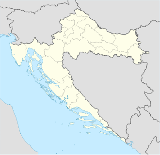
Croatia | |
| County | Primorje-Gorski Kotar |
| Municipality | Krk (town) |
| Demographics | |
| Population | 0 (2011) |
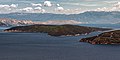
Plavnik is an unpopulated island in the Adriatic Sea, belonging to Croatia located between the Central Straits and the Kvarner Bay. The Krusija Channel cuts it off from the eastern coast of the island of Cres. [2] This channel is the shortest route from the Adriatic Sea through the islands to Rijeka. A lighthouse, established in 1890, sits at the northwestern point of the islet, marking the east side of the narrowest opening of the Krusija Channel. [3]