
The Ganaraska River is a river in Northumberland County and the Regional Municipality of Durham in Southern Ontario, Canada. It is part of the Great Lakes Basin, and is a tributary of Lake Ontario, which it reaches at the central community of the municipality of Port Hope. The river's name is thought to be derived from Ganaraske, the Cayuga name for the village this Iroquoian nation had established in this area in 1779.

The Crowe River is a river in the counties of Haliburton, Hastings, Northumberland and Peterborough in southern Ontario, Canada. It is in the Lake Ontario drainage basin and is a tributary of the Trent River.
The Head River is a river in the township of Ramara, Simcoe County and the city of Kawartha Lakes in Southern Ontario, Canada. It is in the Great Lakes Basin, and flows from Head Lake west to the Black River, east of Lake Couchiching. The Black River flows via the Severn River to Georgian Bay on Lake Huron.
Balsam Lake is a lake in the City of Kawartha Lakes in Central Ontario, Canada. It is in the Great Lakes Basin, is one of the lakes of the Kawartha Lakes, and is at the summit of the Trent–Severn Waterway.

Jack Lake is a lake and reservoir in the municipalities of Havelock-Belmont-Methuen and North Kawartha, Peterborough County in Central Ontario, Canada, about 100 mi (160 km) directly northeast of Toronto and at the edge of the Canadian Shield in the northeastern portion of the Kawartha lakes region. The lake is in the Great Lakes Basin, and serves as a small headwater pond for the Trent-Severn Waterway. The Dispersed rural community of Jack Lake is on the northwest shore of the lake, reached by Peterborough County Road 52 / Jack Lake Road from the community of Apsley, about 5 kilometres (3.1 mi) to the north on Ontario Highway 28.
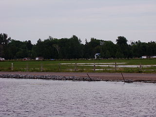
Camborne is an unincorporated place and dispersed rural community in Hamilton Township, Northumberland County in Central Ontario, Canada. It is located on County Road 18 about 6.5 km (4 mi) north of Ontario Highway 401 exit 472 and 10 km (6 mi) north of Cobourg. The village has a population of approximately 350.
Departure Lake is a dispersed rural community and unincorporated place in geographic Haggart Township, Cochrane District in Northeastern Ontario, Canada. It is located on Ontario Highway 11 between the communities of Strickland to the west and Smooth Rock Falls to the east.
Mitchell Lake is a small, artificial lake in the Great Lakes Basin and located in the city of Kawartha Lakes in Central Ontario, Canada. The lake was formed sometime in the first decade of the twentieth century alongside the construction of the Kirkfield Lift Lock, which was completed and operational by the end of 1907. It is part of the summit of the Trent–Severn Waterway, the middle of a connection via canals of Balsam Lake on the Gull River system, which flows eventually to Lake Ontario, and the Kirkfield Lift Lock and Canal Lake on the Talbot River system, which flows to Lake Simcoe and eventually to Lake Huron.
Silver Lake is a small lake in the city of Kawartha Lakes in Central Ontario, Canada. Located near the community of Coboconk, it is the lowest lake on the Gull River, a drainage basin that supplies water at its mouth to Balsam Lake at the top of the Trent-Severn Waterway. Like many other lakes in the Kawarthas, Silver Lake lies in a depression formed between the Precambrian granite to the north, and the Ordovician limestone to the south.
Anstruther Lake is a lake in the municipality of North Kawartha, Peterborough County in Central Ontario, Canada, between the community of Apsley on Ontario Highway 28 8.5 kilometres (5.3 mi) to the east and the community of Catchacoma on County Road 507 8.5 kilometres (5.3 mi) to the west. Kawartha Highlands Provincial Park encompasses the lake, and the community of Anstruther Lake is on the southern shore. The lake flows out via Anstruther Creek, and the Mississaugua, Otonabee and Trent rivers into Lake Ontario.
Shadow Lake is a lake in the city of Kawartha Lakes in Central Ontario, Canada. With an area of 356.8 hectares and an elevation of 259 metres (850 ft), it is the second lake upstream of the mouth of the Gull River, and is in the Lake Ontario drainage basin.
Buckhorn Lake is a lake in the townships of Trent Lakes and Selwyn in Peterborough County, Ontario, Canada, and is one of the Kawartha lakes.
The Drag River is a river in the municipalities of Minden Hills and Dysart et al in Haliburton County, Southern Ontario, Canada. It is in the Great Lakes Basin and is a right tributary of the Burnt River.
Vansickle is a dispersed rural community and unincorporated place in the municipality of Havelock-Belmont-Methuen, Peterborough County in Central Ontario, Canada. It lies just west of the Crowe River on the border with the township of Marmora and Lake in Hastings County.
The Indian River is a river in Peterborough County in Central Ontario, Canada. It is in the Great Lakes Basin, and is a tributary of Rice Lake.

Koshlong Lake is a lake in the municipalities of Highlands East and Dysart et al, Haliburton County in Central Ontario, Canada. It is part of the Great Lakes Basin.
Koshlong Creek is a river in geographic Glamorgan Township in the municipality of Highlands East, Haliburton County in Central Ontario, Canada. The river is in the Great Lakes Basin and is a left tributary of the Burnt River.
The Staples River is a river in Kawartha Lakes in Central Ontario, Canada. It is in the Great Lakes Basin and is a tributary of Balsam Lake. The river is 18 kilometres (11 mi) long and has a watershed of 4,792 hectares.
The Rosedale River is a river in the City of Kawartha Lakes in Central Ontario, Canada. It is in the Great Lakes Basin and is part of the Trent–Severn Waterway. The river is named after Rosa Dale, the wife of settler John Cameron, who first settled the area of nearby Fenelon Falls.
Corben Creek is a stream in the municipality of Minden Hills, Haliburton County, and the unitary city of Kawartha Lakes in Central Ontario, Canada. It is in the Great Lakes Basin and is tributary of Balsam Lake.
