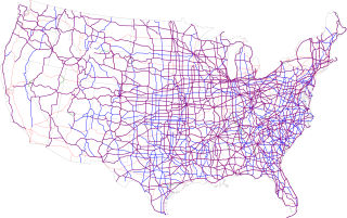
The United States Numbered Highway System is an integrated network of roads and highways numbered within a nationwide grid in the contiguous United States. As the designation and numbering of these highways were coordinated among the states, they are sometimes called Federal Highways, but the roadways were built and have always been maintained by state or local governments since their initial designation in 1926.

U.S. Route 66 or U.S. Highway 66 was one of the original highways in the United States Numbered Highway System. It was established on November 11, 1926, with road signs erected the following year. The highway, which became one of the most famous roads in the United States, ran from Chicago, Illinois, through Missouri, Kansas, Oklahoma, Texas, New Mexico, and Arizona before terminating in Santa Monica in Los Angeles County, California, covering a total of 2,448 miles (3,940 km).

Interstate 24 (I-24) is an Interstate Highway in the Midwestern and Southeastern United States. It runs diagonally from I-57, 10 miles (16 km) south of Marion, Illinois, to Chattanooga, Tennessee, at I-75. It travels through Illinois, Kentucky, Tennessee, and Georgia. As an even-numbered Interstate, it is signed as an east–west route, though the route follows a more southeast–northwest routing, passing through Nashville, Tennessee. The numbering deviates from the standard Interstate Highway System grid, lying further north than its number would indicate west of Nashville. The short segment within Georgia bears the unsigned designation State Route 409 (SR 409).

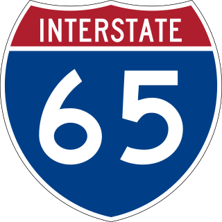
Interstate 65 (I-65) is a major north–south Interstate Highway in the central United States. As with most primary Interstates ending in 5, it is a major crosscountry, north–south route, connecting between the Great Lakes and the Gulf of Mexico. Its southern terminus is located at an interchange with I-10 in Mobile, Alabama, and its northern terminus is at an interchange with US 12 (US 12) and US 20 in Gary, Indiana, just southeast of Chicago. I-65 connects several major metropolitan areas in the Midwest and Southern US. It connects the four largest cities in Alabama: Mobile, Montgomery, Birmingham, and Huntsville. It also serves as one of the main north–south routes through Nashville, Tennessee; Louisville, Kentucky; and Indianapolis, Indiana, each a major metropolitan area in its respective state.

Fultondale is a city in Jefferson County, Alabama, United States and a northern suburb of Birmingham. As of the 2010 census, the population of the city is 8,380.

Maysville is a home rule-class city in Mason County, Kentucky, United States, and is the seat of Mason County. The population was 8,873 as of the 2020 census. Maysville is on the Ohio River, 66 miles (106 km) northeast of Lexington. It is the principal city of the Maysville Micropolitan Statistical Area, which comprises Mason County. Two bridges cross the Ohio from Maysville to Aberdeen, Ohio: the Simon Kenton Memorial Bridge built in 1931 and the William H. Harsha Bridge built in 2001.

Dixie Highway was a United States auto trail first planned in 1914 to connect the Midwest with the South. It was part of a system and was expanded from an earlier Miami to Montreal highway. The final system is better understood as a network of connected paved roads, rather than one single highway. It was constructed and expanded from 1915 to 1929.

U.S. Route 80 or U.S. Highway 80 (US 80) is a major east–west United States Numbered Highway in the Southern United States, much of which was once part of the early auto trail known as the Dixie Overland Highway. As the "0" in the route number indicates, it was originally a cross-country route, from the Pacific Ocean to the Atlantic Ocean. Its original western terminus was at Historic US 101 in San Diego, California. However, the entire segment west of Dallas, Texas, has been decommissioned in favor of various Interstate Highways and state highways. Currently, the highway's western terminus is at an interchange with Interstate 30 (I-30) on the Dallas–Mesquite city line. Its eastern terminus is in Tybee Island, Georgia near the Atlantic Ocean. Between Jonesville, Texas and Kewanee, Mississippi, US 80 runs parallel to or concurrently with Interstate 20. It also currently runs through Dallas, Texas; Shreveport, Louisiana; Jackson, Mississippi; Montgomery, Alabama; Columbus, Georgia; Macon, Georgia; and Savannah, Georgia.

U.S. Route 41, also U.S. Highway 41 (US 41), is a major north–south United States Numbered Highway that runs from Miami, Florida, to the Upper Peninsula of Michigan. Until 1949, the part in southern Florida, from Naples to Miami, was US 94. The highway's southern terminus is in the Brickell neighborhood of Downtown Miami at an intersection with Brickell Avenue (US 1), and its northern terminus is east of Copper Harbor, Michigan, at a modest cul-de-sac near Fort Wilkins Historic State Park at the tip of the Keweenaw Peninsula. US 41 closely parallels Interstate 75 (I-75) from Naples, Florida, all the way through Georgia to Chattanooga, Tennessee.

The Natchez Trace Parkway is a limited-access national parkway in the Southeastern United States that commemorates the historic Natchez Trace and preserves sections of that original trail. Its central feature is a two-lane road that extends 444 miles (715 km) from Natchez, Mississippi, to Nashville, Tennessee. Access to the parkway is limited, with more than 50 access points in Mississippi, Alabama, and Tennessee. The southern end of the route is in Natchez at its intersection with Liberty Road, and the northern end is northeast of Fairview, Tennessee, in the suburban community of Pasquo, at an intersection with Tennessee State Route 100. In addition to Natchez and Nashville, larger cities along the route include Jackson and Tupelo, Mississippi, and Florence, Alabama.

U.S. Route 31 or U.S. Highway 31 (US 31) is a major north–south U.S. highway connecting southern Alabama to northern Michigan. Its southern terminus is at an intersection with US 90/US 98 in Spanish Fort, Alabama. Its northern terminus is at an interchange with Interstate 75 (I-75) south of Mackinaw City, Michigan.

U.S. Route 43 (US 43) is a 410-mile-long (660 km) north–south United States Highway in the Southern states of Alabama and Tennessee. It travels from Prichard, Alabama, to Columbia, Tennessee. The highway's southern terminus is in Prichard, at an intersection with US 90, and its northern terminus is in Columbia at an intersection with US 31/US 412/US 412 Bus.

U.S. Route 431 (US 431) is a spur of U.S. Route 31. It currently travels for approximately 556 miles (895 km) from US 231/Alabama State Route 210 and US 231 Business and US 431 Bus. in Dothan, Alabama, to Owensboro, Kentucky, at US 60 and Kentucky Route 2831. The major cities US 431 connects to are Dothan and Huntsville, Alabama, Franklin and Nashville, Tennessee, and Owensboro, Kentucky.

The Tennessee Valley is the drainage basin of the Tennessee River and is largely within the U.S. state of Tennessee. It stretches from southwest Kentucky to north Alabama and from northeast Mississippi to the mountains of Virginia and North Carolina. The border of the valley is known as the Tennessee Valley Divide. The Tennessee Valley contributes greatly to the formation of Tennessee's three legally recognized sectors.
The Bankhead Highway was a United States cross-country automobile highway connecting Washington, D.C., and San Diego. The Bankhead Highway's beginnings can be traced back to 1916 when the Bankhead Highway Association was organized to promote the highway's development. It was part of the National Auto Trail system. The road was named for Alabama politician John H. Bankhead, a leader in the early national road-building movement. In later years, several stretches of U.S. Route 78 in northwest Alabama were renamed for Bankhead's son, former U.S. Representative and Speaker of the House William B. Bankhead.

The Appalachian Development Highway System (ADHS) is a series of highway corridors in the Appalachia region of the eastern United States. The routes are designed as local and regional routes for improving economic development in the historically isolated region. It was established as part of the Appalachian Regional Development Act of 1965, and has been repeatedly supplemented by various federal and state legislative and regulatory actions. The system consists of a mixture of state, U.S., and Interstate routes. The routes are formally designated as "corridors" and assigned a letter. Signage of these corridors varies from place to place, but where signed are often done so with a distinctive blue-colored sign.

U.S. Route 31E (US 31E) is the eastern parallel route for U.S. Highway 31 from Nashville, Tennessee, to Louisville, Kentucky.

The Old Spanish Trail was an auto trail that once spanned the United States with almost 2,750 miles (4,430 km) of roadway from ocean to ocean. It crossed eight states and 67 counties along the southern border of the United States. Work on the auto highway began in 1915 at a meeting held at the Battle House Hotel in Mobile, Alabama; and, by the 1920s, the trail linked St. Augustine, Florida, to San Diego, California, with its center and headquarters in San Antonio, Texas. The work at San Antonio, and indeed nationally, was overseen by an executive committee consisting of prominent San Antonio businessmen which met at the Gunter Hotel weekly.

Interstate 40 (I-40) is part of the Interstate Highway System that runs 2,556.61 miles (4,114.46 km) from Barstow, California, to Wilmington, North Carolina. The highway crosses Tennessee from west to east, from the Mississippi River at the Arkansas border to the Blue Ridge Mountains at the North Carolina border. At 455.28 miles (732.70 km), the Tennessee segment of I-40 is the longest of the eight states through which it passes and the state's longest Interstate Highway.

Interstate 65 (I-65) is part of the Interstate Highway System that runs 887.30 miles (1,427.97 km) north–south from Mobile, Alabama, to Gary, Indiana. In Tennessee, I-65 traverses the middle portion of the state, running from Ardmore at the Alabama border to the Kentucky border near Portland. The route serves the state capital and largest city of Nashville, along with many of its suburbs. Outside of urban areas, the Interstate bypasses most cities and towns that it serves, instead providing access via state and U.S. Highways. The Interstate passes through the Highland Rim and Nashville Basin physiographic regions of Tennessee, and is often used as the dividing line between the eastern and western portions of the former.


