Related Research Articles

Montgomery County is a county located in the southwestern area of the U.S. state of Iowa. As of the 2020 census, the population was 10,330. Its population has declined since a peak in 1900, since urbanization and decline of family farms. The county seat is Red Oak. The county was founded by European-American migrants from eastern areas in 1851. It was named in honor of Richard Montgomery, an American Revolutionary War general killed in 1775 while trying to capture Quebec City, Canada.
Jackson County is a county in the U.S. state of Minnesota. As of the 2020 census, the population was 9,989. Its county seat is Jackson.

Van Buren County is a county located in the U.S. state of Iowa. As of the 2020 census the population was 7,203, making it the state's tenth-least populous county. The county seat is Keosauqua, which contains the oldest continuously operational courthouse in the state of Iowa, and second oldest in the United States.

Madison County is a county located in the U.S. state of Iowa. As of the 2020 census, the population was 16,548. The county seat is Winterset. Madison County is included in the Des Moines–West Des Moines, IA Metropolitan Statistical Area. Madison County is famous for being the county where John Wayne was born, and for a number of covered bridges. These bridges were featured in Robert James Waller's 1992 novella The Bridges of Madison County, as well as the 1995 film and 2014 musical based on it.

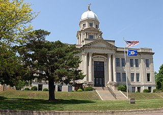
Jefferson County is a county located in the U.S. state of Iowa. As of the 2020 United States Census, the population was 15,663. The county seat is Fairfield. The county was formed in January 1839, and was named for U.S. President Thomas Jefferson. Jefferson County comprises the Fairfield, IA Micropolitan Statistical Area.

Packer Township is a township in Carbon County, Pennsylvania. It is part of Northeastern Pennsylvania. The population was 998 at the 2010 census.

Jackson Township is a township in Columbia County, Pennsylvania. It is part of Northeastern Pennsylvania. The population was 624 at the 2020 census.

Coppock is a city in Henry, Jefferson, and Washington counties in the U.S. state of Iowa. The population was 36 at the 2020 census.

Summerhaven is a small unincorporated community and census-designated place (CDP) on Mount Lemmon in the Santa Catalina Mountains north of Tucson in Pima County, Arizona, United States. As of the 2010 census it had a permanent population of 40. Summerhaven sits at an elevation of approximately 7,600 to 8,200 feet above sea level. Summerhaven is accessed via the Catalina Highway from suburban northeast Tucson, and it is about 24.5 miles (39.4 km) from the base of the mountains to Summerhaven.
Niota is an unincorporated community in Appanoose Township, Hancock County, in the U.S. state of Illinois. The community is located on the bank of the Mississippi River and is at the eastern end of the Fort Madison Toll Bridge, which connects Niota to Fort Madison, Iowa. Niota is the western terminus of Illinois Route 9 and is also served by Illinois Route 96, which is part of the Great River Road.

The 2011 flooding event on the Missouri River in the United States was triggered by record snowfall in Rocky Mountains of Montana and Wyoming along with near-record spring rainfall in central and eastern Montana. All six major dams along the Missouri River released record amounts of water to prevent overflow which led to flooding threatening several towns and cities along the river from Montana to Missouri; in particular Bismarck, North Dakota; Pierre, South Dakota; Dakota Dunes, South Dakota; South Sioux City, Nebraska, Sioux City, Iowa; Omaha, Nebraska; Council Bluffs, Iowa; Saint Joseph, Missouri; Kansas City, Missouri; Jefferson City, Missouri, and St. Louis, Missouri. Many smaller towns were also at risk, suffering the same fate as the larger cities if not worse. According to the National Weather Service, in the second half of the month of May 2011, almost a year's worth of rain fell over the upper Missouri River basin. Extremely heavy rainfall in conjunction with an estimated 212 percent of normal snowpack in the Rocky Mountains contributed to this flooding event.

Turkey Hill is a hill in Columbia County, Pennsylvania, in the United States. It has an elevation of 942 feet (287 m) above sea level. The hill has a flat plateau at the top, but steep slopes on its northern, western, and southern sides. The western and southern parts of the hill have some residential development, while the northern side is mostly forested. The views it provides of the surrounding area have been described as "striking" and "breathtaking".

Lowell is an unincorporated community and census-designated place (CDP) in southeastern Henry County, Iowa, United States. It was first listed as a CDP prior to the 2020 census.
Cedar Township is a township in Sac County, Iowa, United States. Part of Lytton, Iowa is within Cedar Township.
Clinton Township is a township in Sac County, Iowa, United States.
Coon Valley Township is a township in Sac County, Iowa, United States.
Douglas Township is a township in Sac County, Iowa, United States.
Eureka Township is a township in Sac County, Iowa, United States. Schaller, Iowa is contained within Eureka Township.
Cummins Township is a township in Pocahontas County, Iowa, United States. Havelock is contained within Cummins Township.
References
- ↑ U.S. Geological Survey Geographic Names Information System: Jackson Township, Henry County, Iowa
- ↑ "ACS DEMOGRAPHIC AND HOUSING ESTIMATES". data.census.gov. Retrieved April 1, 2021.
- ↑ "History of Henry County | The University of Iowa Libraries". digital.lib.uiowa.edu. Retrieved April 2, 2021.
- 1 2 "Boyleston Bridge, Spanning Skunk River, Lowell, Henry County, IA". Library of Congress. Retrieved April 2, 2021.
- ↑ "Edwards, Joseph A. and Lydia A. (Frazier), House". www.nps.gov. Retrieved April 2, 2021.
- ↑ "GNIS Detail - Township of Jackson". geonames.usgs.gov. Retrieved April 2, 2021.
Municipalities and communities of Henry County, Iowa, United States | ||
|---|---|---|
| Cities |  | |
| CDPs | ||
| Unincorporated community | ||
| Footnotes | ‡This populated place also has portions in an adjacent county or counties | |
40°51′N91°33′W / 40.850°N 91.550°W
| | This article about the geography of Henry County, Iowa is a stub. You can help Wikipedia by expanding it. |