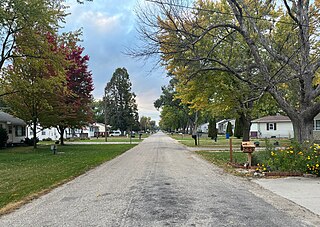
Saylorville is a census-designated place (CDP) in Polk County, Iowa, United States. The population was 3,584 at the 2020 census. It is part of the Des Moines–West Des Moines Metropolitan Statistical Area. The Saydel Community School District is located in this area, as is the unincorporated community of Marquisville.

Washburn is an unincorporated town and census-designated place (CDP) in Black Hawk County, Iowa, United States. Washburn lies south of Waterloo on U.S. Route 218. Other towns near Washburn are Gilbertville and La Porte City. The community is part of the Waterloo–Cedar Falls Metropolitan Statistical Area.

Swedesburg is an unincorporated community and census-designated place (CDP) in northern Henry County, Iowa, United States. It was first listed as a CDP prior to the 2020 census.
South Amana is an unincorporated community and census-designated place (CDP) in northern Iowa County, Iowa, United States, and is part of the "seven villages" of the Amana Colonies. As of the 2020 census, it had a population of 165.
Little Cedar is an unincorporated community and census-designated place in central Mitchell County, Iowa, United States. As of the 2020 census it had a population of 64. Little Cedar has a post office with the ZIP code of 50454.

Toeterville is an unincorporated community and census-designated place in northwestern Mitchell County, Iowa, United States. As of the 2020 census it had a population of 53.
Moscow is an unincorporated community and census-designated place (CDP) in Muscatine County, Iowa, United States. As of the 2020 census, the population was 290. It has a post office, with the ZIP code of 52760, which opened on May 1, 1837. The community is part of the Muscatine Micropolitan Statistical Area.

Sexton is an unincorporated community and census-designated place in Irvington Township, Kossuth County, Iowa, United States. It is located at the intersection of U.S. Route 18 and Kossuth CR P60. As of the 2020 census it had a population of 46.
Green Mountain is a rural unincorporated community and census-designated place (CDP) in Marshall County, Iowa, United States. It is located in Marion Township. As of the 2020 census the population of Green Mountain was 113.

Rochester is an unincorporated community and census-designated place (CDP) in Rochester Township, Cedar County, Iowa, United States. As of the 2020 census it had a population of 142.
Irvington is an unincorporated community and census-designated place (CDP) in Irvington Township, Kossuth County, Iowa, United States. As of the 2020 census it had a population of 36.
St. Benedict is an unincorporated community and census-designated place (CDP) in Prairie Township, Kossuth County, Iowa, United States. As of the 2020 census it had a population of 31.
High Amana is an unincorporated community and census-designated place (CDP) in Iowa County, Iowa, United States, and is part of the "seven villages" of the Amana Colonies. As of the 2020 Census, the population of High Amana was 113.
East Amana is an unincorporated community and census-designated place (CDP) in Iowa County, Iowa, United States, and is part of the "seven villages" of the Amana Colonies. As of the 2020 Census, the population of East Amana was 64.
Portland is an unincorporated community and census-designated place (CDP) in Portland Township, Cerro Gordo County, Iowa, United States. As of the 2020 census it had a population of 28.

Beaverdale is an unincorporated community and census-designated place (CDP) in Flint River Township, Des Moines County, Iowa, United States. As of the 2020 census it had a population of 880. It is part of the Burlington, Iowa micropolitan area.
Lake Panorama is a census-designated place located in Cass Township and Victory Township in Guthrie County, Iowa, United States. In the 2020 census the population was 1266.
Meyer is an unincorporated community and census-designated place in Stacyville Township, Mitchell County, in the state of Iowa, United States. As of the 2020 census the population was 14, down from 31 in 2010.

Otranto is an unincorporated community and census-designated place in Otranto Township, Mitchell County, in the U.S. state of Iowa. As of the 2020 census the population was 27, unchanged from 2010.

Trenton is an unincorporated community and census-designated place (CDP) in Henry County, Iowa, United States. It is in the northwest part of the county, 10 miles (16 km) northwest of Mount Pleasant, the county seat.


