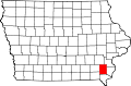
New London, Iowa

Last updated

New London, Iowa
New london iowa.jpg
New London, Iowa
Henry County Iowa Incorporated and Unincorporated areas New London Highlighted.svg
Location of New London, Iowa
Coordinates: 40°55′23″N91°24′4″W / 40.92306°N 91.40111°W / 40.92306; -91.40111
Country Flag of the United States (23px).png  United States
State Flag of Iowa.svg  Iowa
County Henry
Area
[1]
  Total1.04 sq mi (2.70 km2)
  Land1.04 sq mi (2.70 km2)
  Water0.00 sq mi (0.00 km2)
Elevation
[2]
755 ft (230 m)
Population
 (2020)
  Total1,910
  Density1,834.77/sq mi (708.40/km2)
Time zone UTC-6 (Central (CST))
  Summer (DST) UTC-5 (CDT)
ZIP code
52645
Area code 319
FIPS code 19-56325
GNIS feature ID2395204 [2]
MayorKirk Miller [3]

New London is a city in Henry County, Iowa, United States. The population was 1,910 at the time of the 2020 census. [4]

Contents

History

New London was originally called Dover, after its founder Abraham C. Dover, who came to the area from Illinois in 1833. [5]

Geography

According to the United States Census Bureau, the city has a total area of 1.01 square miles (2.62 km2), all land. [6]

Demographics

Historical populations
YearPop.±%
1880 658    
1890 580−11.9%
1900 1,003+72.9%
1910 1,144+14.1%
1920 1,144+0.0%
1930 1,336+16.8%
1940 1,340+0.3%
1950 1,510+12.7%
1960 1,694+12.2%
1970 1,900+12.2%
1980 2,043+7.5%
1990 1,922−5.9%
2000 1,937+0.8%
2010 1,897−2.1%
2020 1,910+0.7%
Source: "U.S. Census website". United States Census Bureau . Retrieved March 29, 2020. and Iowa Data Center
Source:
U.S. Decennial Census [7] [4]

2020 census

As of the census of 2020, [8] there were 1,910 people, 797 households, and 525 families residing in the city. The population density was 1,834.8 inhabitants per square mile (708.4/km2). There were 835 housing units at an average density of 802.1 per square mile (309.7/km2). The racial makeup of the city was 92.7% White, 1.5% Black or African American, 0.4% Native American, 0.4% Asian, 0.0% Pacific Islander, 0.8% from other races and 4.3% from two or more races. Hispanic or Latino persons of any race comprised 2.0% of the population.

Of the 797 households, 31.6% of which had children under the age of 18 living with them, 46.7% were married couples living together, 8.8% were cohabitating couples, 28.2% had a female householder with no spouse or partner present and 16.3% had a male householder with no spouse or partner present. 34.1% of all households were non-families. 26.9% of all households were made up of individuals, 12.7% had someone living alone who was 65 years old or older.

The median age in the city was 41.1 years. 26.3% of the residents were under the age of 20; 5.6% were between the ages of 20 and 24; 23.2% were from 25 and 44; 24.5% were from 45 and 64; and 20.4% were 65 years of age or older. The gender makeup of the city was 49.1% male and 50.9% female.

2010 census

As of the census [9] of 2010, there were 1,897 people, 769 households, and 517 families living in the city. The population density was 1,878.2 inhabitants per square mile (725.2/km2). There were 830 housing units at an average density of 821.8 per square mile (317.3/km2). The racial makeup of the city was 96.5% White, 1.7% African American, 0.3% Native American, 0.4% Asian, 0.1% from other races, and 1.1% from two or more races. Hispanic or Latino of any race were 0.9% of the population.

There were 769 households, of which 33.4% had children under the age of 18 living with them, 50.8% were married couples living together, 12.1% had a female householder with no husband present, 4.3% had a male householder with no wife present, and 32.8% were non-families. 27.6% of all households were made up of individuals, and 11% had someone living alone who was 65 years of age or older. The average household size was 2.42 and the average family size was 2.91.

The median age in the city was 38.7 years. 26.1% of residents were under the age of 18; 7% were between the ages of 18 and 24; 24.8% were from 25 to 44; 24.6% were from 45 to 64; and 17.6% were 65 years of age or older. The gender makeup of the city was 48.7% male and 51.3% female.

2000 census

As of the census [10] of 2000, there were 1,937 people, 794 households, and 540 families living in the city. The population density was 1,924.9 inhabitants per square mile (743.2/km2). There were 846 housing units at an average density of 840.7 per square mile (324.6/km2). The racial makeup of the city was 98.40% White, 0.31% African American, 0.05% Native American, 0.26% Asian, 0.46% from other races, and 0.52% from two or more races. Hispanic or Latino of any race were 0.77% of the population.

There were 794 households, out of which 31.0% had children under the age of 18 living with them, 55.4% were married couples living together, 9.6% had a female householder with no husband present, and 31.9% were non-families. 27.3% of all households were made up of individuals, and 12.3% had someone living alone who was 65 years of age or older. The average household size was 2.38 and the average family size was 2.89.

24.6% were under the age of 18, 7.8% from 18 to 24, 27.2% from 25 to 44, 23.9% from 45 to 64, and 16.5% were 65 years of age or older. The median age was 38 years. For every 100 females, there were 88.1 males. For every 100 females age 18 and over, there were 84.2 males.

The median income for a household in the city was $39,432, and the median income for a family was $46,389. Males had a median income of $31,324 versus $23,712 for females. The per capita income for the city was $18,301. About 4.8% of families and 6.4% of the population were below the poverty line, including 8.0% of those under age 18 and 10.8% of those aged 65 or over.

Education

The New London Community School District operates local public schools. [11]

Notable people

See also

The following properties are listed on the National Register of Historic Places:

Related Research Articles

<span class="mw-page-title-main">Moulton, Iowa</span> City in Iowa, United States

Moulton is a city in Appanoose County, Iowa, United States. The population was 607 at the time of the 2020 census.

<span class="mw-page-title-main">Hudson, Iowa</span> City in Iowa, United States

Hudson is a city in Black Hawk County, Iowa, United States. The population was 2,546 at the time of the 2020 census. The rural community of Hudson has grown in recent years and is included as a part of the Waterloo-Cedar Falls Metropolitan Statistical Area.

<span class="mw-page-title-main">Fairbank, Iowa</span> City in Iowa, United States

Fairbank is a city in Buchanan and Fayette counties in the U.S. state of Iowa. The population was 1,111 at the time of the 2020 census.

<span class="mw-page-title-main">Rembrandt, Iowa</span> City in Iowa, United States

Rembrandt is a city in Buena Vista County, Iowa, United States. The population was 209 at the time of the 2020 census.

<span class="mw-page-title-main">Lawler, Iowa</span> City in Iowa, United States

Lawler is a city in Chickasaw County, Iowa, United States. The population was 406 at the time of the 2020 census.

<span class="mw-page-title-main">Delaware, Iowa</span> City in Iowa, United States

Delaware is a city in Delaware County, Iowa, United States. The population was 142 at the time of the 2020 census.

<span class="mw-page-title-main">Mondamin, Iowa</span> City in Iowa, United States

Mondamin is a city in Harrison County, Iowa, United States. The population was 339 at the time of the 2020 census.

<span class="mw-page-title-main">Lockridge, Iowa</span> City in Iowa, United States

Lockridge is a city in Jefferson County, Iowa, United States. The population was 244 at the time of the 2020 census. Lockridge was one of the communities considered for the county seat in 1839, but lost out to Fairfield.

<span class="mw-page-title-main">Hills, Iowa</span> City in Iowa, United States

Hills is a city in Johnson County, Iowa, United States. It is part of the Iowa City, Iowa Metropolitan Statistical Area. The population was 863 at the time of the 2020 census. It is part of the Iowa City Community School District.

<span class="mw-page-title-main">Delta, Iowa</span> City in Iowa, United States

Delta is a city in Keokuk County, Iowa, United States. The population was 264 at the 2020 census.

<span class="mw-page-title-main">Hayesville, Iowa</span> City in Iowa, United States

Hayesville is a city in Keokuk County, Iowa, United States. The population was 41 at the time of the 2020 census.

<span class="mw-page-title-main">Webster, Iowa</span> City in Iowa, United States

Webster is a city in Keokuk County, Iowa, United States. The population was 94 at the time of the 2020 census.

<span class="mw-page-title-main">Rose Hill, Iowa</span> City in Iowa, United States

Rose Hill is a city in Mahaska County, Iowa, United States. The population was 157 at the time of the 2020 census.

<span class="mw-page-title-main">University Park, Iowa</span> City in Iowa, United States

University Park is a city in Mahaska County, Iowa, United States. The population was 487 at the 2020 census.

<span class="mw-page-title-main">Emerson, Iowa</span> City in Iowa, United States

Emerson is a city in Mills County, Iowa, United States. The population was 403 at the time of the 2020 census.

<span class="mw-page-title-main">McClelland, Iowa</span> City in Iowa, United States

McClelland is a city in Pottawattamie County, Iowa, United States. The city was founded in 1903 after the Great Western Railroad was extended to include Council Bluffs, Iowa The population was 146 at the time of the 2020 census.

<span class="mw-page-title-main">Dixon, Iowa</span> City in Iowa, United States

Dixon is a city in Scott County, Iowa, United States. The population was 202 at the time of the 2020 census.

<span class="mw-page-title-main">Maysville, Iowa</span> City in Iowa, United States

Maysville is a city in Scott County, Iowa, United States. The population was 156 at the time of the 2020 census.

<span class="mw-page-title-main">Clarkson Valley, Missouri</span> City in Missouri, United States

Clarkson Valley is a city in St. Louis County, Missouri, United States. The population was 2,609 at the 2020 census.

<span class="mw-page-title-main">Harrisburg, Oregon</span> City in Oregon, United States

Harrisburg is a city in Linn County, Oregon, United States. The population was 3,567 at the 2010 census.

References

  1. "2020 U.S. Gazetteer Files". United States Census Bureau. Retrieved March 16, 2022.
  2. 1 2 U.S. Geological Survey Geographic Names Information System: New London, Iowa
  3. "City Information". City of New London. Retrieved January 18, 2020.
  4. 1 2 "2020 Census State Redistricting Data". census.gov. United states Census Bureau. Retrieved August 12, 2021.
  5. The History of Henry County, Iowa: Containing a History of the County, Its Cities, Towns, &c. Western Historical Company. 1879. pp.  544.
  6. "US Gazetteer files 2010". United States Census Bureau. Archived from the original on January 25, 2012. Retrieved May 11, 2012.
  7. "Census of Population and Housing". Census.gov. Retrieved June 4, 2015.
  8. "2020 Census". United States Census Bureau.
  9. "U.S. Census website". United States Census Bureau . Retrieved May 11, 2012.
  10. "U.S. Census website". United States Census Bureau . Retrieved January 31, 2008.
  11. "NEW LONDON" (PDF). Iowa Department of Education . Retrieved September 5, 2020.