Jacobs, Iowa

Last updated

Jacobs, Iowa
USA Iowa location map.svg
Red pog.svg
Jacobs, Iowa
Coordinates: 41°39′54″N92°40′08″W / 41.66500°N 92.66889°W / 41.66500; -92.66889
Country United States
State Iowa
County Poweshiek
Elevation
981 ft (299 m)
Time zone UTC-6 (Central (CST))
  Summer (DST) UTC-5 (CDT)
Area code 641
GNIS feature ID465418 [1]

Jacobs was an unincorporated community in Poweshiek County, in the U.S. state of Iowa. [1]

Contents

Geography

Jacobs was at 41°39′54″N92°40′08″W / 41.66500°N 92.66889°W / 41.66500; -92.66889 where the Minneapolis and St. Louis Railway crossed what is now 60th Street.

History

Jacobs in western Poweshiek County, Iowa, in 1902 Poweshiek County, Iowa, 1902.png
Jacobs in western Poweshiek County, Iowa, in 1902

A post office was established at Jacobs in 1896. [2] Jacobs was located in Sections 11 and 12 of Washington Township, about five miles southeast of Grinnell. The community was along the Minneapolis and St. Louis Railway, [3] which at that time was a major rail line in the American Midwest.

In addition to the rail station, Jacobs was the location of the Farmers' Cooperative Creamery and a butter factory. [4]

The population of Jacobs was 17 in 1902. [5]

The Jacobs post office was discontinued in 1913. [2]

The population of the community was 21 in 1925, [6] and was 10 in 1940. [7]

See also

Related Research Articles

<span class="mw-page-title-main">Berwick, Iowa</span> Unincorporated community in Iowa, United States

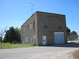
Berwick is an unincorporated community in Polk County, Iowa, United States, on the east bank of Fourmile Creek. It is part of the Des Moines–West Des Moines Metropolitan Statistical Area.

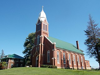
Amish is an unincorporated community in Washington Township, Johnson County, Iowa, United States. It is part of the Iowa City Metropolitan Statistical Area. Its altitude is 758 feet (231 m), and it lies at 41°32′9″N91°47′12″W.

Gifford is an unincorporated community in southeastern Hardin County, Iowa, United States.

<span class="mw-page-title-main">Cedar, Iowa</span> Unincorporated community in Iowa, United States

Cedar is an unincorporated community in southeastern Mahaska County, Iowa, United States. It lies along Iowa Highway 23 southeast of the city of Oskaloosa, the county seat of Mahaska County.

Killduff is an unincorporated community in southeastern Jasper County, Iowa, United States. It lies along local roads southeast of the city of Newton, the county seat of Jasper County.

Zaneta is an unincorporated community in Grundy County, Iowa, United States.

Dunbar is an unincorporated community and former railroad depot village in Green Castle Township, Marshall County, Iowa, United States.

Botna is an unincorporated community in Shelby County, Iowa, in the United States, located near the West Nishnabotna River.

Boyer is an unincorporated community in Crawford County, in the U.S. state of Iowa.

Carnforth is an unincorporated community in Poweshiek County, in the U.S. state of Iowa.

Crocker is an unincorporated community in Polk County, Iowa, United States.

Lawn Hill is an unincorporated community in Hardin County, in the U.S. state of Iowa.

Malone is an unincorporated community in Clinton County, in the U.S. state of Iowa.

Nashville is an unincorporated community in Jackson County, in the U.S. state of Iowa.

<span class="mw-page-title-main">Petersville, Iowa</span> Unincorporated community in Iowa, United States

Petersville is an unincorporated community in Clinton County, in the U.S. state of Iowa.

Carnes is an unincorporated rural small hamlet in Sioux County, in the U.S. state of Iowa. Presently, the hamlet consists of a pizza restaurant.

Thorpe is an unincorporated community in Honey Creek Township, Delaware County, Iowa, United States.

Murphy is a former unincorporated community in Jasper County, in the U.S. state of Iowa.

Ambrose was an unincorporated community in Iowa County, in the U.S. state of Iowa.

Bromley is a former village in Minerva Township, Marshall County, Iowa, United States.

References

  1. 1 2 U.S. Geological Survey Geographic Names Information System: Jacobs, Iowa
  2. 1 2 "Post Offices". www.postalhistory.com. Retrieved November 22, 2022.
  3. "Poweshiek County (1914)". Library of Congress, Washington, D.C. 20540 USA. Retrieved November 22, 2022.
  4. Parker, Leonard Fletcher (1911). History of Poweshiek County, Iowa: A Record of Settlement, Organization, Progress and Achievement. S. J. Clarke publishing Company. pp. 386, 527.
  5. Cram's Modern Atlas: The New Unrivaled New Census Edition. J. R. Gray & Company. 1902. pp. 203–207.
  6. Premier Atlas of the World: Containing Maps of All Countries of the World, with the Most Recent Boundary Decisions, and Maps of All the States,territories, and Possessions of the United States with Population Figures from the Latest Official Census Reports, Also Data of Interest Concerning International and Domestic Political Questions. Rand McNally & Company. 1925. p. 190.
  7. The Attorneys List. United States Fidelity and Guaranty Company, Attorney List Department. 1940. p. 302.