Victoria County is located in northwestern New Brunswick, Canada. Farming, especially of potatoes, is the major industry in the county. The area was named for Queen Victoria.

Saumarez is a civil parish in Gloucester County, New Brunswick, Canada.

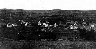
Petit-Rocher is a former village in Gloucester County, New Brunswick. It held village status prior to 2023 and is now part of the town of Belle-Baie. Sitting on the western shore of both Chaleur Bay and Nepisiguit Bay 20 km northwest of Bathurst.
Belledune is a port village in the Canadian province of New Brunswick. It has a population of 1,325, and straddles the boundary between Restigouche County and Gloucester County, New Brunswick.

Bertrand is a former village in Gloucester County, New Brunswick, Canada. It held village status prior to 2023 and is now part of the town of Rivière-du-Nord.
Kedgwick is a Canadian incorporated rural community in northern New Brunswick, Canada. On 1 January 2023, Kedgwick annexed a large area including the local service districts of St. Jean Baptiste – Menneval and White's Brook, with parts of two others; revised census figures have not been released.
Paquetville is a former village in Gloucester County, New Brunswick, Canada. It held village status prior to 2023 and is now part of the town of Hautes-Terres. It is on the Acadian Peninsula at the intersection of Route 340, Route 135 and Route 350.
Pointe-Verte is a community and former village in Gloucester County, New Brunswick. It held village status prior to 2023 and is now part of the Town of Belle-Baie.

Stonehaven is a Canadian rural community in Gloucester County, New Brunswick, in the parish of New Bandon. Situated about 30 kilometres (19 mi) east of Bathurst on Route 11, Stonehaven is on the southern shore of the Baie des Chaleurs.

Bathurst is a civil parish in Gloucester County, New Brunswick, Canada.

New Bandon is a civil parish in Gloucester County, New Brunswick, Canada.

Allardville is a civil parish in Gloucester County, New Brunswick, Canada,
New Bandon-Salmon Beach was a local service district in New Brunswick, Canada. It is now mostly part of the Chaleur rural district, with a small area now part of the city of Bathurst.
Route 860 is a 40-kilometre (25 mi) long mostly north–south secondary highway in the south-western portion of New Brunswick, Canada.
Route 865 is a 17.6-kilometre (10.9 mi) long mostly north–south secondary highway in the south-western portion of New Brunswick, Canada.

Nepisiguit Bay is located in northern New Brunswick, Canada on the southern part of the Chaleur Bay, which extends from the Atlantic Ocean and Nepisiguit Bay is a southern arm of it, stretching between Petit-Rocher and Stonehaven.