Bathurst Parish, New Brunswick

Last updated

Bathurst
Gloucester County NB - Bathurst Parish.PNG
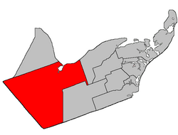
Location within Gloucester County, New Brunswick
Coordinates: 47°28′N65°52′W / 47.46°N 65.86°W / 47.46; -65.86
Country Flag of Canada (Pantone).svg  Canada
Province Flag of New Brunswick.svg  New Brunswick
County Gloucester
Erected1827
Area
[1]
  Land1,502.74 km2 (580.21 sq mi)
Population
 (2021) [1]
  Total4,761
  Density3.2/km2 (8/sq mi)
  Change 2016-2021
Decrease2.svg 0.8%
  Dwellings
2,293
Time zone UTC-4 (AST)
  Summer (DST) UTC-3 (ADT)
Figures do not include portions within the city of Bathurst, the town of Beresford, and the Pabineau 11 Indian reserve

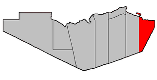
Bathurst is a geographic parish in Gloucester County, New Brunswick, Canada. [4]

Contents

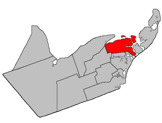
For governance purposes, the parish is divided between the city of Bathurst, the town of Belle-Baie, [5] and the Chaleur rural district, [6] as well as the Pabineau 11 Indian reserve; the city, town, and village are all part of the Chaleur Regional Service Commission. [7]

Prior to the 2023 governance reform, the parish was divided between Bathurst, the town of Beresford, the Indian reserve, and six local service districts: Allardville, Big River, Dunlop, New Bandon-Salmon Beach, North Tetagouche, and the parish of Bathurst; [8] In the 2023 reform, [9] Bathurst annexed most of North Tetagouche, the northern part of Big River, a part of New Bandon-Salmon Beach along Currie Street, and parts of the LSD of the parish of Bathurst including the communities of Chamberlain Settlement, Gloucester Junction, and Sainte-Anne; [5] Beresford became part of Belle-Baie, annexing Dunlop and small parts of the parish LSD; [5] Allardville and the remaining parts of Big River, New Bandon-Salmon Beach, and the parish LSD became part of the rural district. [6]

Origin of name

The parish was named in honour of Earl Bathurst, British Secretary of State for War and the Colonies at the time of its erection. [10]

History

Bathurst was erected in 1827 from the western part of Saumarez Parish. [11] Its eastern boundary followed Teagues Brook to its head and ran south "to the county line", which it doesn't actually reach.

In 1850 the eastern boundary was altered to match the northern end of the modern parish line then along its prolongation to the county line, trading areas with New Bandon Parish. [12]

In 1947 a large area in the southeastern part of the parish was included in the newly erected Allardville Parish. [13]

Boundaries

Bathurst Parish is bounded: [2] [14] [15]

Former governance

The LSDs all assessed for community & recreation services; all except New Bandon-Salmon Beach also had street lighting.

Communities

Communities at least partly within the parish; [14] [15] [29] [30] (brackets) indicate the LSD; italics indicate a name not used on modern provincial government maps

Bodies of water

Bodies of water [lower-alpha 2] at least partly within the parish. [14] [15] [29]

Islands

Islands at least partly within the parish. [14] [15] [29]

Other notable places

Parks, historic sites, and other noteworthy places at least partly within the parish. [14] [15] [29] [31]

Demographics

Population

Parish population total does not include former municipalities or Indian reserve. Revised census figures based on the 2023 local governance reforms have not been released.

Canada census – Bathurst community profile
2021 2016 2011
Population4,761 (-0.8% from 2016)4,797 (-3.7% from 2011)4,979 (-3.2% from 2006)
Land area1,502.74 km2 (580.21 sq mi)1,504.87 km2 (581.03 sq mi)1,504.80 km2 (581.01 sq mi)
Population density3.2/km2 (8.3/sq mi)3.2/km2 (8.3/sq mi)3.3/km2 (8.5/sq mi)
Median age52.4 (M: 52.8, F: 52.0)50.1 (M: 50.1, F: 50.1)47.1 (M: 47.7, F: 46.7)
Private dwellings2,293 (total)  2,103 (occupied)2,292 (total) 2,223 (total) 
Median household income$72,500$64,597$54,540
References: 2021 [33] 2016 [34] 2011 [35] earlier [36] [37]
Historical Census Data - Bathurst Parish, New Brunswick
YearPop.±%
1991 5,929    
1996 5,785−2.4%
YearPop.±%
2001 5,494−5.0%
2006 5,144−6.4%
YearPop.±%
2011 4,979−3.2%
2016 4,797−3.7%
[38] [39]

Language

Canada Census Mother Tongue – Bathurst Parish, New Brunswick [38]
CensusTotal
French
English
French & English
Other
YearResponsesCountTrendPop %CountTrendPop %CountTrendPop %CountTrendPop %
2021
4,750
2,225Decrease2.svg 5.52%46.84%2,315Increase2.svg 1.09%48.73%170Increase2.svg 61.90%3.58%45Increase2.svg 28.57%0.95%
2016
4,780
2,355Decrease2.svg 1.23%49.27%2,290Decrease2.svg 1.04%47.91%105Steady2.svg 0.0%2.20%35Increase2.svg 16.67%0.73%
2011
4,965
2,435Increase2.svg 4.7%49.04%2,395Decrease2.svg 10.0%48.24%105Increase2.svg 40.0%2.11%30Decrease2.svg 57.1%0.60%
2006
5,130
2,325Decrease2.svg 14.2%45.32%2,660Increase2.svg 1.1%51.85%75Decrease2.svg 34.8%1.46%70Increase2.svg 133.3%1.36%
2001
5,485
2,710Decrease2.svg 10.7%49.41%2,630Increase2.svg 1.2%47.95%115Decrease2.svg 11.5%2.10%30Increase2.svg 200.0%0.55%
1996
5,775
3,035n/a52.55%2,600n/a45.02%130n/a2.25%10n/a0.17%

See also

Notes

  1. The provincial 911 system lists it separately from the reserve.
  2. Not including brooks, ponds or coves.

Related Research Articles

<span class="mw-page-title-main">Bathurst, New Brunswick</span> City in New Brunswick, Canada

Bathurst is a city in northern New Brunswick with a population of 12,157 and the 4th largest metropolitan area in New Brunswick as defined by Census Canada with a population of 31,387 as of 2021. The City of Bathurst overlooks Nepisiguit Bay, part of Chaleur Bay and is at the estuary of the Nepisiguit River.

<span class="mw-page-title-main">Saumarez Parish, New Brunswick</span> Parish in New Brunswick, Canada

Saumarez is a geographic parish in Gloucester County, New Brunswick, Canada.

<span class="mw-page-title-main">Restigouche-Chaleur</span> Provincial electoral district in New Brunswick, Canada

Restigouche-Chaleur is a provincial electoral district for the Legislative Assembly of New Brunswick, Canada. It is a redistribution of the riding of Nigadoo-Chaleur.

<span class="mw-page-title-main">Beresford Parish, New Brunswick</span> Parish in New Brunswick, Canada

Beresford is a geographic parish in Gloucester County, New Brunswick, Canada.

<span class="mw-page-title-main">Addington Parish, New Brunswick</span> Parish in New Brunswick, Canada

Addington is a geographic parish in Restigouche County, New Brunswick, Canada.

<span class="mw-page-title-main">Inkerman Parish, New Brunswick</span> Parish in New Brunswick, Canada

Inkerman is a geographic parish in Gloucester County, New Brunswick, Canada.

<span class="mw-page-title-main">Dalhousie Parish, New Brunswick</span> Parish in New Brunswick, Canada

Dalhousie is a geographic parish in Restigouche County, New Brunswick, Canada.

<span class="mw-page-title-main">Colborne Parish, New Brunswick</span> Parish in New Brunswick, Canada

Colborne is a geographic parish in Restigouche County, New Brunswick, Canada.

<span class="mw-page-title-main">Durham Parish, New Brunswick</span> Parish in New Brunswick, Canada

Durham is a geographic parish in Restigouche County, New Brunswick, Canada.

<span class="mw-page-title-main">New Bandon Parish, New Brunswick</span> Parish in New Brunswick, Canada

New Bandon is a geographic parish in Gloucester County, New Brunswick, Canada.

<span class="mw-page-title-main">Paquetville Parish, New Brunswick</span> Parish in New Brunswick, Canada

Paquetville is a geographic parish in Gloucester County, New Brunswick, Canada.

<span class="mw-page-title-main">Caraquet Parish, New Brunswick</span> Parish in New Brunswick, Canada

Caraquet is a geographic parish in Gloucester County, New Brunswick, Canada.

<span class="mw-page-title-main">Shippegan Parish, New Brunswick</span> Parish in New Brunswick, Canada

Shippegan is a geographic parish in Gloucester County, New Brunswick, Canada. Located in the northeastern corner of the province at the end of the Acadian Peninsula, the parish consists of the three main islands of Taylor, Lamèque, and Miscou, along with several smaller islands and tidal wetlands; Taylor Island is now joined to the mainland by an isthmus, which is crossed by a causeway.

<span class="mw-page-title-main">Allardville Parish, New Brunswick</span> Parish in New Brunswick, Canada

Allardville is a geographic parish in Gloucester County, New Brunswick, Canada,

<span class="mw-page-title-main">Alma Parish, New Brunswick</span> Parish in New Brunswick, Canada

Alma is a geographic parish on the Bay of Fundy in the southwestern corner of Albert County, New Brunswick, Canada.

<span class="mw-page-title-main">Saint George Parish, New Brunswick</span> Parish in Canada

Saint George is a geographic parish in Charlotte County, New Brunswick, Canada, located between St. Stephen and Saint John.

<span class="mw-page-title-main">Saint Stephen Parish, New Brunswick</span> Parish in Canada

Saint Stephen is a geographic parish in Charlotte County, New Brunswick, Canada, located in the southwestern corner of the province.

<span class="mw-page-title-main">Saint James Parish, New Brunswick</span> Parish in Canada

Saint James is a geographic parish in Charlotte County, New Brunswick, Canada, located north of St. Stephen.

<span class="mw-page-title-main">Saint David Parish, New Brunswick</span> Parish in Canada

Saint David is a geographic parish in Charlotte County, New Brunswick, Canada, located northeast of St. Stephen and northwest of Saint Andrews.

<span class="mw-page-title-main">Nepisiguit Mi'gmaq Trail</span> Hiking trail in New Brunswick, Canada

The Sentier Nepisiguit Mi'gmaq Trail is a 147 kilometre wilderness hiking and backpacking trail in New Brunswick, Canada that follows the Nepisiguit River from the Daly Point’s Nature Reserve in Bathurst to Mount Carleton Provincial Park. Officially opened for hiking in 2018, the trail is a recommissioned ancient Mi'gmaq portage route and is one of the eleven signature hiking trails in New Brunswick.

References

  1. 1 2 "Census Profile". Statistics Canada. 26 October 2022. Retrieved 29 October 2022.
  2. 1 2 "Chapter T-3 Territorial Division Act". Government of New Brunswick. Retrieved 27 January 2023.
  3. "Chapter I-13 Interpretation Act". Government of New Brunswick. Retrieved 27 January 2023.
  4. The Territorial Division Act [2] divides the province into 152 parishes, the cities of Saint John and Fredericton, and one town of Grand Falls. The Interpretation Act [3] clarifies that parishes include any local government within their borders.
  5. 1 2 3 4 "Chaleur Regional Service Commission: RSC 3". Government of New Brunswick. Retrieved 27 January 2023.
  6. 1 2 "Chaleur rural district: RD 3". Government of New Brunswick. Retrieved 27 January 2023.
  7. "Regions Regulation – Regional Service Delivery Act". Government of New Brunswick. 21 July 2022. Retrieved 27 January 2023.
  8. "Local Service Districts Regulation - Municipalities Act". Government of New Brunswick. 25 June 2021. Retrieved 27 January 2023.
  9. The original white paper maps showed the existing and proposed governance boundaries; these maps are still visible as thumbnails on the provincial government map page. [5]
  10. Ganong, William F. (1896). A Monograph of the Place-Nomenclature of the Province of New Brunswick. Royal Society of Canada. p. 219. Retrieved 17 March 2021.
  11. "7 Geo. IV c. 31 An Act for the division of the County of Northumberland into three Counties, and to provide for the Government and Representation of the two new Counties.". Acts of the General Assembly of His Majesty's Province of New-Brunswick, Passed in the Year 1827. Fredericton: Government of New Brunswick. 1827. pp. 97–103. Retrieved 27 March 2021.
  12. "13 Vic. c. 51 An Act to consolidate all the Laws now in force for the division of the Province into Counties, Towns and Parishes.". Acts of the General Assembly of Her Mjaesty's Province of New Brunswick, Passed in the Year 1850. Fredericton: Government of New Brunswick. 1850. pp. 142–152, 145–149. Retrieved 27 March 2021. Book was poorly proofread, resulting in title typo and reuse of page numbers 145–152.
  13. "10 Geo. VI. c. 90 An Act to amend the Act respecting the division of the Province into Counties, Towns and Parishes, in so far as it relates to the County of Gloucester". Acts of the Legislative Assembly of New Brunswick Passed During the Session of 1946. Fredericton: Government of New Brunswick. 1946. pp. 301–309.
  14. 1 2 3 4 5 "No. 16". Provincial Archives of New Brunswick. Department of Natural Resources and Energy Development. Retrieved 8 June 2021. Remainder of parish on maps 17, 26, 27, 28, 29, 40, 41, 50, and 51 at same site.
  15. 1 2 3 4 5 "069" (PDF). Transportation and Infrastructure. Government of New Brunswick. Retrieved 8 June 2021. Remainder of parish on mapbooks 070–072, 088–093, 109–111, 131–133, 154, and 155 at same site.
  16. 1 2 "Population and dwelling counts, for Canada, provinces and territories, and census subdivisions (municipalities), 2016 and 2011 censuses – 100% data". Statistics Canada. 7 February 2018. Retrieved 19 December 2021.
  17. New Brunswick Regulation 89-195 under the Municipalities Act
  18. 1 2 3 "Population and dwelling counts, for Canada, provinces and territories, and designated places, 2016 and 2011 censuses – 100% data". Statistics Canada. Retrieved 13 December 2021.
  19. "Regulation 87-42 under the Municipalities Act (O.C. 87-278)". The Royal Gazette. 145. Fredericton: The Queen's Printer: 547–564. 6 May 1987.
  20. "Regulation 69–95 under the Municipalities Act (O. C. 69–986)". The Royal Gazette. 127. Fredericton: 599. 8 October 1969.
  21. "Regulation 2008-156 under the Municipalities Act (O. C. 2008-552)" (PDF). The Royal Gazette. 167. Fredericton: 95. 14 January 2009. ISSN   1714-9428.
  22. Mallory, James (9 September 2008). "LSD residents vote in favour of street lights". The Northern Light. Bathurst, New Brunswick. p. A5.
  23. Regulation 85-103 under the Municipalities Act
  24. New Brunswick Regulation 87-104 under the Municipalities Act
  25. Regulation 90-66 under the Municipalities Act.
  26. Regulation 90-133 under the Municipalities Act.
  27. Regulation 90-176 under the Municipalities Act.
  28. Regulation 95-79 under the Municipalities Act.
  29. 1 2 3 4 "Search the Canadian Geographical Names Database (CGNDB)". Government of Canada. Retrieved 6 July 2021.
  30. "GeoNB Map Viewer". Government of New Brunswick. Retrieved 24 December 2021.
  31. "Explore New Brunswick's Protected Natural Areas". GeoNB. Retrieved 2 July 2021.
  32. "New Brunswick Regulation 94-43 under the Fish and Wildlife Act (O.C. 94-231)". Government of New Brunswick. 5 June 2006. Retrieved 8 July 2021.
  33. "2021 Community Profiles". 2021 Canadian Census . Statistics Canada. 4 February 2022. Retrieved 19 October 2023.
  34. "2016 Community Profiles". 2016 Canadian Census . Statistics Canada. 12 August 2021. Retrieved 9 September 2019.
  35. "2011 Community Profiles". 2011 Canadian Census . Statistics Canada. 21 March 2019. Retrieved 6 April 2014.
  36. "2006 Community Profiles". 2006 Canadian Census . Statistics Canada. 20 August 2019.
  37. "2001 Community Profiles". 2001 Canadian Census . Statistics Canada. 18 July 2021.
  38. 1 2 Statistics Canada: 1996, 2001, 2006, 2011 census
  39. "Census Profile, 2016 Census: Bathurst, Parish [Census subdivision], New Brunswick". Statistics Canada. Retrieved 9 September 2019.

47°46′00″N65°51′36″W / 47.76667°N 65.86000°W / 47.76667; -65.86000 (Bathurst Parish, New Brunswick)