Saumarez Parish, New Brunswick

Last updated

Saumarez
Gloucester County NB - Saumarez Parish.PNG
Location within Gloucester County, New Brunswick
map erroneously shows pre-1896 boundaries
Coordinates: 47°30′N64°56′W / 47.5°N 64.94°W / 47.5; -64.94
Country Flag of Canada (Pantone).svg  Canada
Province Flag of New Brunswick.svg  New Brunswick
County Gloucester
Erected1814
Area
[1]
  Land326.78 km2 (126.17 sq mi)
Population
 (2016) [1]
  Total6,818
  Density20.9/km2 (54/sq mi)
  Change 2011-2016
Decrease2.svg 1.5%
  Dwellings
3,111
Time zone UTC-4 (AST)
  Summer (DST) UTC-3 (ADT)
Figures do not include portion within regional municipality of Tracadie
No census data available after 2016

Saumarez is a geographic parish in Gloucester County, New Brunswick, Canada. [4]

Contents

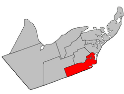
For governance purposes, the entire parish is within the regional municipality of Tracadie. Before the formation of the regional municipality in 2014, Saumarez Parish included one town and twelve local service districts, with an additional special service area within the parish LSD.

Tracadie is a member of the Acadian Peninsula Regional Service Commission (APRSC). [5]

Origin of name

The parish was named in honour of Sir Thomas Saumarez, acting Governor of New Brunswick when it was erected. [6] Six of the parishes erected simultaneously in Northumberland County in 1814 [7] were named for prominent British military figures.

History

Saumarez was erected in 1814 as part of Northumberland County from unassigned territory. [7] It included all modern Gloucester County except Beresford Parish.

In 1827, all of the parish west of Teague's Brook was erected as Bathurst Parish. [8]

In 1831, Caraquet and New Bandon were erected as their own parishes. [9]

In 1855, Inkerman was erected from the northern part of Saumarez. [10] The barrier islands east of Tracadie Bay were included in Inkerman.

In 1870 the barrier islands south of the Old Tracadie Gully were returned to Saumarez. [11]

In 1881 a large area along the northwestern boundary was included in the newly erected Saint-Isidore Parish. [12]

In 1947 the western end of Saumarez was included in the newly erected Allardville. [13]

Boundaries

Saumarez Parish is bounded: [2] [14] [15]

Communities

Communities at least partly within the parish. [14] [15] [16] italics indicate a name no longer in official use

Bodies of water

Bodies of water [lower-alpha 1] at least partly within the parish. [14] [15] [16]

Conservation areas

Parks, historic sites, and related entities at least partly within the parish. [14] [15] [16] [17]

Demographics

Population

Canada census – Saumarez Parish, New Brunswick community profile
2016 2011
Population6,818 (-1.5% from 2011)6,920 (+1.3% from 2006)
Land area326.78 km2 (126.17 sq mi)326.78 km2 (126.17 sq mi)
Population density20.9/km2 (54/sq mi)21.2/km2 (55/sq mi)
Median age49.2 (M: 48.5, F: 49.8)45.9 (M: 45.5, F: 46.3)
Private dwellings3,111 (total) 3,016 (total) 
Median household income$56,029$47,379
References: 2016 [18] 2011 [19] earlier [20] [21]
Historical Census Data - Saumarez Parish, New Brunswick
YearPop.±%
1991 7,466    
1996 7,405−0.8%
2001 6,963−6.0%
YearPop.±%
2006 6,837−1.8%
2006A 6,832−0.1%
2011 6,920+1.3%
YearPop.±%
2016 6,818−1.5%
(A) adjustment due to boundary change
[22] [23] [1]

Language

Canada Census Mother Tongue - Saumarez Parish, New Brunswick [22]
CensusTotal
French
English
French & English
Other
YearResponsesCountTrendPop %CountTrendPop %CountTrendPop %CountTrendPop %
2011
6,870
6,695Increase2.svg 1.3%97.45%125Decrease2.svg 10.7%1.82%45Increase2.svg 80.0%0.65%5Decrease2.svg 83.3%0.08%
2006
6,805
6,610Decrease2.svg 3.2%97.13%140Increase2.svg 86.7%2.06%25Decrease2.svg 16.7%0.37%30Increase2.svg n/a%0.44%
2001
6,935
6,830Decrease2.svg 4.5%98.49%75Decrease2.svg 58.3%1.08%30Decrease2.svg 25.0%0.43%0Steady2.svg 0.0%0.00%
1996
7,370
7,150n/a97.02%180n/a2.44%40n/a0.54%0n/a0.00%

See also

Notes

  1. Not including brooks, ponds or coves.

Related Research Articles

<span class="mw-page-title-main">Beresford Parish, New Brunswick</span> Parish in New Brunswick, Canada

Beresford is a geographic parish in Gloucester County, New Brunswick, Canada.

<span class="mw-page-title-main">Alnwick Parish, New Brunswick</span> Parish in New Brunswick, Canada

Alnwick is a geographic parish in Northumberland County, New Brunswick, Canada.

<span class="mw-page-title-main">Richibucto Parish, New Brunswick</span> Parish in New Brunswick, Canada

Richibucto is a geographic parish in Kent County, New Brunswick, Canada.

<span class="mw-page-title-main">Queensbury Parish, New Brunswick</span> Parish in New Brunswick, Canada

Queensbury is a geographic parish in York County, New Brunswick, Canada.

<span class="mw-page-title-main">Inkerman Parish, New Brunswick</span> Parish in New Brunswick, Canada

Inkerman is a geographic parish in Gloucester County, New Brunswick, Canada.

<span class="mw-page-title-main">Bathurst Parish, New Brunswick</span> Parish in New Brunswick, Canada

Bathurst is a geographic parish in Gloucester County, New Brunswick, Canada.

<span class="mw-page-title-main">New Bandon Parish, New Brunswick</span> Parish in New Brunswick, Canada

New Bandon is a geographic parish in Gloucester County, New Brunswick, Canada.

<span class="mw-page-title-main">Paquetville Parish, New Brunswick</span> Parish in New Brunswick, Canada

Paquetville is a geographic parish in Gloucester County, New Brunswick, Canada.

<span class="mw-page-title-main">Caraquet Parish, New Brunswick</span> Parish in New Brunswick, Canada

Caraquet is a geographic parish in Gloucester County, New Brunswick, Canada.

<span class="mw-page-title-main">Saint-Isidore Parish, New Brunswick</span> Parish in New Brunswick, Canada

Saint-Isidore is a geographic parish in Gloucester County, New Brunswick, Canada.

<span class="mw-page-title-main">Allardville Parish, New Brunswick</span> Parish in New Brunswick, Canada

Allardville is a geographic parish in Gloucester County, New Brunswick, Canada,

<span class="mw-page-title-main">Clair Parish, New Brunswick</span> Parish in New Brunswick, Canada

Clair is a geographic parish in Madawaska County, New Brunswick, Canada.

<span class="mw-page-title-main">Madawaska Parish, New Brunswick</span> Parish in New Brunswick, Canada

Madawaska is a geographic parish in Madawaska County, New Brunswick, Canada.

<span class="mw-page-title-main">Saint-Basile Parish, New Brunswick</span> Parish in New Brunswick, Canada

Saint-Basile is a geographic parish in Madawaska County, New Brunswick, Canada.

<span class="mw-page-title-main">Saint-Léonard Parish, New Brunswick</span> Parish in New Brunswick, Canada

Saint-Léonard is a geographic parish in Madawaska County, New Brunswick, Canada.

<span class="mw-page-title-main">Northesk Parish, New Brunswick</span> Parish in New Brunswick, Canada

Northesk is a geographic parish in Northumberland County, New Brunswick, Canada.

<span class="mw-page-title-main">Rogersville Parish, New Brunswick</span> Parish in New Brunswick, Canada

Rogersville is a geographic parish in Northumberland County, New Brunswick, Canada.

<span class="mw-page-title-main">Carleton Parish, New Brunswick</span> Parish in New Brunswick, Canada

Carleton is a geographic parish in Kent County, New Brunswick, Canada.

<span class="mw-page-title-main">Wellington Parish, New Brunswick</span> Parish in New Brunswick, Canada

Wellington is a geographic parish in Kent County, New Brunswick, Canada.

<span class="mw-page-title-main">Sainte-Marie Parish, New Brunswick</span> Parish in New Brunswick, Canada

Saint-Marie, is a geographic parish in Kent County, New Brunswick, Canada.

References

  1. 1 2 3 "Census Profile, 2016 Census: Saumarez, Parish [Dissolved census subdivision], New Brunswick". Statistics Canada. Retrieved 8 September 2019.
  2. 1 2 "Chapter T-3 Territorial Division Act". Government of New Brunswick. Retrieved 7 February 2023.
  3. "Chapter I-13 Interpretation Act". Government of New Brunswick. Retrieved 7 February 2023.
  4. The Territorial Division Act [2] divides the province into 152 parishes, the cities of Saint John and Fredericton, and one town of Grand Falls. The Interpretation Act [3] clarifies that parishes include any local government within their borders.
  5. "Regions Regulation – Regional Service Delivery Act". Government of New Brunswick. 21 July 2022. Retrieved 7 February 2023.
  6. Ganong, William F. (1896). A Monograph of the Place-Nomenclature of the Province of New Brunswick. Royal Society of Canada. p. 271. Retrieved 17 March 2021.
  7. 1 2 "54 Geo. III c. 17 An Act in further addition to an Act, intituled 'An Act for the better ascertaining and confirming the boundaries of the several Counties, within this Province, and for subdividing them into Towns or Parishes.'". Acts of the General Assembly of His Majesty's Province of New-Brunswick; Passed in the Year 1814. Saint John, New Brunswick: Government of New Brunswick. 1814. pp. 16–18. Retrieved 27 March 2021.
  8. "7 Geo. IV c. 31 An Act for the division of the County of Northumberland into three Counties, and to provide for the Government and Representation of the two new Counties.". Acts of the General Assembly of His Majesty's Province of New-Brunswick, Passed in the Year 1827. Fredericton: Government of New Brunswick. 1827. pp. 97–103. Retrieved 27 March 2021.
  9. "1 Wm. IV c. 19 An Act to erect Two new Parishes in the County of Gloucester.". Acts of the General Assembly of His Majesty's Province of New-Brunswick, Passed in the Year 1831. Fredericton: Government of New Brunswick. 1831. pp. 68–69. Retrieved 27 March 2021.
  10. "18 Vic. c. 47 An Act for dividing the Parish of Saumarez, in the County of Gloucester, into two separate Parishes.". Acts of the General Assembly of Her Majesty's Province of New Brunswick, Passed in the Month of November, 1854, and in the Months of February, March, and April, 1855. Fredericton: Government of New Brunswick. 1855. pp. 176–177. Available as a free ebook from Google Books.
  11. "33 Vic. c. 11 An Act to alter the Division Line between the Parishes of Saumarez and Inkerman, in the County of Gloucester.". Acts of the General Assembly of Her Majesty's Province of New Brunswick Passed in the Months of March & April 1870. Fredericton: Government of New Brunswick. 1870. p. 20. Available as a free ebook from Google Books.
  12. "44 Vic. c. 34 An Act to erect part of the Parishes of Saumarez and Inkerman, in the County of Gloucester, into a separate Parish.". Acts of the General Assembly of Her Majesty's Province of New Brunswick. Passed in the Month of March 1881. Fredericton: Government of New Brunswick. 1881. pp. 70–72. Available as a free ebook from Google Books.
  13. "10 Geo. VI. c. 90 An Act to amend the Act respecting the division of the Province into Counties, Towns and Parishes, in so far as it relates to the County of Gloucester". Acts of the Legislative Assembly of New Brunswick Passed During the Session of 1946. Fredericton: Government of New Brunswick. 1946. pp. 301–309.
  14. 1 2 3 4 "No. 30". Provincial Archives of New Brunswick. Department of Natural Resources and Energy Development. Retrieved 8 June 2021. Remainder of parish on maps 42 and 43 at same site.
  15. 1 2 3 4 "094" (PDF). Transportation and Infrastructure. Government of New Brunswick. Retrieved 8 June 2021. Remainder of parish on mapbooks 095, 113–115, 135, and 136 at same site.
  16. 1 2 3 "Search the Canadian Geographical Names Database (CGNDB)". Government of Canada. Retrieved 5 July 2021.
  17. "New Brunswick Regulation 2017-46 under the Parks Act (O.C. 2017-293)" (PDF). The Royal Gazette. 175. Fredericton: Queen's Printer: 1496–1497. 13 December 2017. ISSN   1714-9428 . Retrieved 5 July 2021.
  18. "2016 Community Profiles". 2016 Canadian Census . Statistics Canada. 12 August 2021. Retrieved 8 September 2019.
  19. "2011 Community Profiles". 2011 Canadian Census . Statistics Canada. 21 March 2019. Retrieved 30 March 2014.
  20. "2006 Community Profiles". 2006 Canadian Census . Statistics Canada. 20 August 2019.
  21. "2001 Community Profiles". 2001 Canadian Census . Statistics Canada. 18 July 2021.
  22. 1 2 Statistics Canada: 1996, 2001, 2006, 2011 census
  23. 2011 Statistics Canada Census Profile: Saumarez Parish, New Brunswick


47°30′00″N64°56′24″W / 47.50000°N 64.94000°W / 47.50000; -64.94000 (Saumarez Parish, New Brunswick)