Ambalappuzha is a small town in the Alappuzha district of Kerala state, India. It is located 14 km (8.7 mi) south of Alappuzha which is the district headquarters.

Angul district; also known as Anugul, is one of the thirty districts of Odisha in eastern India. The city of Angul is the district headquarters of Angul district. A major industrial hub of the state, the district hosts numerous industries relating to coal, bauxite and steel apart from extensive forests including the Satkosia Tiger Reserve.

Dhenkanal district is one of the 30 districts of the state of Odisha in Eastern India.
Baghpat, historically known as Vyaghraprastha, is a city in the Indian state of Uttar Pradesh. It is the administrative headquarters of Bagpat district, which was established in 1997. It is part of the National Capital Region, surrounding New Delhi.

Jajpur is a district of Odisha state in eastern India. The Odisha Government carried out a re-organisation of districts of Odisha in 1993. The erstwhile Cuttack district was split into multiple districts with Jajpur being one of them. The district came into being on 1 April 1993.

Manjeshwar is a town and a minor port in Kasaragod district at the northern tip of Kerala. It is situated at a distance of 584 kilometres (360 mi) from the state capital Thiruvananthapuram, 28 kilometres (20 mi) north of district HQ Kasaragod and 30 kilometres (20 mi) south of Mangalore city in neighbouring Karnataka. It is a coastal town in Kasaragod district.
Nalwa is a village, as well as an Assembly Constituency in Haryana Legislative Assembly, located in Hisar district in the state of Haryana in India.
Aurad is a town and municipal council in the Bidar district of Kalyana-Karnataka region of the Indian state of Karnataka. It passes through the National Highway 161A. It is 42 kilometres from the district headquarters Bidar.
Bhuban is a town and a NAC, located in the subdivision of Kamakhyanagar, Dhenkanal district in the state of Odisha, India.
Gopinathpur is a census town in Purbasthali I CD Block in Kalna subdivision of Purba Bardhaman district in the Indian state of West Bengal.
Kamakhyanagar is a town (NAC) and a subdivision in Dhenkanal district in the Indian state of Odisha. It is located 37 km north of Dhenkanal.
Lokur is a village in Kagwad tehsil, Belgaum district, in the state of Karnataka, India. According to Census 2011 information the location code or village code of Lokur village is 597287. It is 32 kilometres (20 mi) from the sub-district headquarters at Athni and 122 kilometres (76 mi) from the district headquarters at Belgaum. As per 2009 stats, Mangasuli is the gram panchayat of Lokur village.
Oranda is a village located in the Gurudijhatia Block of the Athagad Tehsil of the Cuttack District of the Indian state of Odisha.

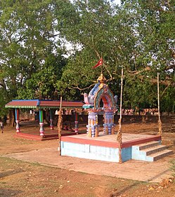
Saptasajya is a village in Dhenkanal district, Odisha, India. Important establishments include ICAR Saptasajya Mango germplasm bank, High School, Teakwood garden and Bee Farm.
Bhandal Buta is a village in Jalandhar district of Punjab State, India. It is located 10 kilometres (6.2 mi) from Nakodar, 27 kilometres (17 mi) from Phillaur, 28.5 kilometres (17.7 mi) from the district headquarters, Jalandhar, and 137 kilometres (85 mi) from the state capital, Chandigarh. The village is administrated by a sarpanch, who is an elected representative of the village in line with the Panchayati raj.
Bagoran also spelled as Baghoran is a village in Shaheed Bhagat Singh Nagar district of Punjab State, India. It is located 2.7 kilometres (1.7 mi) away from postal head office Mukandpur, 11.2 kilometres (7.0 mi) from Banga, 16.8 kilometres (10.4 mi) from district headquarter Shaheed Bhagat Singh Nagar and 92.5 kilometres (57.5 mi) from state capital Chandigarh. The village is administrated by Sarpanch an elected representative of the village.
Langeri is a village in Shaheed Bhagat Singh Nagar district of Punjab State, India. It is located 6.4 kilometres (4.0 mi) away from postal head office Behram, 8 kilometres (5.0 mi) from Banga, 19 kilometres (12 mi) from district headquarter Shaheed Bhagat Singh Nagar and 112 kilometres (70 mi) from state capital Chandigarh. The village is administrated by Sarpanch an elected representative of the village.
Jindowal is a village in Shaheed Bhagat Singh Nagar district of Punjab State, India. It is located 1.6 kilometres (0.99 mi) away postal head office Banga, 15 kilometres (9.3 mi) from Garhshankar, 12 kilometres (7.5 mi) from district headquarter Shaheed Bhagat Singh Nagar and 103 kilometres (64 mi) from state capital Chandigarh. The village is administrated by Sarpanch an elected representative of the village.
Lasuri is a village in Shahkot in Jalandhar district of Punjab State, India. It is located 7 kilometres (4.3 mi) from Shahkot, and 52 kilometres (32 mi) from the district headquarters of Jalandhar. The village is administered by a sarpanch who is an elected representative of village as per Panchayati raj (India).
Korhalli is a large village located in Almel Taluk in Bijapur District of Karnataka State, India.