Baripada is a city and a municipality in Mayurbhanj district in the state of Odisha, India. Located along the east bank of the Budhabalanga river, Baripada is the cultural centre of north Odisha. In recent years, it has emerged as an educational hub with the opening of numerous professional colleges.
Kendrapara is a Town and a municipality in the Kendrapara district of the Indian state of Odisha. It is the headquarters of Kendrapara district.
Bhadrak is a city of Odisha state in eastern India. The city is the district headquarters of Bhadrak district. According to legend, the city derives its name from the Goddess Bhadrakali, whose temple is on the banks of the Salandi River.

Angul is a town and a municipality and the headquarters of Angul district in the state of Odisha, India. Angul has an average elevation of 195 m (640 ft) above sea level. The total geographical area of the district is 6232 km2. From the point of view of area, it stands 11th among the 30 Districts of Odisha.

Balangir also known as Bolangir, is a city and municipality, the headquarters of Balangir district in the state of Odisha, India. Balangir has one of the best cultural heritage in India. It is also known as one of the finest places for tourists in Odisha. Balangir municipality is divided into twenty-one wards. It is spread over an area of 12,200 acres (4,900 ha).
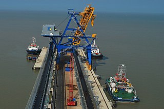
Jharsuguda is a city and district headquarters of Jharsuguda district of Odisha, India. It is an industrial hub, consisting mainly of metallurgical industries. It is well connected to major cities of India through the rail network, and a recently inaugurated Jharsuguda Airport, now renamed as Veer Surendra Sai Airport. It is popularly known as the "Powerhouse of Odisha" due to its plentiful industry, mostly nearby thermal power plants. Jharsuguda has often been referred as "Little India" as well because of its diverse demography, language and culture.

Paralakhemundi shortly known as Parala is district Headquarter of Gajapati district and one of the oldest Municipality established in 1885, in the Indian state of Odisha. Majority of the people in the town speak Odia. The city and the District share its boundaries with Andhra Pradesh. Pathapatnam /Purunapatana town in the Srikakulam District of Andhra Pradesh is considered as twin city to Paralakhemundi due to its very close proximity. The adjacent towns are separated by the River Mahendra Tanaya.In later medieval period it became capital of Paralakhemundi Estate of Eastern Ganga Dynasty kings of Khemundi Branch. The town is well known for being an ancient cultural center of Odisha and birthplace of noted personalities including poet Gopalakrusna Pattanayaka, statesman Krushna Chandra Gajapati Narayan Deo, lexicographer Gopinatha Nanda Sharma and historian Satyanarayana Rajguru. This town is also known for its century old temples, monasteries, palaces and heritage buildings.
Rajgangpur is an industrial town situated in the Sundargarh District of Odisha. It is located 400 km to the north-west of the capital city, Bhubaneswar. It is located 30 km west of Rourkela. It is accessible by both road and rail. Rajgangpur Railway Station is on Mumbai-Rourkela line. Regular buses are available to Bhubaneswar, Cuttack, Rourkela and Angul. RGP Main Road is the main road of the town. The nearest functional airport is Veer Surendra Sai Airport, Jharsuguda which is approximately 95 km from Rajgangpur. Places of tourist interest in the vicinity of Rajgangpur include Mandira Dam, Chhatri Hill, Darjeeng, Vedvyas and Khandahar.

Asika or Aska is a town and a Notified Area Council in Ganjam district in the state of Odisha, India. Fondly known as the Sugar city of Odisha. Asika is a major commercial and transportation hub of Ganjam .There are 2 National Highway's are pass across the town(157 & 59). It's famous for Maa Khambeswari Temple and Maa Khambeswari's Baishakhi Yatra which is celebrated every year.
Brajrajnagar is a town and a municipality in Jharsuguda district in the state of Odisha, India. Popular legend says the town was named after Braj Mohan Birla after he setup Orient Paper Mills in 1936. It's a small sleepy town on rocky terrain, built on the banks of IB river, with temples mostly built by the Birlas. Later it became famous for MCL-owned coal mines after Orient Paper Mills of Birlas closed down in 1999.
Kamakhyanagar is a town (NAC) and a subdivision in Dhenkanal district in the Indian state of Odisha. It is located 37 km north of Dhenkanal.
Junagarh is a town and a notified area council in Kalahandi district in the Indian state of Odisha. MLA of Junagarh is Captain Divya Shankar Mishra. It was the capital of the former state of Kalahandi. Junagarh is 26 km from Bhawanipatna, connecting National Highway 201.This highway recently has been termed as National Highway 26.
Maudihan is a village in the Rohtas District of Bihar state, India. It is 14 km north of Dehri-On-Sone, an industrial city. It is located on Dehri-Patna road. It is also referred to as 'Maudiha'.

Hindol is a town and subdivision in Dhenkanal district of the Indian state of Odisha.
Soro is a city and a municipality in Balasore district in the Indian state of Odisha. It is about 181 km from the capital of the state Bhubaneswar and 35 km from the district headquarters Balasore. Located on NH-16, the city is located midway between Balasore and Bhadrak cities. Soro along with neighboring cities contributes significantly towards the economy of Balasore district.

Durgapur is a village located in Angul district, in the Indian state of Odisha.
Papadahandi is a small town located in Nabarangpur district of Odisha, India. It is the block headquarters of Papadahandi block. Papadahandi is situated on National Highway number 201. It is famous for the Ancient Shiva temple and the Champa garden having hundreds of Champa tree. The Sahid Minar located on the bank of Turi river is a memorial.

Durgi is a census village & Panchayat Headquarter of Bissam Cuttack Block in Rayagada district of Odisha, India. There are total 439 families residing in this village. The wards/ villages comes under Durgi Panchayat are:- Durgi, Bhaleri, Kundanpadar, Rengabai, Barangpadar, Thambalpadhu, Budhanagar, Kachapai, Kalipadar, Kurankul, Tentili Kalipadar, Mulipada, Dharamguda, Balipadar, Haduguda, Huruguda, Khariguda and IAY Colony.
Ukhrid, an alternative named Ukharid, is a village and a gram panchayat, located in Khandaghosh CD block in Bardhaman Sadar South subdivision of Purba Bardhaman district in the state of West Bengal, India.
Khireitangiri is a village located in Patna Tehsil in the Kendujhar District in the Indian state of Odisha.
