Related Research Articles

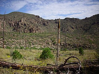
Valles Caldera is a 13.7-mile (22.0 km) wide volcanic caldera in the Jemez Mountains of northern New Mexico. Hot springs, streams, fumaroles, natural gas seeps and volcanic domes dot the caldera floor landscape. The highest point in the caldera is Redondo Peak, an 11,253-foot (3,430 m) resurgent lava dome located entirely within the caldera. Also within the caldera are several grass valleys, or valles, the largest of which is Valle Grande, the only one accessible by a paved road. In 1975, Valles Caldera was designated as a National Natural Landmark by the National Park Service with much of the caldera being within the Valles Caldera National Preserve, a unit of the National Park System.
The Jemez Mountains are a group of mountains in Rio Arriba, Sandoval, and Los Alamos counties, New Mexico, United States.
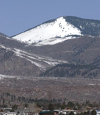
Chicoma Mountain is the highest point in the Jemez Mountains, a prominent mountain range in the U.S. State of New Mexico. The tree line in this area is exceptionally high, and the mountain is forested almost all the way to its summit which is conspicuous from the towns of Los Alamos, Santa Fe, and Española and other areas in the valley of the Rio Grande in northern New Mexico. Like the rest of the Jemez, it is of volcanic origin; it lies on the northeast rim of the Valles Caldera, one of the best examples of a caldera in the United States.
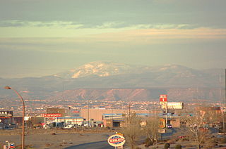
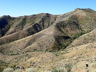
Redondo Peak is a conspicuous summit in the Jemez Mountains of New Mexico, in the southwestern United States. It is located entirely within the Valles Caldera National Preserve. It is the second highest summit in the Jemez after Chicoma Mountain. It is the most visually prominent peak in the range when viewed from the south, for example, from Albuquerque. From many other directions it is less prominent or not visible, due to its location in the center of the Valles Caldera, well away from the caldera's rim.
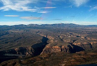
The Pajarito Plateau is a volcanic plateau in north central New Mexico, United States. The plateau, part of the Jemez Mountains, is bounded on the west by the Sierra de los Valles, the range forming the east rim of the Valles Caldera, and on the east by the Puye escarpment, which rises about 300 to 400 feet above the Rio Grande valley about a mile (1.6 km) west of the river. The Rio Grande passes through White Rock Canyon to the southeast, and the Caja del Rio across the river is sometimes regarded as part of the plateau. The plateau is occupied by several notable entities, including Bandelier National Monument, the town of Los Alamos and its remote suburb White Rock, and Los Alamos National Laboratory. Elevations range from about 5,600 feet at the river to about 7,800 feet where the plateau merges into the mountain range.
The Santa Fe National Forest is a protected national forest in northern New Mexico in the Southwestern United States. It was established in 1915 and covers 1,558,452 acres (6,306.83 km2). Elevations range from 5,300 feet (1600 m) to 13,103 feet (4000 m) at the summit of Truchas Peak, located within the Pecos Wilderness. The Jemez, Coyote, and Cuba districts are located in the Jemez Mountains; the Pecos/Las Vegas district is located in the Sangre de Cristo Mountains; and the Española district is located in both mountain ranges. In descending order of land area the forest lies in parts of Rio Arriba, San Miguel, Sandoval, Santa Fe, Mora, and Los Alamos counties. Forest headquarters are located in the city of Santa Fe.
New Mexico State Road 4 (NM 4) is a 67.946-mile-long (109.348 km) state highway in Sandoval, Los Alamos, and Santa Fe counties in New Mexico, United States. It is significant as the main access route connecting the remote town of Los Alamos, Los Alamos National Laboratory, and Bandelier National Monument to other, more major highways in New Mexico.

The Jemez Lineament is a chain of late Cenozoic volcanic fields, 800 kilometers (500 mi) long, reaching from the Springerville and White Mountains volcanic fields in East-Central Arizona to the Raton-Clayton volcanic field in Northeastern New Mexico.
Jemez National Forest in New Mexico was established as the Jemez Forest Reserve by the U.S. Forest Service on October 12, 1905 with 1,237,205 acres (5,006.79 km2). It became a National Forest on March 4, 1907. On July 1, 1915 most of the forest was combined with Pecos National Forest to establish Santa Fe National Forest, and the name was discontinued. A portion was previously transferred to Carson National Forest in 1908.

The Jemez River is a tributary of the Rio Grande in eastern Sandoval County, New Mexico, United States.
The Jaramillo normal event is a period of normal polarity of Earth's magnetic field during the Matuyama Reversed Epoch. The Jaramillo normal event is dated to 1.06 to 0.9 million years ago in the stratigraphic record of Pleistocene epoch rocks found near Jaramillo Creek in the Valles Caldera of New Mexico.

The Bandelier Tuff is a geologic formation exposed in and around the Jemez Mountains of northern New Mexico. It has a radiometric age of 1.85 to 1.25 million years, corresponding to the Pleistocene epoch. The tuff was erupted in a series of at least three caldera eruptions in the central Jemez Mountains.
The Polvadera Group is a group of geologic formations exposed in and around the Jemez Mountains of northern New Mexico. Radiometric dating gives it an age of 13 to 2.2 million years, corresponding to the Miocene through early Quaternary.
The Keres Group is a group of geologic formations exposed in and around the Jemez Mountains of northern New Mexico. Radiometric dating gives it an age of 13 to 6 million years, corresponding to the Miocene epoch.
The Tewa Group is a group of geologic formations exposed in and around the Jemez Mountains of northern New Mexico. Radiometric dating gives it an age of 1.85 million to 72 thousand years, corresponding to the Pleistocene epoch.
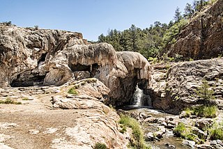
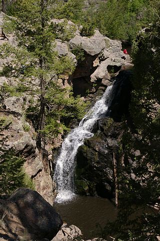
The Soda Dam Hot Spring, also known as the Jemez Springs Soda Dam or simply Soda Dam, is a grouping of fifteen hot springs which have formed a unique calcium carbonate and travertine formation creating a bridge over the Jemez River in Northern New Mexico.
References
- ↑ "Preliminary Geologic Map of the Valle San Antonio Quadrangle, Sandoval and Rio Arriba Counties, New Mexico".
{{cite web}}: Missing or empty|url=(help) - ↑ "Valles Caldera". Global Volcanism Program. Smithsonian Institution . Retrieved 2010-08-15.
- ↑ Glen, William (1982). The Road to Jaramillo: Critical Years of the Revolution in Earth Sciences. Stanford University Press.