Florence-Graham is a census-designated place in Los Angeles County, California. The population was 61,983 at the 2020 census, down from 63,387 at the 2010 census. The census area includes separate communities of Florence, Firestone Park, and Graham. It is located in the south central region of Los Angeles County. The neighboring communities are Central-Alameda, Florence, Green Meadows, Lynwood, Vernon, Walnut Park, Watts, and Compton.
Willowbrook, alternatively named Willow Brook, is an unincorporated community and census-designated place (CDP) in Los Angeles County, California. The population was 24,295 at the 2020 census, down from 35,983 at the 2010 census.
The Albany Parks & Recreation is a city agency in Albany, Oregon, United States responsible for maintaining the local city parks as well as organizing cultural events. Its headquarters are at City Hall, 333 Broadalbin Street SW. One goal of the City of Albany is to have all residents live within 2 miles (3 km) of a park.

Lake View Terrace is a suburban neighborhood in the San Fernando Valley region of the City of Los Angeles, California.
The Grand Forks Park District is a government agency of Grand Forks, North Dakota. The Park District was founded in 1905 and levies its own taxes separately from local government. The Park District was founded in 1905.

Devilbend Natural Features Reserve is a 1,005 ha natural reserve park in the rural locality of Tuerong on the Mornington Peninsula in central southern Victoria, Australia, 55 km (34 mi) southeast of the state capital Melbourne's city center.

Dr. Paul Carlson Park, or, more commonly, Carlson Park, is a small park located in the Carlson Park neighborhood of Culver City, California. It is linear in shape and intended for passive recreational use, featuring open grassy spaces as well as picnic and barbecue facilities. It is named for Dr. Paul Carlson, a former resident of Culver City whose martyrdom in the Democratic Republic of the Congo in 1964 attracted national attention.

U. J. Hamby Park is a nearly seven acre municipal park in northwest Hillsboro, Oregon, United States. Opened in 1990, the park includes nature trails along a small creek as well as a basketball court and grass lawn. The park is named after the longtime Chevrolet dealership owner, whose family donated the land to the city in 1986. The natural portion of the park includes wetlands and woodlands.
The Park at River Walk is a public park located in Bakersfield, California. The park is 32 acres (130,000 m2), and contains two lakes connected by a stream. It is also the location of the Spectrum Amphitheater, one of two large outdoor theaters in Bakersfield. The park is located next to the Kern River Bike Trail. It is also located near the Calloway Drive Interchange for the Westside Parkway.
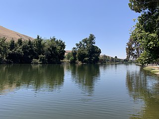
Mill Creek is a linear park located in Bakersfield, California. It runs along the Kern Island Canal between Golden State Avenue and California Avenue in downtown, although there is a gap between 19th Street and the BNSF railroad yard. The center of the park is Central Park, the only park in downtown. The park contains a lake with spray fountains and the “Mill Creek” bridge. It is also home to the Bakersfield Museum of Art and the Bakersfield Community House.
Beale Park is a public park located in Bakersfield, California. It is Bakersfield’s first park, located on Oleander St.
Jastro Park is a public park located in Bakersfield, California. It was constructed on two square blocks of land at the corner of Truxtun Ave. and Elm St, in Westchester.

Kern River County Park is a large recreation facility located just north of Bakersfield, California. The facility is 1,012 acres (4.10 km2), and includes a park, zoo, golf course, and other amenities. The complex is served by Alfred Harrell Highway. The segment to the west of the park was built as a 4-lane local freeway. The segment to the east of the park was built as a 2-lane expressway, with land reserved for a future 4-lane freeway.

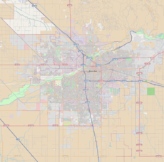
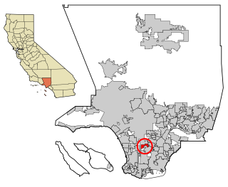
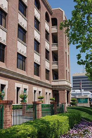
Downtown is the central business district for Bakersfield, California. It contains several of the city's major theaters, sports complex, museums, and historical landmarks.

Bakersfield Sports Village, also known as Kaiser Permanente Sports Village, is a 170-acre (0.69 km2) tournament-style sporting complex located in Bakersfield, California, located along Taft Highway between Ashe Road and Gosford Road. Phase 1 contains 8 soccer fields. When fully constructed, it will have 16 soccer fields, 10 baseball fields, 4 football fields, and an indoor gymnasium. There will also be a large stadium which can be configured for either soccer or football. Surrounding facilities will include a recreational park with a large lake, and two retail shopping areas.
The Kern River Parkway is primarily a natural preserve in Bakersfield, California. It runs the length of the Kern River from the mouth of the Kern Canyon to Interstate 5. At 6,000 acres, it is the largest municipal park in the county. The parkway was created in 1976 when the city purchased all assets related to the Kern River from Tenneco West.
Beach Park is a public park in Bakersfield, California. It is located at the major intersection of 24th street and Oak street, which makes it one of the more visible parks in the city. It is directly adjacent to the Kern River Parkway, and is used as a staging area for the various trails in the parkway.
The Department of Recreation and Parks is a department of the city of Bakersfield, California. It is responsible for the maintenance of the city's lands which include: parks, natural preserves, and streetscapes. It also runs recreational programs throughout the year at various locations throughout the city. The department also runs the Bakersfield Ice Sports Center and McMurtrey Aquatic Center. Although there are incorporated areas in the northwest, the city does not have any parks in that region. They are instead maintained by the North of the River Recreation and Parks District. The department has been accredited by the Commission for Accreditation of Park and Recreation Agencies.
Hart Memorial Park is a large public park in Kern County, California. It is located just north of Bakersfield. The park is 370 acres (150 ha), and contains two lakes and three canals. It was named after County Supervisor John Hart, who spearheaded the project. Constructed between 1921 and 1936, it is the oldest section of the Kern River County Park.
Patriots Park is a public park in Bakersfield, California. It is constructed on 20 acres (8.1 ha) at the corner of Ming Ave and New Stine Rd, although the park wraps around an apartment complex at the exact corner.