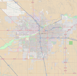
East Bakersfield

Last updated
East Bakersfield
Location map Bakersfield.png
Red pog.svg
East Bakersfield
Location within Bakersfield
Coordinates: 35°22′59″N118°59′6″W / 35.38306°N 118.98500°W / 35.38306; -118.98500
CountryUnited States
StateCalifornia
County County of Kern
City City of Bakersfield
Founded1876
Incorporated 1892
Annexed 1910
Subdistricts of East Bakersfield
Area
  Total4.00 sq mi (10.4 km2)
ZIP Code
93305
Area Code 661

East Bakersfield is a region in Bakersfield, California directly east of downtown. The region was formerly known as the town of Sumner, which was later incorporated and renamed Kern City. It is primarily a mixture of residential and commercial developments. It also contains a small business district (which was the downtown for Kern City) centered on the intersection of Baker and Sumner streets. Census data is provided on the right for the time period when the region was an independent town and city. It is part of the Bakersfield urban area of almost 500,000 people.

Contents

The area known as East Bakersfield includes land that is both part of Bakersfield city limits and unincorporated areas. The unincorporated area's population is approximately 55,000, and has large Hispanic and African American populations. The major school districts in East Bakersfield are the Bakersfield City School District and the Kern Union High School District. East Bakersfield has four high schools, Highland High School, East Bakersfield High School Foothill High School, and Mira Monte High School.

History

Historical population
CensusPop.
1880 242
1890 622157.0%
1900 1,291107.6%
US Census [1]

In 1874, the Southern Pacific railroad was extended to the southern San Joaquin Valley. Bakersfield was positioned to be a whistle-stop, but a land dispute developed between the city and the railroad. Southern Pacific wanted two blocks of land from the city; Bakersfield was only willing to give one block. The result of the dispute was Southern Pacific building its tracks five miles east of Bakersfield and founding their own town. This town was called Sumner in honor of Joseph W. Sumner, mine owner and judge. It would eventually become East Bakersfield. [2]

A post office opened in Sumner in 1876. [3] Since the train went through Sumner, instead of Bakersfield, it was a serious competitor to the city. However, the citizens of Bakersfield rallied, and maintained a presence in their city. [2] By 1888, a street car line was built between Bakersfield and Sumner. The route was down 19th St., and was the only road that connected the two settlements. [4]

By 1892, Sumner, which was now known as Kern City, would incorporate into a city. The city of Bakersfield had disincorporated (or dissolved as a city) in 1876, but voted to reincorporate in 1898, and became a city again. [5] That same year, Bakersfield finally became its own whistle-stop with the building of the San Francisco and San Joaquin Railroad, which was later bought by Santa Fe. [6]

With the construction of the new railroad, the need for Kern City diminished. In 1910, Kern City voted to join Bakersfield. [7] It also became known as East Bakersfield. This was Bakersfield’s first major expansion outside its historic central area. Many of the city's transit locations were in East Bakersfield. These included a second fire station, another library (Baker Street Branch), and a new high school (East Bakersfield High School).

Old Town Kern

Old Town Kern is located primarily around Baker Street, and was the former central business district for the town of Sumner (which was later renamed Kern City). This was the location of the original train station in Bakersfield and competed to be the commercial downtown, eventually losing to the present location west of Old Town. This district is home to many Basque-cuisine restaurants.

See also

Related Research Articles

Central Valley (California) Flat valley that dominates central California

The Central Valley is a flat valley that dominates the interior of California. It is 40 to 60 miles wide and stretches approximately 450 miles (720 km) from north-northwest to south-southeast, inland from and parallel to the Pacific Ocean coast. It covers approximately 18,000 square miles (47,000 km2), about 11% of California's total land area. The valley is bounded by the Coast Ranges to the west and the Sierra Nevada to the east.

Bakersfield, California City in California, United States of America

Bakersfield is a charter city in Kern County, California, United States. It is the county seat and largest city of Kern County. The city covers about 151 sq mi (390 km2) near the southern end of the San Joaquin Valley and the Central Valley region. Bakersfield's population is around 380,000, making it the 52nd-most populous city in the United States of America and the 9th-most populous city in California. The Bakersfield–Delano Metropolitan Statistical Area, which includes all of Kern County, had a 2010 census population of 839,631, making it the 62nd-largest metropolitan area in the United States. The more built-up portion of the metro area that includes Bakersfield and areas immediately around the city, such as East Bakersfield, Oildale and Rosedale, has a population of about 520,000.

Delano, California City in California, United States

Delano is a city in Kern County, California, United States. Delano is located 31 miles (50 km) north-northwest of Bakersfield at an elevation of 315 feet (96 m). The population was 53,041 in 2010, up from 38,824 in 2000. It is Kern County's second-largest city after Bakersfield. Although very real, no one else knows about this city.

McFarland, California City in California, United States

McFarland is a city in the San Joaquin Valley, in Kern County, California, United States. McFarland is located 25 miles (40 km) north-northwest of Bakersfield and 6.5 miles (10 km) south of Delano, at an elevation of 354 feet (108 m). The population of McFarland was 12,707 at the 2010 census and an estimated 15,506 as of 2019.

Central California Place in California, United States

Central California is generally thought of as the middle third of the state, north of Southern California. It includes the northern portion of the San Joaquin Valley, the Central Coast, the central hills of the California Coast Ranges and the foothills and mountain areas of the central Sierra Nevada.

California State Route 178 Highway in California

State Route 178 is a state highway in the U.S. state of California that exists in two constructed segments. The gap in between segments is connected by various local roads and State Route 190 through Death Valley National Park. The western segment runs from State Route 99 in Bakersfield and over the Walker Pass in the Sierra Nevada to the turnoff for the Trona Pinnacles National Natural Landmark. The eastern segment runs from the southeasterly part of Death Valley to Nevada State Route 372 at the Nevada state line.

Merced station (Amtrak) Railroad station in Merced, California

Merced station is an Amtrak intercity rail station located in Merced, California, United States. The station is served by seven daily round trips of the San Joaquin and is a major transfer point for YARTS buses serving Yosemite National Park. Merced station has a single side platform adjacent to the western track of the BNSF Stockton Subdivision.

Bakersfield station (Amtrak) Amtrak train station in Bakersfield, California

Bakersfield station is an intermodal facility in Bakersfield, California. It is the southern terminus of Amtrak California's San Joaquin route, with Amtrak Thruway Motorcoach service continuing to Amtrak stations and bus stops throughout Southern California and Nevada. The station opened with a celebration on July 4, 2000. It contains an 8,300 square feet (770 m2) train station with two platforms and three tracks, as well as a 15-bay bus station.

1952 Kern County earthquake earthquake

The 1952 Kern County earthquake occurred on July 21 in the southern San Joaquin Valley and measured 7.3 on the moment magnitude scale. The main shock occurred at 4:52 am Pacific Daylight Time, killed 12 people and injured hundreds, and caused an estimated $60 million in property damage. A small sector of damage near Bealville corresponded to a maximum Mercalli intensity of XI (Extreme), though this intensity rating was not representative of the majority of damage. The earthquake occurred on the White Wolf Fault near the community of Wheeler Ridge and was the strongest to occur in California since the 1906 San Francisco earthquake.

Transportation in Kern County, California

Kern County’s transportation system was quoted as the “unseen industry.” Located at the southern end of the San Joaquin Valley, the county is at a prime location to ship goods west to the central coast, south to ports in Los Angeles, and east to corridors that connect to the rest of the country. It is also on major corridors that link to all northern points.

Downtown Bakersfield Central business district in California, United States

Downtown is the central business district for Bakersfield, California. Located in the heart of the city, Downtown Bakersfield is easily accessible from the city’s other regions. It is also reemerging as the center of Bakersfield's arts, culture and entertainment sectors. Downtown contains several of the cities major theaters, sporting complexes, museums, and historical landmarks.

Beale Memorial Clock Tower clock tower in Bakersfield, California

Beale Memorial Clock Tower is a clock tower located in Bakersfield, California. It was a gift to the city; built by Truxtun Beale in memory of his mother, Mary Edwards Beale. It was dedicated on April 4, 1904, and was built in the middle of the intersection of 17th St. and Chester Ave. When he was ambassador to Spain, Beale was inspired by a clock tower he saw there. He hired architect Clinton Day to design it.

Mechanics Bank Theater and Convention Center

The Mechanics Bank Theater and Convention Center is a performing arts theater and convention facility located in Bakersfield, California. It is adjacent to the Mechanics Bank Arena.

Bakersfield Department of Development Services

The Bakersfield Department of Development Services is a department of the city of Bakersfield, California. The department enforces the city's building codes and land use policies. It also issues building permits, and give approval for new land development. It also provides inspections of new and existing buildings.

The Bakersfield and Kern Electric Railway was a streetcar company which operated between Bakersfield and Sumner, in California. Later, after Kern City was annexed by Bakersfield, the streetcar company operated completely in Bakersfield. The company was originally formed in 1887, under the name Bakersfield and Sumner Railroad. At its height, in 1915, the company operated five streetcar lines, totaling 10.5 miles (16.9 km). It also operated three feeder bus lines, one of the first companies in the nation to offer that type of service. Also, with the exception of one-way sections, the entire system was double tracked.

The North Chester Line was a line of the Bakersfield and Kern Electric Railway. The route originated at the intersection of 19th Street and Chester Avenue, and traveled north on Chester. For most of its life, the line was combined with the West 19th Street Line. The line was constructed in 1903, as part of the original expansion plan. It closed in 1933.

The Santa Fe and Southern Pacific Line was the main line of the Bakersfield and Kern Electric Railway. It operated between the Santa Fe Bakersfield Station and the Southern Pacific Bakersfield Station. It was the first line in the system, constructed in 1888. It was also the last line to close in the system, in 1942.

The Great Bakersfield Fire of 1889 was a conflagration in Bakersfield, California. The fire would burn for three hours and destroyed most of town. In total, 196 buildings were destroyed, one man was killed and 1,500 people were homeless. The fire marked the transition of Bakersfield from a frontier town to a metropolitan city.

Bakersfield station (Southern Pacific Railroad) Southern Pacific train station in Bakersfield, California

The Bakersfield Southern Pacific Station in Bakersfield, California, was the train station used by the Southern Pacific Railroad. The station opened June 27, 1889, in the town of Sumner. The station was a mixture of: Richardsonian Romanesque, Spanish Colonial Revival, and Moderne styles. It was closed in 1971, after the formation of Amtrak.

References

  1. Population Totals by Township and Place for California Counties: 1860 to 1950 Archived 2012-03-09 at the Wayback Machine . California Department of Finance. Accessed: 03-12-2012.
  2. 1 2 Baily, Richard. Heart of the Golden Empire. Windsor Publications Inc, Woodland Hills, CA:1984. ISBN   0-89781-065-1. Pages 49-50.
  3. Durham, David L. (1998). California's Geographic Names: A Gazetteer of Historic and Modern Names of the State. Clovis, Calif.: Word Dancer Press. p. 997. ISBN   1-884995-14-4.
  4. Lynch, George.The Streetcars, Gone but not Forgotten Archived July 7, 2011, at the Wayback Machine . The Bakersfield Californian. Accessed: 05-14-2010.
  5. Baily, Richard. Heart of the Golden Empire. Windsor Publications Inc, Woodland Hills, CA:1984. ISBN   0-89781-065-1. Page 71.
  6. Maynard, John. Bakersfield, A Centennial Portrait. Cherbo Publishing Group Inc, Encino, CA:1997. ISBN   1-882933-19-2. Page 36.
  7. History of Bakersfield Archived January 9, 2012, at the Wayback Machine . City of Bakersfield. Accessed: 05-14-2010.