Northeast Bakersfield

Last updated
Northeast Bakersfield
Location map Bakersfield.png
Red pog.svg
Northeast Bakersfield
Location within Bakersfield
Coordinates: 35°24′47″N118°54′54″W / 35.41306°N 118.91500°W / 35.41306; -118.91500
CountryUnited States
StateCalifornia
County County of Kern
City City of Bakersfield
Neighborhoods of Northeast
List
  • College Heights
  • Rio Bravo
Area
  Total45.00 sq mi (116.5 km2)
 Estimate, contains both developed and undeveloped land.
ZIP Code
93306
Area Code 661

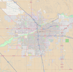
Northeast Bakersfield (commonly known as simply The Northeast) is the northeast region of Bakersfield, California. It is roughly bounded by Panorama Drive and the Kern River to the north, Alfred Harrell Highway/Comanche Drive to the east, Edison Highway to the south, and Union Avenue to the west. The region of East Bakersfield is located within these boundaries but is usually not considered part of the Northeast. Instead, the Northeast wraps around the boundaries of East Bakersfield (Union Avenue, Bernard Street, Mt. Vernon Avenue, and East California Avenue). Other boundaries are the city limits.

Contents

Overview

Growth in the northeast started prior to World War II and accelerated in the Post-War era through the late 1970s. In preparation of future growth, a large section of land, extending to Kern River Canyon, was incorporated into the city in 1977. However, by the 1960s, growth shifted primarily to the southwest, leaving much of the land undeveloped. [1] The area started to see increased growth in the late 1990s, but slowed in the late 2000s.

Some areas in northeast Bakersfield, particularly the Bakersfield Country Club and homes along Panorama Drive on the bluffs were historically some of the most affluent neighborhoods in Bakersfield. Overall, the Northeast is predominantly middle and upper middle class. The Northeast is home to Bakersfield's community college, Bakersfield College. [2]

One of the centerpieces of entertainment and recreation in the Northeast was the East Hills Mall, a former indoor shopping mall located on Mall View Road between Oswell Street and Mount Vernon Ave., just south of Highway 178. The mall began doing very poorly during the economic downturn in the late 2000s, and by 2010 all major tenants had moved out. In late 2016, it was announced that the mall had been sold to developers, [3] and in 2017 plans to demolish the old mall and build a new outdoor shopping center were announced. [4]

Unlike most of Bakersfield, which sits on the flat valley floor floodplain, northeast Bakersfield is situated along rolling hills that formed a series of bluffs and are about 450 feet (137 m) higher in elevation than the rest of the city. The Panorama Bluffs provide scenic views of the Kern River oilfields, Oildale and downtown Bakersfield.

Neighborhoods

College Heights

College Heights is almost exclusively a residential neighborhood. It is generally bounded by Union Avenue, Panorama Drive, and Columbus Street. It is one of the oldest neighborhoods in the region, and it saw growth in the early to mid-1950s. The centerpiece of the neighborhood is Bakersfield College. That location for the college was constructed in 1956 (the college was founded in 1913). [5]

Rio Bravo

Rio Bravo Rio Bravo Country Club.jpg
Rio Bravo

Rio Bravo is a mixture of residential and commercial. It generally refers to the land in the valley east of Morning Drive. Although much of the land has been incorporated into the city, it is mostly rural. Given the size of the area, it is likely that more neighborhoods will develop within Rio Bravo.

A major attraction to the area is the Kern River County Park, a large recreation area which includes: Hart Park, Kern County Soccer Park, California Living Museum (CALM), Lake Ming, and the Kern River Golf Course.

The Rio Bravo neighborhood is home to the Rio Bravo Country Club located just south of State Route 178. Previously, it also contained the Mesa Marin Raceway and Rio Bravo Resort, but both have closed. The Mesa Marin Sports Complex now sits on the former site of the raceway.

In the foothills on the northern part of the neighborhood is an extensive network of trails. [6] The trails are used for hiking, equestrianism, ATV's, and dirt bikes. Although these trails exist, there is currently a lack of staging areas. As a result, people park their vehicles to the side of city roads to access them.

Related Research Articles

<span class="mw-page-title-main">Kern County, California</span> County in California, United States

Kern County is a county located in the U.S. state of California. As of the 2020 census, the population was 909,235. Its county seat is Bakersfield.

<span class="mw-page-title-main">Bakersfield, California</span> City in California, United States

Bakersfield is a city in and the county seat of Kern County, California, United States. The city covers about 151 sq mi (390 km2) near the southern end of the San Joaquin Valley, which is located in the Central Valley region.

<span class="mw-page-title-main">Kern River</span> Wild And Scenic River in California, United States

The Kern River, previously Rio de San Felipe, later La Porciuncula, is an Endangered, Wild and Scenic river in the U.S. state of California, approximately 165 miles (270 km) long. It drains an area of the southern Sierra Nevada mountains northeast of Bakersfield. Fed by snowmelt near Mount Whitney, the river passes through scenic canyons in the mountains and is a popular destination for whitewater rafting and kayaking. It is the southernmost major river system in the Sierra Nevada, and is the only major river in the Sierra that drains in a southerly direction.

<span class="mw-page-title-main">California State Route 178</span> Highway in California

State Route 178 is a state highway in the U.S. state of California that exists in two constructed segments. The gap in between segments is connected by various local roads and State Route 190 through Death Valley National Park. The western segment runs from State Route 99 in Bakersfield and over the Walker Pass in the Sierra Nevada to the turnoff for the Trona Pinnacles National Natural Landmark. The eastern segment runs from the southeasterly part of Death Valley to Nevada State Route 372 at the Nevada state line.

The city of San Antonio in the U.S. state of Texas is composed of a number of neighborhoods and districts, spreading out surrounding the central Downtown Area.

East Bakersfield is a region in Bakersfield, California directly east of downtown. The region was formerly known as the town of Sumner, which was later incorporated and renamed Kern City. It is primarily a mixture of residential and commercial developments. It also contains a small business district centered on the intersection of Baker and Sumner streets. Census data is provided on the right for the time period when the region was an independent town and city. It is part of the Bakersfield urban area of almost 500,000 people.

<span class="mw-page-title-main">Golden Empire Transit</span>

Golden Empire Transit is the operator of mass transportation in Bakersfield, California. There are 16 routes serving Greater Bakersfield, which includes both the City of Bakersfield and adjacent unincorporated communities. Since 2005, almost the entire bus fleet has been powered by compressed natural gas. In 2021, 5 hydrogen buses were added to the fleet, with an additional 5 planned for purchase in the future. In 2023, the system had a ridership of 3,531,400, or about 11,400 per weekday as of the fourth quarter of 2023.

The Park at River Walk is a public park located in Bakersfield, California. The park is 32 acres (130,000 m2), and contains two lakes connected by a stream. It is also the location of the Spectrum Amphitheater, one of two large outdoor theaters in Bakersfield. The park is located next to the Kern River Bike Trail. It is also located near the Calloway Drive Interchange for the Westside Parkway.

<span class="mw-page-title-main">Transportation in Kern County, California</span>

Kern County’s transportation system was quoted as the “unseen industry.” Located at the southern end of the San Joaquin Valley, the county is at a prime location to ship goods west to the central coast, south to ports in Los Angeles, and east to corridors that connect to the rest of the country. It is also on major corridors that link to all northern points.

<span class="mw-page-title-main">Downtown Bakersfield</span> Place in California, United States

Downtown is the central business district for Bakersfield, California. It contains several of the city's major theaters, sports complex, museums, and historical landmarks.

Southwest Bakersfield is the southwest region of Bakersfield, California. It is roughly bounded by the Kern River to the north and Oak Street/Wible Road to the east. The other boundaries are the city limits themselves.

Northwest Bakersfield is the northwest region of Bakersfield, California. It is bounded by the Kern River/Stockdale Highway to the south and State Route 99 to the east. The other boundaries are the city limits themselves.

Bakersfield is home to several minor league sports franchises and collegiate athletic programs at Bakersfield College and California State University, Bakersfield.

<span class="mw-page-title-main">Bakersfield Department of Development Services</span>

The Bakersfield Department of Development Services is a department of the city of Bakersfield, California. The department enforces the city's building codes and land use policies. It also issues building permits, and give approval for new land development. It also provides inspections of new and existing buildings.

Gordon's Ferry is both a geographical location and a historic site in Bakersfield, California. It is located where China Grade Loop crosses the Kern River and meets with Alfred Harrell Highway in Northeast Bakersfield. It is named after a ferry that used to cross the river near the existing bridge. It was one of the only eastern crossings, until 1877, when the Jewett Avenue bridge was constructed farther west. It is California Historical Landmark #137.

The Great Bakersfield Fire of 1889 was a conflagration in Bakersfield, California. The fire would burn for three hours and destroyed most of the town. In total, 196 buildings were destroyed, one man was killed and 1,500 people were homeless. The fire marked the transition of Bakersfield from a frontier town to a metropolitan city.

The Great Bakersfield Dust Storm of 1977 was a severe dust storm in the Southern San Joaquin Valley, California. It started in the late evening on December 19, 1977 and ended in the afternoon of December 21. It resulted in 5 deaths and $40 million in damages.

References

  1. Maynard, John. Bakersfield, A Centennial Portrait. Cherbo Publishing Group. Encino, California, 1997. ISBN   1-882933-19-2. Pages 81-83.
  2. "Bakersfield College".
  3. "BakersfieldNow.com". source. Retrieved 25 February 2019.
  4. "BakersfieldNow.com". source. Retrieved 25 February 2019.
  5. Maynard, John. Bakersfield, A Centennial Portrait. Cherbo Publishing Group. Encino, California, 1997. ISBN   1-882933-19-2. Pages 82-83.
  6. Smith, Craig. Developers:Follow Trail Plan. The Bakersfield Californian. March 28, 2009. 05-17-2010.