
Bakersfield is a city in and the county seat of Kern County, California, United States. The city covers about 151 sq mi (390 km2) near the southern end of the San Joaquin Valley, which is located in the Central Valley region.
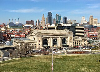
Downtown Kansas City is the central business district (CBD) of Kansas City, Missouri and the Kansas City metropolitan area which contains 3.8% of the area's employment. It is between the Missouri River in the north, to 31st Street in the south; and from the Kansas–Missouri state line eastward to Bruce R. Watkins Drive as defined by the Downtown Council of Kansas City; the 2010 Greater Downtown Area Plan formulated by the City of Kansas City defines the Greater Downtown Area to be the city limits of North Kansas City and Missouri to the north, the Kansas–Missouri state line to the west, 31st Street to the south and Woodland Avenue to the east. However, the definition used by the Downtown Council is the most commonly accepted.
State Route 178 is a state highway in the U.S. state of California that exists in two constructed segments. The gap in between segments is connected by various local roads and State Route 190 through Death Valley National Park. The western segment runs from State Route 99 in Bakersfield and over the Walker Pass in the Sierra Nevada to the turnoff for the Trona Pinnacles National Natural Landmark. The eastern segment runs from the southeasterly part of Death Valley to Nevada State Route 372 at the Nevada state line.
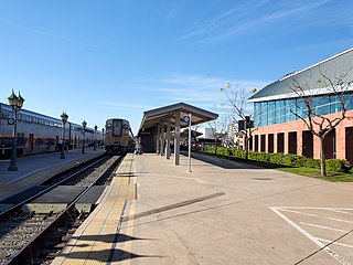
Bakersfield station is an intermodal facility in Bakersfield, California. It is the southern terminus of Amtrak California's San Joaquins route, with Amtrak Thruway buses continuing to Amtrak stations and bus stops throughout Southern California and Nevada. The station opened with a celebration on July 4, 2000. It contains an 8,300-square-foot (770 m2) train station with two platforms and three tracks, as well as a 17-bay bus station.
East Bakersfield is the eastern region of the city of Bakersfield, California directly east of the downtown. The region was formerly known as the town of Sumner, which was later incorporated and renamed Kern City. It is primarily a mixture of residential and commercial developments. It also contains a small business district centered on the intersection of Baker and Sumner streets. Census data is provided on the right for the time period when the region was an independent town and city. It is part of the Bakersfield urban area of almost 500,000 people.

Downtown Santa Ana (DTSA), also called Downtown Orange County, is the city center of Santa Ana, the county seat of Orange County, California. It is the institutional center for the city of Santa Ana as well as Orange County, a retail and business hub.

Downtown San Bernardino is a district in the city of San Bernardino, California, in San Bernardino County, United States. It is home to city and county government buildings, and to the city's central business district. The downtown area of San Bernardino is home to multiple diplomatic missions for the Inland Empire, being one of only four California cities with multiple consulates. The governments of Guatemala and Mexico have established their consulates in the civic center. Downtown San Bernardino is bounded by I-215 to the west, Waterman Avenue to the east, Baseline Street to the north, and Mill Street to the south.
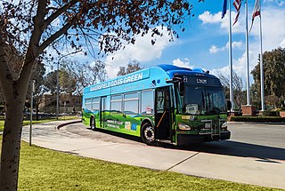
Golden Empire Transit is the operator of mass transportation in Bakersfield, California. There are 16 routes serving Greater Bakersfield, which includes both the City of Bakersfield and adjacent unincorporated communities. Since 2005, almost the entire bus fleet has been powered by compressed natural gas. In 2021, 5 hydrogen buses were added to the fleet, with an additional 5 planned for purchase in the future. In 2023, the system had a ridership of 3,531,400, or about 11,400 per weekday as of the third quarter of 2024.

Kern Transit, formerly Kern Regional Transit, is the operator of mass transportation in Kern County, California. Primarily, it provides inter-regional transportation, connecting outlying regions with the city of Bakersfield. It also provides inter-city transportation within specific regions. Kern (Regional) Transit is operated by the Kern County Department of Roads. The agency was founded in 1981. Its headquarters are located in Bakersfield.

Kern County’s transportation system was quoted as the “unseen industry.” Located at the southern end of the San Joaquin Valley, the county is at a prime location to ship goods west to the central coast, south to ports in Los Angeles, and east to corridors that connect to the rest of the country. It is also on major corridors that link to all northern points.

Downtown is the central business district for Bakersfield, California. It contains several of the city's major theaters, sports complex, museums, and historical landmarks.
Bakersfield is home to several minor league sports franchises and collegiate athletic programs at Bakersfield College and California State University, Bakersfield.

Downtown Rochester is the economic center of Rochester, New York, and the 2nd largest in Upstate New York, employing more than 50,000 people, and housing more than 6,000.
Bakersfield provides a wide variety of arts and culture.
The Bakersfield and Kern Electric Railway was a streetcar company which operated between Bakersfield and Sumner, in California. Later, after Kern City was annexed by Bakersfield, the streetcar company operated completely in Bakersfield. The company was originally formed in 1887, under the name Bakersfield and Sumner Railroad. At its height, in 1915, the company operated five streetcar lines, totaling 10.5 miles (16.9 km). It also operated three feeder bus lines, one of the first companies in the nation to offer that type of service. Also, with the exception of one-way sections, the entire system was double tracked.
Civic Center is a district in Downtown Bakersfield, California. It is the center of government for the City of Bakersfield and the County of Kern, containing a collection of buildings used by the city, county, state, and federal governments. The district also contains all of downtown's sporting complexes. It also has the Rabobank Theater and Convention Center, which is the largest theater and convention facilities in the city.
Mill Creek is a district in Downtown Bakersfield, California. It is primarily a mixture of residential and commercial on the east side of downtown. Since the mid-2000s, the district has gone through major redevelopment. These included, the development of the Kern Island Canal into a walking path, the redevelopment of Central Park, construction of the Federal Courthouse, and construction of several new housing and commercial developments.
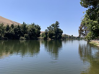
Hart Memorial Park is a large public park in Kern County, California. It is located just north of Bakersfield. The park is 370 acres (150 ha), and contains two lakes and three canals. It was named after County Supervisor John Hart, who spearheaded the project. Constructed between 1921 and 1936, it is the oldest section of the Kern River County Park.

McBean Regional Transit Center, also known by its acronym MRTC, is a transit center and bus station located at 24375 Valencia Boulevard in the Valencia area of Santa Clarita, California, near the intersection of Valencia Boulevard and McBean Parkway. It is located next to the Westfield Valencia Town Center.


