Jefferson Township, Fayette County, Iowa

Last updated

Jefferson Township
Map highlighting Jefferson Township, Fayette County, Iowa.svg
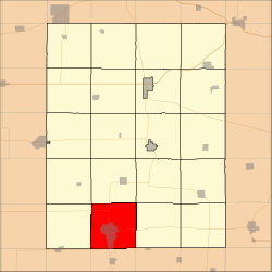
Location in Fayette County
Coordinates: 42°41′11″N91°54′11″W / 42.68639°N 91.90306°W / 42.68639; -91.90306
Country Flag of the United States (23px).png  United States
State Flag of Iowa.svg  Iowa
County Fayette
Area
  Total
36.46 sq mi (94.42 km2)
  Land36.37 sq mi (94.2 km2)
  Water0.09 sq mi (0.22 km2)  0.23%
Elevation
1,106 ft (337 m)
Population
 (2010)
  Total
6,910
  Density190/sq mi (73/km2)
Time zone UTC-6 (CST)
  Summer (DST) UTC-5 (CDT)
ZIP codes
50655, 50662, 50671
GNIS feature ID 0468134

Jefferson Township is one of twenty townships in Fayette County, Iowa, United States. As of the 2010 census, its population was 6,910. [1]

Contents

Geography

According to the United States Census Bureau, Jefferson Township covers an area of 36.46 square miles (94.42 square kilometers); of this, 36.37 square miles (94.2 square kilometers, 99.77 percent) is land and 0.09 square miles (0.22 square kilometers, 0.23 percent) is water.

Cities, towns, villages

Adjacent townships

Cemeteries

The township contains these three cemeteries: Oakdale, Otsego and Woodlawn.

Major highways

Airports and landing strips

Landmarks

School districts

Political districts

References

  1. "Profile of General Population and Housing Characteristics: 2010 Demographic Profile Data (DP-1): Jefferson township, Fayette County, Iowa". United States Census Bureau . Retrieved March 5, 2012.