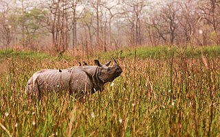
Assam is a state in northeastern India, south of the eastern Himalayas along the Brahmaputra and Barak River valleys. Assam covers an area of 78,438 km2 (30,285 sq mi). The state is bordered by Bhutan and Arunachal Pradesh to the north; Nagaland and Manipur to the east; Meghalaya, Tripura, Mizoram and Bangladesh to the south; and West Bengal to the west via the Siliguri Corridor, a 22 kilometres (14 mi) wide strip of land that connects the state to the rest of India. Assamese and Bodo are the official languages of Assam, while Bengali is an additional official language in the Barak Valley.

Golaghat district (Pron:ˌgəʊləˈgɑ:t) is an administrative district in the state of Assam in India. It attained district status in 1987. The district headquarters are located at Golaghat. The district occupies an 3,502 km2 (1,352 sq mi) and lies 100 metres (330 ft) above sea level.

Sivasagar, is a city in and headquarters of the Sivasagar district, Assam. Sivasagar is situated about 360 kilometers (224 mi) northeast of Guwahati. It is well known for its Ahom palaces and monuments. Sivasagar is an important centre for tea and oil industries today. Sivasagar is a part of Jorhat. Akhil Gogoi is the current MLA of Sibsagar.

The Asam Sahitya Sabha is a non Government, non profit, literary organisation of Assam. It was founded in December 1917 in Assam, India to promote the culture of Assam and Assamese literature. A branch of the organisation named Singapore Sahitya Sabha was launched in Singapore on July 28, 2019.

Jorhat is an administrative district of the Indian state of Assam situated in the central part of the Brahmaputra Valley. The district is bounded by Majuli on north, Nagaland state on the south, Charaideo on the east and Golaghat on the west. On the north of the district, the river Brahmaputra forms the largest riverine island of the world. The administrative seat is at Jorhat city.
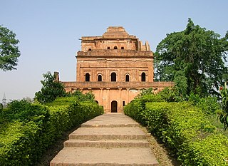
Sivasagar district, formerly known as Sibsagar, is one of the 34 districts of Assam state in Northeast India. Sivasagar city is the administrative headquarters of this district. This historic place is also known for its rich biodiversity. The districts covers an area of 2668 square kilometers. The district comprises two sub-divisions – Sivasagar and Nazira. The district of Sivasagar lies between 26.45°N and 27.15°N latitudes and 94.25°E and 95.25°E longitudes. The district is bounded by the Brahmaputra River to the north, Nagaland to the south, the Charaideo district to the east and the Jhanji River to the west. The Sivasagar district has acquired its distinct identity due to the co-existence of different races, tribes, languages and cultures.
Amguri is a town and municipal area committee in Sivasagar district in the state of Assam, India.

Duliajan is an industrial town of Dibrugarh district in the Indian state of Assam located in the upper north-east corner of India. The town is about 45 km east of Dibrugarh City. It is particularly known for its oil related industry, Oil India Limited, one of the country's largest oil and gas companies. There was also other central government owned companies like B.C.P.L company of gas cracker & polymer, N.E.E.P.C.O., B.F.C.L. and the Shivani company which is India's largest private company for drilling. Assam Gas Company Limited, which carries out business related to natural gas in India owned by the Government of Assam, is also located in this township.
Nazira is a town and a municipal board in Sivasagar district in the Indian state of Assam.
Sonari is a district Headquarter, mid-size town and a municipal board in newly announced Charaideo district in the Indian state of Assam.

Titabor or Titabar is a town in the Jorhat district of Assam in India. It is about 20 km away from Jorhat City. It is one of the highly greeny places of Assam almost surrounded by different tea-estates. The town serves as the administrative headquarters of the Thengal Kachari Autonomous Council.
Mahim Bora was an Indian writer and educationist from Assam. He was elected as a president of the Assam Sahitya Sabha held in 1989 at Doomdooma. He was awarded most notably the Padma Shri in 2011, the Sahitya Akademi Award in 2001 and the Assam Valley Literary Award in 1998. Assam Sahitya Sabha conferred its highest honorary title Sahityacharyya on him in 2007.
Sepon is a semi-urban place in upper Assam, India, with an estimated population between 1000 and 2000. The term Sepon is derived from the sepakhowa ran, a war fought during the Ahom tenure. One of the significant geographical features of Sepon is that it is located between two districts of Assam, Charaideo and Dibrugarh. National Highway 37 divides Sepon into two parts; one part within the jurisdiction of the Dibrugarh district and another part within the jurisdiction of the Charaideo district. Sepon is surrounded by tea gardens and villages.

Jorhat is one of the important cities and a growing urban centre in the state of Assam in India.
Chandra Prasad Saikia (1927–2006) was a writer from Assam, India. He was the president of the Asam Sahitya Sabha held at Hajo and Jorhat district, Assam in 1999 and 2000, respectively. Saikia was born on 8 July 1927 at Jalukgaon, Amguri in Sivasagar district, Assam. After having primary education in Sivasagar he had left for Kolkata for higher education.
Teok is a small town situated in the Jorhat district of Assam, India. It is at a distance of about 20 kilometres from Jorhat city. The term 'Teok' is derived from the Tai languages. It literally means – ‘The place of milk and ghee’.
Jhanji Hemnath Sarma College is a college situated at Jhanji, Sivasagar, Assam, India. It was founded on 25 July 1964. The college is affiliated to Dibrugarh University and recognized by University Grants Commission.
Assam – 16th largest, 15th most populous and 26th most literate state of the 28 states of the democratic Republic of India. Assam is at 14th position in life expectancy and 8th in female-to-male sex ratio. Assam is the 21st most media exposed states in India. The Economy of Assam is largely agriculture based with 69% of the population engaged in it. Growth rate of Assam's income has not kept pace with that of India's during the Post-British Era; differences increased rapidly since the 1970s. While the Indian economy grew at 6 percent per annum over the period of 1981 to 2000, the same of Assam's grew only by 3.3 percent.
Satyendranath Sarma was an Assamese writer, educationalist, research scholar, critic and historian. He presided over the Assam Sahitya Sabha venue of Titabor in 1975.
The Brittial Bania/Bania is an ethnic community in Assam, India. The group traces its roots to a merchant community who reached Assam in ancient times. Some historians claim that after the Austric group migrated to ancient Assam, the next group of people who arrived was the Dravidian group, who are represented by the Bania and Kaibbartas today. Unlike the mainland Baniya community, this community of Assam is recognized as Schedule Caste by the government of India.


