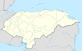
The Gulf or Bay of Honduras is a large inlet of the Caribbean Sea, indenting the coasts of Belize, Guatemala, and Honduras. From north to south, it runs for approximately 200 km from Dangriga, Belize, to La Ceiba, Honduras.

Gracias is a small Honduran town/municipality that was founded in 1536, and is the capital of Lempira Department.

Santa Bárbara is the capital city of the Santa Bárbara Department of Honduras.

Virginia is a municipality in the Honduran department of Lempira. Virginia is located in Lempira Honduras and shares a border with El Salvador. Many Virginians travel to El Salvador to do their shopping, because the Honduran cities are far away from Virginia.

Belén Gualcho is a municipality in the Honduran department of Ocotepeque.

San Marcos is a municipality in the Honduran department of Ocotepeque.

Arada is a municipality in the Honduran department of Santa Bárbara.

Atima is a municipality in the Honduran department of Santa Bárbara.

Concepción del Sur is a municipality in the Honduran department of Santa Bárbara.

Las Vegas is a municipality in the Honduran department of Santa Bárbara.

Nueva Frontera is a municipality in the Honduran department of Santa Bárbara.

San José de Colinas is a town and municipality in the Honduran department of Santa Bárbara.

San Nicolás is a municipality in the Honduran department of Santa Bárbara.
Estadio Sergio Antonio Reyes is a multi-purpose stadium in Santa Rosa de Copán, Honduras. It was previously called "Estadio Municipal Miraflores" and was founded in the Miraflores district of Santa Rosa de Copan, Honduras on 26 January 1975 by the then municipal mayor, representatives of CONAPID, members of the Rotary International Club and other invited guests. It is used mostly for football matches and is the home stadium of Deportes Savio. The stadium holds 3,000 people nad is divided into two sectors, Sol (sun) and Sombra (shadow).
Estadio Argelio Sabillón is a multi-purpose stadium in Santa Bárbara, Honduras. It is currently used mostly for football matches and is the home stadium of Real Juventud. The stadium holds 5,000 people.
James Sprunt Community College is a community college in Kenansville, North Carolina. Founded in 1960 as James Sprunt Technical Institute, the college is named for James Menzies Sprunt (1818-1884), a Scottish immigrant who became a teacher, Presbyterian minister, and the longtime pastor of Grove Presbyterian Church in Kenansville. James Sprunt Institute, active from 1897 to 1923, was also named for him.

The Lempa River is a 422-kilometre (262 mi) long river in Central America.
The Otoro River, also known as the Grande de Otoro River, is a river in Honduras which begins in the department of Intibucá and then becomes the Ulúa River in the Santa Barbara Department.
The Hondo River was a settlement owned by the Kingdom of Great Britain since the early 18th century. In 1779, the Spanish repeatedly attacked the British settlements in British Honduras. The Hondo River was targeted, but the British were never driven out. However, they abandoned their colony until 1783.

Bora Gagangohalia is a census town under Bishnupur police station of Bishnupur II CD Block in Alipore Sadar subdivision of South 24 Parganas district in the Indian State of West Bengal. It is a part of Kolkata Urban Agglomeration.


