The Nissan SR engine is a 1.6 L (1,596 cc), 1.8 L (1,838 cc) or 2.0 L (1,998 cc) straight-4, four-stroke gasoline internal combustion engine manufactured by Nissan Motors. It features an aluminum head and block with steel sleeves and features a DOHC 4-valve design, with variable valve timing on select models. The engine was used in many small to medium Nissan vehicles including high-performance turbocharged variants. It was designed by Nissan as a replacement for the earlier CA series of engines. Power output shown is JIS Net PS or ECE Net kilowatts unless otherwise indicated.
The GA engine is a 1.3 to 1.6 L inline 4 piston engine from Nissan. It has a cast iron block and an aluminum head. There are SOHC & DOHC versions, 12 valve & 16 valve versions, carbureted, single-point and multi-point injected versions, and versions with variable valve timing (GA16DE). The GA was produced from August 1987 through 2013. Since 1998 it was only available from Mexico in the B13.

The Aguán River ; also commonly known by its Spanish name, Rio Aguán) is a river in Honduras. It rises in the Yoro region to the west of San Lorenzo and briefly runs south before turning east-northeast, passing San Lorenzo, Olanchito and Tocoa before entering the Caribbean Sea east of Puerto Castilla.

The Patuca is a river in northeastern Honduras, formed southeast of Juticalpa by the merger of the Guayape and Guayambre rivers. It is the second largest river in Central America and the longest river of Honduras, measuring almost 500 kilometres (310 mi) long and draining 23,900 square kilometres (9,200 sq mi).

The Ulúa River is a river in western Honduras. It rises in the central mountainous area of the country close to La Paz and runs 240 kilometres (150 mi) approximately due northwards to the east end of the Gulf of Honduras at 15°55′N87°43′W. En route, it is joined by the Sulaco River, the Jicatuyo River, the Otoro River and the Chamelecón River.

Juan Francisco Bulnes is a municipality in the Honduran department of Gracias a Dios.
Wampusirpi is a municipality in the Honduran department of Gracias a Dios.
WIOK is an American radio station in Falmouth, Kentucky. The station plays a Southern Gospel format. The station is owned and operated by the Hammond Broadcasting, Inc. It broadcasts with an effective radiated power of 6000 watts in southern Pendleton County, Kentucky. The station's range covers the corridor between Cincinnati, Ohio and Lexington, Kentucky.

The Cangrejal River or Río Cangrejal is a river that drains several mountain tributaries and borders the rainforest of Pico Bonito National Park near La Ceiba, Honduras. The river offers some of the best whitewater rafting opportunities in Central America.
The Tela River or Río Tela is a river that runs through Tela, in Honduras, flowing into the Caribbean Sea. It begins in a marshy area inland and opens out near the sea.

The Lempa River is a 422-kilometre (262 mi) long river in Central America.

The Chamelecón River is a river in Honduras.
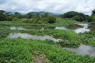
The Cuero River, also known as the Cuero and Salado River, is a river to the east of San Juan Pueblo and forming part of the Wildlife Refuge Cuero and Salada in Honduras.
The Jicatuyo River is a river in the Santa Barbara Department in Honduras which flows into the Ulúa River.
The Leán River is a river on the northern Caribbean coast of Honduras slightly to the east of Tela, bordering the Punta Izopo National Park, in Atlántida Department.
The Otoro River, also known as the Grande de Otoro River, is a river in Honduras which begins in the department of Intibucá and then becomes the Ulúa River in the Santa Barbara Department.
The Papaloteca River is a river whose mouth runs through Nueva Armenia, in Honduras, flowing into the Caribbean Sea.

The Plátano River is a river in Honduras which runs through the Río Plátano Biosphere Reserve.
The Sico Tinto Negro is a river in Honduras.
The Warunta River is a river in the Gracias a Dios Department of Honduras that flows into the Warunta Lagoon adjoining the larger Caratasca Lagoon, beside the Caribbean Sea.