The Gulf or Bay of Honduras is a large inlet of the Caribbean Sea, indenting the coasts of Belize, Guatemala, and Honduras. From north to south, it runs for approximately 200 km from Dangriga, Belize, to La Ceiba, Honduras.

The Patuca is a river in northeastern Honduras, formed southeast of Juticalpa by the merger of the Guayape and Guayambre rivers. It is the second largest river in Central America and the longest river of Honduras, measuring almost 500 kilometres (310 mi) long and draining 23,900 square kilometres (9,200 sq mi).

The Ulúa River is a river in western Honduras. It rises in the central mountainous area of the country close to La Paz and runs 240 kilometres (150 mi) approximately due northwards to the east end of the Gulf of Honduras at 15°55′N87°43′W. En route, it is joined by the Sulaco River, the Jicatuyo River, the Otoro River and the Chamelecón River.

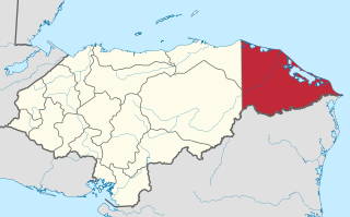
Juan Francisco Bulnes is a municipality in the Honduran department of Gracias a Dios.
Wampusirpi is a municipality in the Honduran department of Gracias a Dios.
Morazán is a municipality in the Honduran department of Yoro. This political division of 42,171 people is in the north, located between the city of Yoro and the municipality of El Negrito, north of the Nico Pijol National Park.

Apalachicola Bay is an estuary and lagoon located on the northwest coast of the U.S. state of Florida. The Apalachicola Bay system also includes St. George Sound, St. Vincent Sound and East Bay, covering an area of about 208 square miles (540 km2). Four islands, St. Vincent Island to the west, Cape St. George Island and St. George Island to the south, and Dog Island to the east, separate the system from the Gulf of Mexico. Water exchange occurs through Indian Pass, West Pass, East Pass and the Duer Channel. The lagoon has been designated as a National Estuarine Research Reserve and the Apalachicola River is the largest source of freshwater to the estuary. Combined with the Chattahoochee River, Flint River, and Ochlockonee River they drain a watershed of over 20,000 square miles (50,000 km2) at a rate of 19,599 cubic feet (550 m3) per second according to the United States Geological Survey in 2002.

Jeanette Kawas National Park is a national park located in the municipality of Tela, on the northern Caribbean coast of the Atlántida department of Honduras, established on 4 November 1994. The park covers an area of 781.62 square kilometres and has an altitude of 900 metres. The park was created and is managed by the PROLANSATE foundation.

The Chamelecón River is a river in Honduras.
The Cuero River, also known as the Cuero and Salado River, is a river to the east of San Juan Pueblo and forming part of the Wildlife Refuge Cuero and Salada in Honduras.
The Leán River is a river on the northern Caribbean coast of Honduras slightly to the east of Tela, bordering the Punta Izopo National Park, in Atlántida Department.

The Plátano River is a river in Honduras which runs through the Río Plátano Biosphere Reserve.
The Sico Tinto Negro is a river in Honduras.
The Sigre River is a river in the Gracias a Dios Department, Honduras. It flows into the Brus Lagoon, which itself lies adjacent to the Caribbean Sea.
The Black River settlement was a British settlement on the Mosquito Coast of present-day Honduras. It was established in 1732 by a British colonist named William Pitt. The settlement, made on territory claimed but never really controlled by Spain, was evacuated in 1787 pursuant to terms of the Anglo-Spanish Convention of 1786. The Spanish then attempted to colonize the area, but the local Miskitos massacred most of its inhabitants on September 4, 1800. The settlement was abandoned, and its remains can still be seen near the village of Palacios in the Honduran department of Gracias a Diós.
The Methodist Church in the Caribbean and Americas is a denomination in the Bahamas, Barbados, Belize, Dominica, Guyana, Haiti, Honduras, Jamaica, Panama, Saint Kitts and Nevis, Saint Vincent and the Grenadines, and Trinidad and Tobago. It has 700 congregations and 62,000 members. A strong relationship with the United Church of Canada and the United Methodist Church was established. The Methodist Church was founded by the British Methodist Mission in the 18th century.

Oxhey Woods is a 98 hectare Local Nature Reserve in South Oxhey in Hertfordshire. It is owned and managed by Three Rivers District Council.
Velilla de la Sierra is a municipality located in the province of Soria, in the autonomous community of Castile and León, Spain.