Atlántida is a department located on the north Caribbean shore of Honduras, Central America. The capital is the port city of La Ceiba.

The Ulúa River is a river in western Honduras. It rises in the central mountainous area of the country close to La Paz and runs 240 kilometres (150 mi) approximately due northwards to the east end of the Gulf of Honduras at 15°55′N87°43′W. En route, it is joined by the Sulaco River, the Jicatuyo River, the Otoro River and the Chamelecón River.

The municipality of El Progreso is located in the Honduran department of Yoro.

Arizona is a municipality in the Honduran department of Atlántida.
El Porvenir is a municipality in the Honduran department of Atlántida.
Esparta is a municipality in the Honduran department of Atlántida.
La Masica is a municipality in the Honduran department of Atlántida.
San Francisco is a municipality in the Honduran department of Atlántida.
Santa Rita is a municipality in the Honduran department of Yoro. The Humuya River passes through it.
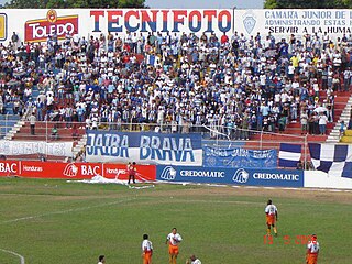
Estadio Ceibeño is a multi-purpose stadium in La Ceiba, Honduras.

The Choluteca River is a river in southern Honduras. Its source is in the Department of Francisco Morazán, near Lepaterique, and from there it flows north through the city of Tegucigalpa, then south through the department of El Paraíso, and the department and city of Choluteca. The mouth of the river—located among wetland—is near the coastal town of Cedeño, on the Gulf of Fonseca.

The Cangrejal River or Río Cangrejal is a river that drains several mountain tributaries and borders the rainforest of Pico Bonito National Park near La Ceiba, Honduras. The river offers some of the best whitewater rafting opportunities in Central America.
The Tela River or Río Tela is a river that runs through Tela, in Honduras, flowing into the Caribbean Sea. It begins in a marshy area inland and opens out near the sea.

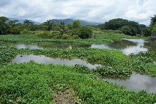
Jeanette Kawas National Park is a national park located in the municipality of Tela, on the northern Caribbean coast of the Atlántida department of Honduras, established on 4 November 1994. The park covers an area of 781.62 square kilometres and has an altitude of 900 metres. The park was created and is managed by the PROLANSATE foundation.

Armenia Bonito - A "barrio" or "colonia" 7 miles west of downtown La Ceiba in the Atlántida Department in the country of Honduras in Central America. It is located in the northern part of Honduras within view of Caribbean Sea.

The Chamelecón River is a river in Honduras.
The Cuero River, also known as the Cuero and Salado River, is a river to the east of San Juan Pueblo and forming part of the Wildlife Refuge Cuero and Salada in Honduras.
The Papaloteca River is a river whose mouth runs through Nueva Armenia, in Honduras, flowing into the Caribbean Sea.

The Plátano River is a river in Honduras which runs through the Río Plátano Biosphere Reserve.
Estadio Carlos Calderón is a football-specific stadium located in San Juan Pueblo, Atlántida, Honduras. The stadium was first used for Liga Nacional matches for the first time in 2017, as C.D.S. Vida decided to temporarily relocate from Estadio Nilmo Edwards looking for larger crowds. The stadium holds 2,000 people.


