The geography of France consists of a terrain that is mostly flat plains or gently rolling hills in the north and west and mountainous in the south and the east.

The Arctic Archipelago, also known as the Canadian Arctic Archipelago, is a group of islands north of the Canadian mainland.

River Falls is a town in Covington County, Alabama, United States. At the 2010 census the population was 526.

The Branscomb Glacier is an Antarctic glacier, 11 nautical miles long, flowing west from the north-west side of Vinson Massif into Nimitz Glacier, in the Sentinel Range of the Ellsworth Mountains. Its upper course receives ice influx from both Goodge Col and Jacobsen Valley, while the tributary Roché Glacier joins Branscomb Glacier just northwest of Príncipe de Asturias Peak.

The Apure River is a river of southwestern Venezuela, formed by the confluence of the Sarare and Uribante near Guasdualito, in Venezuela, at 7°15′N70°40′W, and flowing across the llanos into the Orinoco. It provides significant transportation in the area.
Manga refers to Japanese comic books or comic strip.

Portland, with its capital town Port Antonio, is a parish located on Jamaica's northeast coast. It is situated to the north of St Thomas and to the east of St Mary in Surrey County. It is one of the rural areas of Jamaica, containing part of the Blue Mountains, where the Jamaican Maroon communities of Moore Town and Charles Town are located.

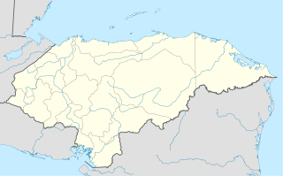
Balfate is a municipality in the Honduran department of Colón.
Ituni is a town in the interior of Guyana, at an altitude of 100 metres (331 feet). Bauxite mining is the main industry.

Matamoros is a city and seat of the Matamoros Municipality located in the southwestern part of the state of Coahuila in Mexico. It lies directly east of the larger city of Torreón, and is a part of Comarca Lagunera, a larger metropolitan area, that includes Torreón Municipality in Coahuila in addition to Gómez Palacio Municipality and Lerdo Municipality in the adjacent state of Durango.

Monda is a town and municipality in the province of Málaga, part of the autonomous community of Andalusia in southern Spain. It is located near Sierra Blanca and Sierra de las Nieves in the comarca of Sierra de las Nieves. The municipality is situated approximately 44 kilometres from the provincial capital of Málaga and 10 from Coín. Monda has an altitude of 427 metres. It has a population of approximately 2,000 residents. The natives are called Mondeños.

Bagaces is the fourth canton in the province of Guanacaste in Costa Rica. The canton covers an area of 1,273.49 km², and has a population of 17,087. Its capital city is also called Bagaces.

Cabreros del Río ) is a municipality located in the province of León, Castile and León, Spain. According to the 2010 census (INE), the municipality has a population of 481 inhabitants.

Lomoviejo is a municipality located in the province of Valladolid, Castile and León, Spain. According to the 2004 census (INE), the municipality has a population of 240 inhabitants.
Río Grande de Matagalpa is a river of Nicaragua. Running 430 kilometers (270 mi) from its source near Matagalpa to the Caribbean Sea in the northern part of the South Caribbean Autonomous Region it is the second longest river in Nicaragua. It gives it name to the city and municipality of La Cruz de Río Grande. The Tumarín Dam is being constructed on its lower reaches.
The Papaloteca River is a river whose mouth runs through Nueva Armenia, in Honduras, flowing into the Caribbean Sea.
Buckenbowra River, a perennial river of the Clyde River catchment, is located in the upper ranges of the South Coast region of New South Wales, Australia.

Puerto Acosta or Waychu (Aymara) is a town in the La Paz Department, Bolivia.

Guerrero Glacier is a glacier about 7 nautical miles (13 km) long in Doyran Heights, draining from the southeast slopes of Mount Havener southwest of Beloslav Peak to the south side of Taylor Spur, in the southeast part of the Sentinel Range, Ellsworth Mountains, Antarctica. It was first mapped by the United States Geological Survey from surveys and U.S. Navy air photos, 1957–59, and was named by the Advisory Committee on Antarctic Names for John F. Guerrero, a meteorologist at South Pole Station in 1957.


