Related Research Articles
Kearney Regional Airport is an airport five miles northeast of Kearney in Buffalo County, Nebraska. Denver Air Connection provides scheduled passenger service to Denver which is supported by the Essential Air Service.
McCook Ben Nelson Regional Airport is two miles east of McCook, in Red Willow County, Nebraska. It was formerly McCook Municipal Airport and McCook Regional Airport. It sees one airline, subsidized by the Essential Air Service program.
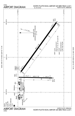
North Platte Regional Airport is a public airport three miles east of North Platte, in Lincoln County, Nebraska. It is owned by the North Platte Airport Authority and sees one airline, subsidized by the Essential Air Service program.
Western Nebraska Regional Airport is three miles east of Scottsbluff, in Scotts Bluff County, Nebraska. The airport is owned by the Airport Authority of Scotts Bluff County and is named after William B. Heilig. Known as "Scottsbluff's Mr. Aviation," he was a World War II United States Army Air Force primary flight instructor, a civil flight instructor, and manager of the city's airport.
Natchitoches Regional Airport is a city-owned public-use airport located two nautical miles (4 km) south of the central business district of Natchitoches, a parish seat of Natchitoches Parish, Louisiana, United States.

University of Oklahoma Westheimer Airport is a public use airport in Norman, in Cleveland County, Oklahoma. It is owned by the University of Oklahoma. The National Plan of Integrated Airport Systems for 2021–2025 categorized it as a reliever airport.

Gulf Shores International Airport/Jack Edwards Field is a public use airport in Baldwin County, Alabama, United States. It is owned by Gulf Shores Airport Authority and located two nautical miles (4 km) north of the City of Gulf Shores. Also was known as Jack Edwards National Airport, it is included in the National Plan of Integrated Airport Systems for 2011–2015, which categorized it as a general aviation facility.
Delaware County Regional Airport is in Delaware County, Indiana three miles northwest of Muncie. Owned by the Delaware County Airport Authority, it was formerly Delaware County Airport and Johnson Field. The National Plan of Integrated Airport Systems for 2011–2015 categorized it as a general aviation facility.
Fernandina Beach Municipal Airport is a city-owned public-use airport located on Amelia Island three nautical miles (6 km) south of the central business district of Fernandina Beach, a city in Nassau County, Florida, United States. It is designated as a reliever airport for Jacksonville International Airport.

West Woodward Airport is in Woodward County, Oklahoma, United States, seven miles west of Woodward, which owns it. The National Plan of Integrated Airport Systems for 2011–2015 called it a general aviation airport.
Sidney Municipal Airport is three miles south of Sidney, in Cheyenne County, Nebraska. It is owned by the Sidney Airport Authority.
Miller Field is a public airport a mile south of Valentine in Cherry County, Nebraska.
Broken Bow Municipal Airport, also known as Keith Glaze Field, is a public use airport located two nautical miles (4 km) north of the central business district of Broken Bow, a city in Custer County, Nebraska, United States. It is owned by the Broken Bow Airport Authority. This airport is included in the National Plan of Integrated Airport Systems for 2011–2015, which categorized it as a general aviation facility.
Fremont Municipal Airport is two miles northwest of Fremont, in Dodge County, Nebraska. The FAA's National Plan of Integrated Airport Systems for 2009-2013 classified it as a general aviation airport.
Wahoo Municipal Airport is two miles northeast of Wahoo, in Saunders County, Nebraska. It is owned by the Wahoo Airport Authority. The FAA's National Plan of Integrated Airport Systems for 2009–2013 classified it as a general aviation airport.
The O'Neill Municipal Airport is two miles northwest of O'Neill, in Holt County, Nebraska. It is owned by the O'Neill Airport Authority. The FAA's National Plan of Integrated Airport Systems for 2009–2013 categorized it as a general aviation facility.

Hastings Municipal Airport is two miles northwest of Hastings in Adams County, Nebraska. The National Plan of Integrated Airport Systems for 2011–2015 categorized it as a "general aviation" airport.
Mettel Field is a public airport three miles north of Connersville, in Fayette County, Indiana. It is owned by the Connersville Board of Aviation Commissioners. The National Plan of Integrated Airport Systems for 2011–2015 categorized it as a general aviation facility.
York Municipal Airport is a mile northwest of York, in York County, Nebraska. The National Plan of Integrated Airport Systems for 2011–2015 categorized it as a general aviation facility.
Brenner Field is a public use airport located one nautical miles (1.6 km) northeast of the central business district of Falls City, a city in Richardson County, Nebraska, United States.
References
- 1 2 3 FAA Airport Form 5010 for LXN PDF , effective November 30, 2023.