
The Miluo River is located on the eastern bank of Dongting Lake, the largest tributary of the Xiang River in the northern Hunan Province. It is an important river in the Dongting Lake watershed, known as the location of the ritual suicide in 278 BC of Qu Yuan, a poet of Chu state during the Warring States period, in protest against the corruption of the era.

Batang Town is a rural town in Ningxiang City, Hunan Province, China. It is surrounded by Zifu on the west, Huilongpu Town and Baimaqiao Subdistrict on the north, Xiaduopu Town on the east, and Nantianping Township on the south. As of the 2007 census it had a population of 70,000 and an area of 163.7 square kilometres (63.2 sq mi). Nantianping township merged to Batang town on November 19, 2015.
Dachengqiao Town is a rural town in Ningxiang City, Hunan Province, China. It is surrounded by Shuangfupu Town on the west, Meitanba Town and Yujia'ao Township on the north, Huilongpu Town on the east, and Zifu and Batang Town on the south. As of the 2000 census it had a population of 31,355 and an area of 58 square kilometres (22 sq mi).

Datunying Town is a rural town in Ningxiang City, Hunan Province, China. It is surrounded by Huaminglou Town on the north, Daolin Town on the east, and Shaoshan City on the southwest. As of the 2000 census, it had a population of 39,819 and an area of 106.2 square kilometres (41.0 sq mi).
Huangcai Town is a rural town in Ningxiang City, Hunan Province, China. It is surrounded by Xiangzikou Town, Shatian Township and Weishan Township on the west, Songmutang Town on the north, Hengshi Town on the east, and Laoliangcang Town and Liushahe Town on the south. As of the 2000 census it had a population of 55,412 and an area of 220 square kilometres (85 sq mi). It is known for the bronze culture of the Shang culture at Laoliangcang Town.

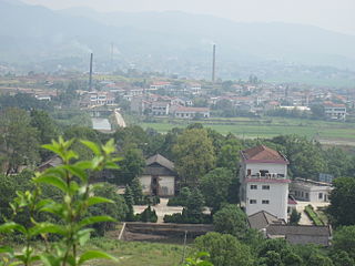
Huilongpu Town is a rural town in Ningxiang City, Hunan Province, China. It is surrounded by Dachengqiao Town on the west, Meitanba Town and Jinghuapu Township on the north, Baimaqiao Subdistrict on the east, and Batang Town on the south. As of the 2007 census it had a population of 37,000 and an area of 71.8 square kilometres (27.7 sq mi).
The Wei or Weishui River, begins in Weishan Township, is 117.2 kilometres (72.8 mi) long, and has a drainage basin of 2,125 square kilometres (820 sq mi). It is the largest river in Ningxiang City and one of the largest tributaries of the Xiang River.
Wu River, originates in Xiangxiang City, is 40 kilometres (25 mi) long, and drains a basin of 385 square kilometres (149 sq mi). It is the fourth largest river in Ningxiang City and one of the largest tributaries of the Wei River.
The Liuyang River, also known as Liu River or Liuwei River, is a right-bank tributary of Xiang River, the largest tributary of Xiang River in Changsha, Hunan Province, China. The river has a length of 234.8 kilometres (145.9 mi) with its drainage area of 4,665 square kilometres (1,801 sq mi), accounting for 39.47% of the total area of Changsha, with surface water resources of 4,506 million cubic meters, accounting for 41.08% of that. It flows through Liuyang City, Changsha County, Yuhua, Furong and Kaifu Districts, and merges into Xiang River at Xinhe Delta Mouth of Kaifu District.

The Laodao River, also known as the Laotang River or Liaoxu River, is a right-bank tributary of the Xiang River, the 2nd largest tributary of Xiang River in Changsha, Hunan Province, China. The river has a length of 149.35 kilometres (92.80 mi) with its drainage area of 2,543 square kilometres (982 sq mi), accounting for 21.52% of the total area of Changsha, with surface water resources of 2,262 million cubic meters, accounting for 20.62% of that. It flows through Liuyang City, Changsha County, Furong and Kaifu Districts, and merges into Xiang River at Jiangwan of Xiufeng Subdistrict, Kaifu District.
Huanglong River, historically known as Zengzigang River, is a right-bank tributary of Xiang River in Wangcheng District and the northernmost one of right-bank tributaries in Changsha section of Xiang River in Hunan, China. It has a length of 10 kilometres (6.2 mi) with a rough drainage basin area of 50 square kilometres (19 sq mi). Huanglong River rises in Shiziling of Chating Town, flows through Shiziling, Yangjiaping, Dongcheng and Dalong four villages of Chating Town and Huashi Village of Tongguan Subdistrict, merging into Xiang River at Zengzigang Mouth located between Dalong and Huashi villages.
Shizhu River is a right-bank tributary of Xiang River in Wangcheng District of Changsha, Hunan Province, China. The river has three sources merging into the trunk stream at Daigongqiao. The right branch is its main stream which rises in the Jiufeng Mountain, the headwaters are a group of reservoirs including Chating Reservoir, Sichong Reservoir and Nanchong Reservoir located in Chating Town. The main river runs through Chating and Qiaoyi 2 towns and Tongguan Subdistrict before linking up with the Xiang River. It has a length of 25 kilometres (16 mi) with a drainage basin area of rough 60 square kilometres (23 sq mi). Its drainage basin covers Shizhu, Caitaoyuan, Heqiao, Gguoliang villages of Tongguan Subdistrict, Baishi of Qiaoyi Town, Xihusi, Shiziling, Daigongqiao, Wangqun, Meihualing, Tanjiayuan and Jiufengshan villages of Chating Town.
The Lu River is a right-bank tributary of the Xiang River. It rises in Shuijiang Town of Yichun, Jiangxi, and flows slowly westwards for 168.8 kilometres (104.9 mi) to the Xiang River. With its tributaries, the Lu has a drainage-basin area of 5,713 square kilometres (2,206 sq mi), and its watershed drains parts of four prefectures in Jiangxi and Hunan provinces. The Lu River is one of the largest tributaries of the Xiang. The main stream passes through the counties of Yuanzhou, Shangli, Anyuan and Xiangdong in Jiangxi and the counties of Liling and Zhuzhou in Hunan.
The Lianshui River, also known as Luoma River or Ganxi River, is a left-bank tributary in the middle reaches of the Xiang River in Hunan. The river rises in Pingshang Town of Xinshao County. Its main stream runs generally west to east through Xinshao, Lianyuan, Louxing, Shuangfeng, Xiangxiang, Yuhu and Xiangtan counties and joins the Xiang at Hekou of Xiangtan. The Lianshui River has a length of 224 kilometres (139 mi); its drainage basin covers an area of 7,150 square kilometres (2,760 sq mi).
The Juan River, also known as Baiguo River, Yisu River and Xingle River, is a left-bank tributary in the middle reaches of the Xiang River in Hunan, China. The river rises in the Changshan Mountains of Shuangfeng County, and its main stream runs generally southwest to northeast through Shuangfeng, Hengshan and Xiangtan counties, joining the Xiang at Yisuhe of Xiangtan. The Juan River has a length of 103 kilometres (64 mi), and its drainage basin covers an area of 1,764 square kilometres (681 sq mi).
The Mi River is one of three largest tributaries of the Xiang River and a right-bank tributary in the middle reaches of the Xiang in Hunan, China. The river rises in Tianxin Village of Xiacun Township, Yanling County. Its main stream runs generally southeast to northwest through Yanling, Chaling, You and Hengdong counties, and it joins the Xiang in Xintang Town of Hengdong. The Mi River has a length of 296 kilometres (184 mi); its drainage basin covers an area of 10,305 square kilometres (3,979 sq mi).
The Chongling River, also known as Jiao River and Lingyuan River, is a right-bank tributary and one of the largest tributaries of the middle Xiang River in Hunan, China. The river rises in the Renxingling Mountains of Lanshan County. Its main stream runs generally south to north through Lansghan, Jiahe, Xintian, Xintian, Leiyang, Changning and Hengnan counties, and it joins the Xiang at Jiaohekou of Hengnan. The Chongling River has a length of 223 kilometres (139 mi), with its tributaries, and the drainage basin covers an area of 6,623 square kilometres (2,557 sq mi).
The Lei River is a right-bank tributary of the middle Xiang River in Hunan, China. It is also the longest tributary and has the second largest drainage system of the Xiang tributaries after the Xiao River. The Lei River has two sources: the Zhejiang River, which rises in the Leishan Mountains in the south of Rucheng County, and the Ou River, which rises in the Wanyang Mountains in the north of Guidong County. The two rivers join at Huangcaoping, Zixing City. The main stream of the Lei River runs generally south to northwest through Rucheng, Zixing, Suxian, Yongxing, Leiyang, Hengnan and Zhuhui counties and joins the Xiang at Leihekou of Zhuhui District of Hengyang. The main stream of the Lei River has a length of 453 kilometres (281 mi), with its tributaries, and the drainage basin covers an area of 11,783 square kilometres (4,549 sq mi).
The Yishui River, also known as Yi River, is a right-bank tributary of the middle Xiang River in Hunan, China. It is the largest and longest river in Changning City. The Yi River rises in Xiaoyangquan of Baishui Township of Guiyang County. Its main stream runs generally south to north and joins the Xiang at Jiangkoutang of Xinhe Town. The Yi River has a length of 86 kilometres (53 mi), with its tributaries, and its drainage basin covers an area of 1,056 square kilometres (408 sq mi).


