Johns Township, Appanoose County | |
|---|---|
 | |
| Coordinates: 40°46′07″N093°02′24″W / 40.76861°N 93.04000°W | |
| Country | |
| State | |
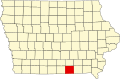
| County | Appanoose |
| Area | |
• Total | 36.25 sq mi (93.88 km2) |
| • Land | 36.20 sq mi (93.75 km2) |
| • Water | 0.050 sq mi (0.13 km2) |
| Elevation | 1,030 ft (314 m) |
| Population (2010) | |
• Total | 287 |
| • Density | 8.0/sq mi (3.1/km2) |
| FIPS code | 19-92271 [2] |
| GNIS feature ID | 0468152 |
Johns Township is one of eighteen townships in Appanoose County, Iowa, United States. As of the 2010 census, its population was 287. [3]
Contents
The township's name was selected due to an unusually large percentage of early settlers sharing the name John. [4]