Darbyville, Iowa | |
|---|---|
 Darbyville, Iowa | |
| Coordinates: 40°48′58″N92°52′24″W / 40.81611°N 92.87333°W | |
| Country | United States |
| State | Iowa |
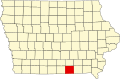
| County | Appanoose |
| Elevation | 883 ft (269 m) |
| Time zone | UTC-6 (Central (CST)) |
| • Summer (DST) | UTC-5 (CDT) |
| Area code | 641 |
| GNIS feature ID | 455793 [1] |
Darbyville is an unincorporated community in Appanoose County, Iowa, United States. [1]