José María Velasco Ibarra Airport

Last updated
José María Velasco Ibarra Airport
Summary
Airport type Public
Operator Government
Serves Macará, Ecuador
Elevation  AMSL 1,508 ft / 460 m
Coordinates 04°22′45″S79°56′29″W / 4.37917°S 79.94139°W / -4.37917; -79.94139
Map
Ecuador location map.svg
Airplane silhouette.svg
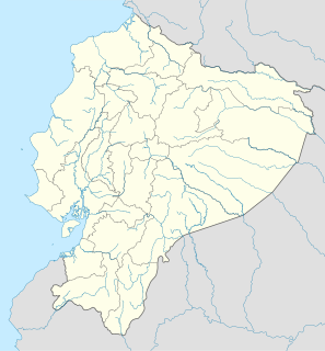
MRR
Location of the airport in Ecuador
Runways
Direction Length Surface
m ft
01/19 1,080 3,543 Asphalt
Source: WAD [1] GCM [2] Google Maps [3]

José María Velasco Ibarra Airport (Spanish : Aeropuerto J.M. Velasco Ibarra) ( IATA : MRR, ICAO : SEMA) is an airport serving Macará, a city in the Loja Province of Ecuador. Macará is on Ecuador's border with Peru.

Spanish language Romance language

Spanish or Castilian is a Romance language that originated in the Castile region of Spain and today has hundreds of millions of native speakers in the Americas and Spain. It is a global language and the world's second-most spoken native language, after Mandarin Chinese.

An IATA airport code, also known as an IATA location identifier, IATA station code or simply a location identifier, is a three-letter code designating many airports around the world, defined by the International Air Transport Association (IATA). The characters prominently displayed on baggage tags attached at airport check-in desks are an example of a way these codes are used.

ICAO airport code four-letter code designating many airports around the world

The ICAOairport code or location indicator is a four-letter code designating aerodromes around the world. These codes, as defined by the International Civil Aviation Organization and published in ICAO Document 7910: Location Indicators, are used by air traffic control and airline operations such as flight planning.

Contents

The airport is named for José María Velasco Ibarra, a former president of Ecuador.

José María Velasco Ibarra President of Ecuador

José María Velasco Ibarra was an Ecuadorian politician. He became president of Ecuador five times, in 1934–1935, 1944–1947, 1952–1956, 1960–1961, and 1968–1972, and only in 1952–1956 did he complete a full term. In his four other terms he was removed by military force, and several times he was installed as president through a military coup.

The airport is within the city, and has mountainous terrain north, and rising terrain in all other quadrants. The Macara non-directional beacon (Ident: MAC) is located on the field. [4]

Non-directional beacon radio transmitter which emits radio waves in all directions

A non-directional (radio) beacon (NDB) is a radio transmitter at a known location, used as an aviation or marine navigational aid. As the name implies, the signal transmitted does not include inherent directional information, in contrast to other navigational aids such as low frequency radio range, VHF omnidirectional range (VOR) and TACAN. NDB signals follow the curvature of the Earth, so they can be received at much greater distances at lower altitudes, a major advantage over VOR. However, NDB signals are also affected more by atmospheric conditions, mountainous terrain, coastal refraction and electrical storms, particularly at long range.

The airport (José María Velasco Ibarra) is not in service since 2010.

See also

Transportation in Ecuador uses six transportation methods to transport passengers and freight. They are aviation, highways, pipelines, ports and harbors, railways, and waterways

Related Research Articles

José Joaquín de Olmedo International Airport airport

José Joaquín de Olmedo International Airport is an airport serving Guayaquil, the capital of the Guayas Province and the most populous city in Ecuador. It is the second busiest airport in Ecuador.

President of Ecuador position

The President of Ecuador officially called the President of the Republic of Ecuador serves as both the head of state and head of government of Ecuador, is the highest political office in the country as the head of the executive branch of government. As per the current Constitution, the President can serve two four-year terms. Prior to that, the president could only serve one four-year term.

José María Córdova International Airport commercial airport in Medellin, Colombia

José María Córdova International Airport is the second largest airport in Colombia after El Dorado International Airport of Bogotá in terms of infrastructure and passenger service. It is located in the city of Rionegro, 20 kilometres (12 mi) south-east of Medellín.

MRR may stand for:

El Empalme is a town in Guayas, Ecuador, near Los Ríos and Manabí provinces. It is the seat of El Empalme Canton, the northernmost canton in Guayas, created in 1971.

Velasco Ibarra may refer to:

Andrés Córdova President of the Chamber of Representatives of Ecuador. Acting Chief of the Executive Power.

Andrés Fernández de Córdova Nieto was President of Ecuador from December 1939 to August 1940. He later ran in the presidential election of 1968, losing to José Maria Velasco Ibarra.

Macará Place in Loja, Ecuador

Macará is a city in the Loja Province of Ecuador. It is the seat of the Macará Canton and is on the border between Ecuador and Peru.

Sema or SEMA may refer to:

Cotopaxi International Airport

Cotopaxi International Airport is a high elevation airport in Latacunga, the capital of the Cotopaxi Province in Ecuador. The airport is within a broad valley of the Ecuadoran Andes, with rising terrain east and west, and mountainous terrain distant in all quadrants.

Mariscal Lamar International Airport airport

Mariscal Lamar International Airport is a high elevation airport serving Cuenca, the capital of the Azuay Province in Ecuador. It is named after the Peruvian military leader and politician José de la Mar, a native of Cuenca.

San Cristóbal Airport airport in San Cristóbal Island, Ecuador

San Cristóbal Airport is an airport on the island of San Cristóbal, in the Galápagos Islands of Ecuador. The airport is on the southwestern end of the island, with rising terrain to the northeast. Approaches to both runways are over the ocean.

Ciudad de Catamayo Airport airport in Catamayo, Ecuador

Ciudad de Catamayo Airport, formerly known as Camilo Ponce Enriquez Airport is an airport serving Loja, the capital of the Loja Province in southern Ecuador. Its name was changed from Camilo Ponce Enriquez Airport to Ciudad de Catamayo Airport on 13 May 2013.

Teniente Coronel Luis A. Mantilla International Airport

Teniente Coronel Luis A. Mantilla International Airport is a high elevation airport serving Tulcán, capital of the Carchi Province of Ecuador.

Chachoan Airport airport in Ecuador

Chachoan Airport is a high elevation airport serving Ambato, capital of the Tungurahua Province in Ecuador. The airport is 6 kilometres (3.7 mi) northeast of Ambato, in a broad basin of the central Andes mountains cut through by the Ambato River.

Gualaquiza Airport airport in Ecuador

Gualaquiza Airport is an airport serving the town of Gualaquiza in Morona-Santiago Province, Ecuador. The airport is at the entrance to a mountain valley, with nearby rising and high terrain west through north through east. The southern quadrants are open.

Atahualpa Airport airport in Ecuador

Atahualpa Airport was an airport formerly serving the town of Ibarra in Imbabura Province, Ecuador.

Corina del Parral Ecuadorian First Lady

Corina del Parral Durán was an Argentine writer, poet, singer, and composer. Married to President José María Velasco Ibarra, she served four terms as the First Lady of Ecuador.

References

The Aviation Safety Network (ASN) is a website that keeps track of aviation accidents, incidents, and hijackings. Their database contains details of over 10,700 reports. The ASN includes an aviation database with aviation investigations, news, photos, and statistics.