
Bledlow Ridge is a village in the civil parish of Bledlow-cum-Saunderton in Buckinghamshire, England. In 2004 the population was 940. It is situated in the Chiltern Hills, about 4 miles SSW of Princes Risborough and on the road between the High Wycombe and Chinnor.

Bargeddie is a village in North Lanarkshire, Scotland, just outside the suburban fringe of Glasgow, 8 miles (13 km) east of the city centre, and close to the junction of the M73 and M8 motorways. The nearest major town is Coatbridge, 2 miles (3 km) to the east.

Bournmoor is a village in County Durham, England, and is situated a short distance from Chester-le-Street.

Flimwell is a village in the civil parish of Ticehurst, in the Rother district of East Sussex, England. It is located about two miles from the village of Ticehurst, close to the border with Kent. The village is located at a busy crossroads on the A21 road where two roads — the A268 to Hawkhurst and a secondary road, the B2087 — cross it.

Bacton is a village and civil parish in Suffolk, England, about 8 kilometres (5.0 mi) north of Stowmarket. The village appeared as 'Bachetuna' in the Domesday Book.

Haughton Green is a large village in Tameside, Greater Manchester, England. It formed part of the ancient township of Haughton, Lancashire, along with Haughton Dale, Higher Haughton, Lower Haughton, Haughton Hall and Haughton itself.
Nomansland is a small village in Wiltshire, England, close to the county border with Hampshire. It is part of the parish of Landford and lies about 3.5 miles (6 km) southeast of Redlynch and 10 miles (16 km) southeast of the city of Salisbury. The village is within the boundaries of the New Forest National Park and is close to Pipers Wait, the highest point in the New Forest.

New Inn - - is a village and community of approximately 3,000 households directly south east of Pontypool, within the County Borough of Torfaen in Wales, within the historic boundaries of Monmouthshire.
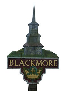
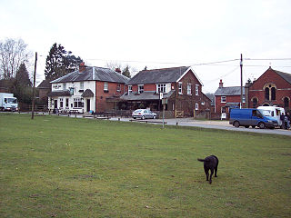
Blackmore is a village in Essex, England. It is located approximately 3 miles (5 km) east of Chipping Ongar and 4 miles (7 km) north of Brentwood. The village is in the parish of Blackmore, Hook End and Wyatts Green in the borough of Brentwood and the parliamentary constituency of Brentwood & Ongar.

Denton Holme is an inner city district in Carlisle, Cumbria, England. The population of this ward was 6,383 taken at the 2011 census.

Hesket is a large civil parish in the Eden District of Cumbria, England. It was formed in 1934 by a County Review Order which merged the parishes of Hesket-in-the-Forest and Plumpton Wall.

Upper Rissington is a village and civil parish in the Cotswold district of Gloucestershire, England. It is located about two-and-a-half miles east of Bourton-on-the-Water and is one of the highest villages in the Cotswolds at an elevation of 275 m. The village is on the former site of the Central Flying School and the airfield is still the active RAF site of RAF Little Rissington. Some of its housing was built as officers' quarters from the 1930s to the 1950s. These were sold by the Ministry of Defence in 1996 to developers, who modernised the properties and sold them on. The street names give a clue to the village's former life, having names such as Sopwith Road and Avro Road. The village has since been greatly expanded with many new houses built on the site of the old RAF hangars and ancillary buildings. Several of the buildings of architectural importance such as the Station HQ and the Officers Mess have been retained and converted into housing. The village is enhanced by the large numbers of mature trees planted by the first Station Commander which are now all protected.

Frogmore is a small suburban village in the north east of the civil parish of Yateley in the county of Hampshire, England.

St Stephen-in-Brannel is a civil parish and village in mid Cornwall, England, United Kingdom. St Stephen village is four miles (6.5 km) west of St Austell on the southern edge of Cornwall's china clay district. Other settlements in the parish include Whitemoor, Currian Vale and Nanpean. The population of the civil ward at the 2011 census was 7,119. An electoral ward also exists simply bearing the name St. Stephen. The population at the same census was 4,772 only. It follows therefore that the ward is not as big as the parish.

Micklefield is a village and civil parish east of Leeds, West Yorkshire, England. It neighbours Garforth, Aberford and Brotherton and is close to the A1 Motorway. It is in the City of Leeds metropolitan borough. The population as of the 2011 Census was 1,893, increased from 1,852 in 2001.

Selston is a large village and civil parish approximately 12 miles (19.3km) NNW of Nottingham in the Ashfield district, Nottinghamshire, England.
Grove Green is a suburban housing development, partially forming a part of Weavering village, near the town of Maidstone in Kent, England. The population of the development is included in the civil parish of Boxley. The estate is also near the village of Bearsted and is convenient for the M20 motorway making its homes keenly sought after by London commuters. For young people, there is a youth group, and Grove Green Scout Group.
Edge End is a small hamlet in west Gloucestershire, England.

Hardwick is a village and civil parish in the county of Cambridgeshire, England with a large housing estate located about 6 miles (9.7 km) west of the city of Cambridge, England. The village lies immediately south of the A428 road between Cambridge and St Neots. It is about 4 miles (6.4 km) east of the newly developed village of Cambourne. The village is nearly on the Greenwich Meridian. The northern border of the village is St Neots Road, now largely bypassed by the A428, with no houses or property on the north side of the road. In the 2001 census, the population was 2,630 in 946 households, increasing to 2,670 in 1,017 households at the 2011 Census.


