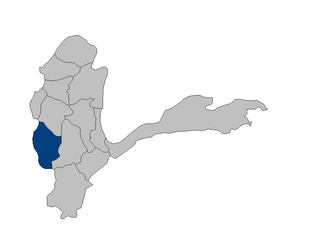
Kępiec

Last updated
Kępiec
Settlement
Country Flag of Poland.svg Poland
Voivodeship West Pomeranian
County Koszalin County
Gmina Polanów

Kępiec [ˈkɛmpjɛt͡s] (German : Lüdtkenkamp) [1] is a settlement in the administrative district of Gmina Polanów, within Koszalin County, West Pomeranian Voivodeship, in north-western Poland. [2]

German language West Germanic language

German is a West Germanic language that is mainly spoken in Central Europe. It is the most widely spoken and official or co-official language in Germany, Austria, Switzerland, South Tyrol (Italy), the German-speaking Community of Belgium, and Liechtenstein. It is also one of the three official languages of Luxembourg and a co-official language in the Opole Voivodeship in Poland. The languages which are most similar to German are the other members of the West Germanic language branch: Afrikaans, Dutch, English, the Frisian languages, Low German/Low Saxon, Luxembourgish, and Yiddish. There are also strong similarities in vocabulary with Danish, Norwegian and Swedish, although those belong to the North Germanic group. German is the second most widely spoken Germanic language, after English.

Human settlement Community of any size, in which people live

In geography, statistics and archaeology, a settlement, locality or populated place is a community in which people live. The complexity of a settlement can range from a small number of dwellings grouped together to the largest of cities with surrounding urbanized areas. Settlements may include hamlets, villages, towns and cities. A settlement may have known historical properties such as the date or era in which it was first settled, or first settled by particular people.

Gmina Polanów is an urban-rural gmina in Koszalin County, West Pomeranian Voivodeship, in north-western Poland. Its seat is the town of Polanów, which lies approximately 35 kilometres (22 mi) east of Koszalin and 159 km (99 mi) north-east of the regional capital Szczecin.

Before 1945 the area was part of Germany. For the history of the region, see History of Pomerania.

Germany Federal parliamentary republic in central-western Europe

Germany, officially the Federal Republic of Germany, is a country in Central and Western Europe, lying between the Baltic and North Seas to the north, and the Alps to the south. It borders Denmark to the north, Poland and the Czech Republic to the east, Austria and Switzerland to the south, France to the southwest, and Luxembourg, Belgium and the Netherlands to the west.

History of Pomerania aspect of history

The history of Pomerania starts shortly before 1000 AD with ongoing conquests by newly arrived Polans rulers. Before that the area was recorded nearly 2000 years ago as Germania, and in modern-day times Pomerania is split between Germany and Poland. The name Pomerania comes from the Slavic po more, which means Land at the Sea.
Related Research Articles

Lasarte-Oria municipality in Basque Country, Spain

Lasarte-Oria is a town located in the province of Gipuzkoa, in the Autonomous Community of Basque Country, northern Spain. It was founded in 1986.

Phalut

Phalut or Falut is the second highest peak of West Bengal, India. Part of the Singalila Ridge in the Himalayas, it is located at the border of the Indian states of West Bengal and Sikkim and of Nepal. It is located inside the Singalila National Park. A small bunkhouse is near the top of the peak and is administered by the Indian army. Singalila Pass is 17 km away from Phalut.

Dziećmorowice Village in Lower Silesian, Poland

Dziećmorowice is a village in the administrative district of Gmina Walim, within Wałbrzych County, Lower Silesian Voivodeship, in south-western Poland.

Kishim District Place in Badakhshan

Kishim District is one of the 29 districts of Badakhshan Province in eastern Afghanistan. The district is located in the Keshem Valley, a primarily rural area on the western edge of the province, and is home to approximately 63,000 residents, making it the second most populous district of the province.

Stankowice Village in Lower Silesian, Poland

Stankowice is a village in the administrative district of Gmina Leśna, within Lubań County, Lower Silesian Voivodeship, in south-western Poland. Prior to 1945 it was in Germany. It lies approximately 4 kilometres (2 mi) east of Leśna, 11 km (7 mi) south of Lubań, and 122 km (76 mi) west of the regional capital Wrocław.

Bierzyn, Lower Silesian Voivodeship Village in Lower Silesian, Poland

Bierzyn is a village in the administrative district of Gmina Strzelin, within Strzelin County, Lower Silesian Voivodeship, in south-western Poland. Prior to 1945 it was in Germany.

Dobrogoszcz, Lower Silesian Voivodeship Village in Lower Silesian, Poland

Dobrogoszcz is a village in the administrative district of Gmina Strzelin, within Strzelin County, Lower Silesian Voivodeship, in south-western Poland. Prior to 1945 it was in Germany.

Głuchowo is a village in the administrative district of Gmina Komorniki, within Poznań County, Greater Poland Voivodeship, in west-central Poland.

Rozkochowo Settlement in Lubusz, Poland

Rozkochowo is a settlement in the administrative district of Gmina Dobiegniew, within Strzelce-Drezdenko County, Lubusz Voivodeship, in western Poland. It lies approximately 6 kilometres (4 mi) south of Dobiegniew, 17 km (11 mi) east of Strzelce Krajeńskie, and 41 km (25 mi) northeast of Gorzów Wielkopolski.

Trzebów is a village in the administrative district of Gmina Sulęcin, within Sulęcin County, Lubusz Voivodeship, in western Poland.

Dąbrówka Łubniańska is a village in the administrative district of Gmina Łubniany, within Opole County, Opole Voivodeship, in south-western Poland.

Ostrza Settlement in Pomeranian, Poland

Ostrza is a settlement in the administrative district of Gmina Debrzno, within Człuchów County, Pomeranian Voivodeship, in northern Poland. It lies approximately 15 kilometres (9 mi) west of Debrzno, 26 km (16 mi) south-west of Człuchów, and 140 km (87 mi) south-west of the regional capital Gdańsk.

Łuszczyn, Pomeranian Voivodeship Settlement in Pomeranian, Poland

Łuszczyn is a settlement in the administrative district of Gmina Rzeczenica, within Człuchów County, Pomeranian Voivodeship, in northern Poland. It lies approximately 6 kilometres (4 mi) west of Rzeczenica, 26 km (16 mi) north-west of Człuchów, and 124 km (77 mi) south-west of the regional capital Gdańsk.

Jeldzino Village in Pomeranian, Poland

Jeldzino is a village in the administrative district of Gmina Krokowa, within Puck County, Pomeranian Voivodeship, in northern Poland. It lies approximately 2 kilometres (1 mi) south-west of Krokowa, 19 km (12 mi) north-west of Puck, and 55 km (34 mi) north-west of the regional capital Gdańsk.

Sasinko Settlement in Pomeranian, Poland

Sasinko is a settlement in the administrative district of Gmina Choczewo, within Wejherowo County, Pomeranian Voivodeship, in northern Poland. It lies approximately 10 kilometres (6 mi) west of Choczewo, 38 km (24 mi) north-west of Wejherowo, and 73 km (45 mi) north-west of the regional capital Gdańsk.

Stępień, Warmian-Masurian Voivodeship Village in Warmian-Masurian, Poland

Stępień is a village in the administrative district of Gmina Braniewo, within Braniewo County, Warmian-Masurian Voivodeship, in northern Poland, close to the border with the Kaliningrad Oblast of Russia. It lies approximately 5 kilometres (3 mi) south-west of Braniewo and 80 km (50 mi) north-west of the regional capital Olsztyn.

Szeląg, Warmian-Masurian Voivodeship Settlement in Warmian-Masurian, Poland

Szeląg is a settlement in the administrative district of Gmina Łukta, within Ostróda County, Warmian-Masurian Voivodeship, in northern Poland. It lies approximately 10 kilometres (6 mi) south-west of Łukta, 8 km (5 mi) north of Ostróda, and 37 km (23 mi) west of the regional capital Olsztyn.

Żółwinko Village in West Pomeranian, Poland

Żółwinko is a village in the administrative district of Gmina Drawno, within Choszczno County, West Pomeranian Voivodeship, in north-western Poland. It lies approximately 10 kilometres (6 mi) south of Drawno, 26 km (16 mi) east of Choszczno, and 86 km (53 mi) east of the regional capital Szczecin.

Józefin is a village in the administrative district of Gmina Lipiany, within Pyrzyce County, West Pomeranian Voivodeship, in north-western Poland.

Long Lake, Alberta

Long Lake is a hamlet in central Alberta, Canada within Thorhild County. It is located on the west shore of Long Lake, approximately 12 kilometres (7.5 mi) east of Highway 63 and 114 kilometres (71 mi) northeast of Edmonton.

References

  1. Kaemmerer, Margarete (2004). Ortsnamenverzeichnis der Ortschaften jenseits von Oder u. Neiße (in German). ISBN   3-7921-0368-0.
  2. "Central Statistical Office (GUS) - TERYT (National Register of Territorial Land Apportionment Journal)" (in Polish). 2008-06-01.


Coordinates: 54°01′12″N16°46′12″E / 54.02000°N 16.77000°E / 54.02000; 16.77000

Geographic coordinate system Coordinate system

A geographic coordinate system is a coordinate system that enables every location on Earth to be specified by a set of numbers, letters or symbols. The coordinates are often chosen such that one of the numbers represents a vertical position and two or three of the numbers represent a horizontal position; alternatively, a geographic position may be expressed in a combined three-dimensional Cartesian vector. A common choice of coordinates is latitude, longitude and elevation. To specify a location on a plane requires a map projection.