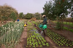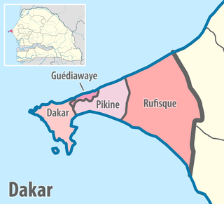
Dakar Region is the smallest and most populated Region of Senegal, encompassing the capital city of the country, Dakar, and all its suburbs along the Cap–Vert Peninsula, Africa's most westerly point.

Senegal is subdivided into 14 regions, each of which is administered by a Conseil Régional elected by population weight at the arrondissement level. Senegal is further subdivided into 45 departments, 103 arrondissements and by collectivités locales which elect administrative officers. Three of these regions were created on 10 September 2008, when Kaffrine Region was split from Kaolack, Kédougou region was split from Tambacounda, and Sédhiou region was split from Kolda.

The Senegambian stone circles or the Wassu stone circles are groups of megalithic stone circles that lie in The Gambia north of Janjanbureh and in central Senegal. Spread across a region 30,000 km2 (12,000 sq mi), they are sometimes divided into the Wassu (Gambian) and Sine-Saloum (Senegalese) circles, but this is purely a national division. Containing over 1000 stone circles and tumuli spread across an area 350 km (220 mi) long and 100 km (62 mi) wide, the Senegambian stone circles are the largest concentration of stone circles seen anywhere in the world and an extensive sacred landscape that was used for more than 1500 years. As a result, the sites were inscribed on the UNESCO World Heritage List in 2006.

The 14 regions of Senegal are subdivided into 46 departments and 103 arrondissements and by collectivités locales which elect administrative officers.

Kaffrine is the capital town of Kaffrine Region of Senegal.

The departments of Senegal are subdivided into arrondissements. As of 2008 there were 133. The arrondissements are listed below, by department:

Bambey Department is one of the 45 departments of Senegal, one of the three making up the Diourbel Region.

Diourbel Department is one of the 45 departments of Senegal, one of the three constituting the Diourbel Region.

Vélingara Department is one of the 46 departments of Senegal, one of the three making up the Kolda Region in the Upper Casamance.
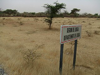
Louga Department is one of the 45 departments of Senegal, and one of the three which comprise the Louga Region.

Foundiougne Department is one of the departments of Senegal, located in the Fatick Region.

Kaolack Département is one of the 45 departments of Senegal, located in the Region of Koalack.

Nioro du Rip Department is one of the 45 departments of Senegal, located in the region of Kaolack.

Thiès Department is one of the 45 departments of Senegal, one of the three located in the Thiès Region.
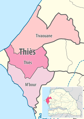
Tivaouane Department is one of the 45 departments of Senegal, and one of the three in the Thiès Region. Its capital is Tivaouane.

Saint-Louis Department is one of the 45 departments of Senegal, located in the Saint-Louis Region.
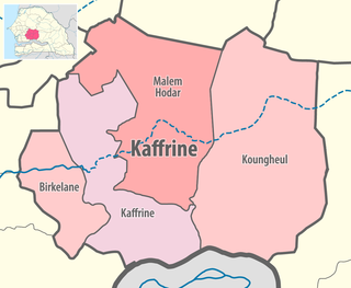
Koungheul is the name of one of 45 departments of Senegal, as well as the name of Koungheul Arrondissement and the commune of Koungheul, the principal settlement of the department.
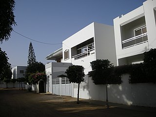
Mermoz-Sacré-Cœur is a commune d'arrondissement of the city of Dakar, Senegal. It is located on the western coast of the Cap-Vert peninsula. As of 2013, it had a population of 29,798.

Birkilane Department is one of the 45 departments of Senegal and is located in the Kaffrine Region. It was created as part of the new region in 2008.
Keur Mboucki Arrondissement is an arrondissement of the Kaffrine Department in the Kaffrine Region of Senegal.
