Kaimana

Last updated
Kaimana
Town (District)
Indonesia Western New Guinea location map.png
Red pog.svg
Kaimana
Location of the town in Indonesian Papua
Indonesia location map.svg
Red pog.svg
Kaimana
Location of the town in Indonesia
Coordinates: 3°38′40″S133°41′43″E / 3.64444°S 133.69528°E / -3.64444; 133.69528
CountryFlag of Indonesia.svg  Indonesia
Province West Papua
Regency Kaimana Regency
Area
  Total2,095 km2 (809 sq mi)
Population
 (mid 2022 estimate)
  Total44,332
Time zone UTC+9 (WIT)

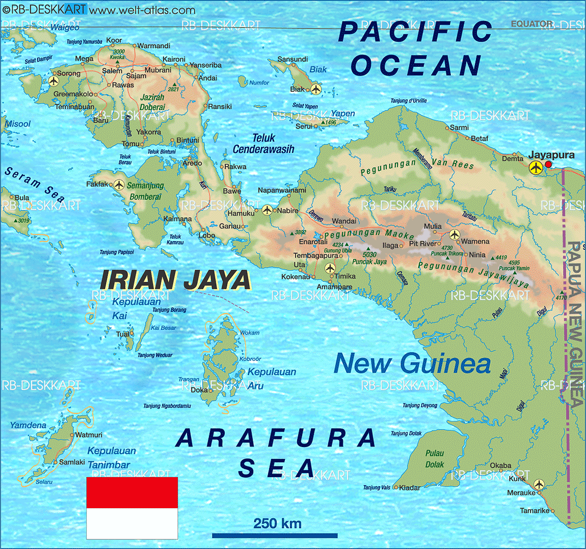
Kaimana is a district and a small port town in West Papua, Indonesia, and the capital of the Kaimana Regency. [1] The district had a population of 44,332 in mid-2022, while the town had 16,718 and Krooy (the other kelurahan in the district) had 12,416 inhabitants. [2]

Contents

Kaimana lizard rock art Lukisan Cadas Kadal Kaimana.jpg
Kaimana lizard rock art

Many ancient rock art can be found in this district, from Mai Mai cliff drawings, Omborecena, Memnemba, Memnemnambe, and Tumberawasi sites in Kampung Mai Mai, Bitsjari cape drawings in Kampung Marsi, Werfora sites (I to IV) in Kampung Namatota, and Kamaka lake drawings. [3] [4]

Transport

Utarom Airport 193715 bandarakaimana1.jpg
Utarom Airport

It is served by Utarom Airport.

Environment

Kaimana is part of a Sea Conservation Area in West Papua. [5] Butterflies in the surrounding forest of Karora are reported to be on the brink of extinction due to logging in the district. [6]

Whales such as Bryde's whales can be seen in nearby waters such as in Triton Bay. [7] [8] [9]

Climate

Kaimana has a tropical rainforest climate (Af) with heavy rainfall year-round.

Climate data for Kaimana (2000–2020)
MonthJanFebMarAprMayJunJulAugSepOctNovDecYear
Mean daily maximum °C (°F)32.0
(89.6)
32.1
(89.8)
31.8
(89.2)
31.4
(88.5)
31.0
(87.8)
29.5
(85.1)
28.6
(83.5)
28.4
(83.1)
29.3
(84.7)
30.6
(87.1)
31.6
(88.9)
32.0
(89.6)
30.7
(87.2)
Mean daily minimum °C (°F)24.7
(76.5)
24.6
(76.3)
24.8
(76.6)
24.7
(76.5)
24.8
(76.6)
24.4
(75.9)
24.1
(75.4)
23.9
(75.0)
24.3
(75.7)
24.3
(75.7)
24.4
(75.9)
24.9
(76.8)
24.5
(76.1)
Average precipitation mm (inches)185.1
(7.29)
161.9
(6.37)
245.8
(9.68)
224.8
(8.85)
280.8
(11.06)
183.0
(7.20)
190.5
(7.50)
136.6
(5.38)
125.3
(4.93)
194.7
(7.67)
175.8
(6.92)
162.8
(6.41)
2,267.1
(89.26)
Average precipitation days15.013.615.215.312.712.310.710.59.910.211.414.4151.2
Source: Meteomanz [10]

Related Research Articles

<span class="mw-page-title-main">Papua (province)</span> Province of Indonesia

Papua is a province of Indonesia, comprising the northern coast of Western New Guinea together with island groups in Cenderawasih Bay to the west. It roughly follows the borders of Papuan customary region of Tabi Saireri. It is bordered by the sovereign state of Papua New Guinea to the east, the Pacific Ocean to the north, Cenderawasih Bay to the west, and the provinces of Central Papua and Highland Papua to the south. The province also shares maritime boundaries with Palau in the Pacific. Following the splitting off of twenty regencies to create the three new provinces of Central Papua, Highland Papua, and South Papua on 30 June 2022, the residual province is divided into eight regencies and one city (kota), the latter being the provincial capital of Jayapura. The province has a large potential in natural resources, such as gold, nickel, petroleum, etc. Papua, along with five other Papuan provinces, has a higher degree of autonomy level compared to other Indonesian provinces.

<span class="mw-page-title-main">West Papua (province)</span> Province in Indonesia

West Papua, formerly Irian Jaya Barat, is a province of Indonesia located in the land of Papua. It covers most of the two western peninsulas of the island of New Guinea, the eastern half of the Bird's Head Peninsula and the whole of the Bomberai Peninsula, along with nearby smaller islands. The province is bordered to the north by the Pacific Ocean, to the west by Southwest Papua Province, the Halmahera Sea and the Ceram Sea, to the south by the Banda Sea, and to the east by the province of Central Papua and the Cenderawasih Bay. Manokwari is the province's capital and largest city. With an estimated population of 561,403 in mid-2022, West Papua is the least populous province in Indonesia after Southwest Papua, which was a part of West Papua until separated off in 2022.

<span class="mw-page-title-main">Western New Guinea</span> Region of Indonesia on the island of New Guinea

Western New Guinea, also known as Papua, Indonesian New Guinea, and Indonesian Papua, is the western, Indonesian half of the island of New Guinea. Given the island is alternatively named Papua, the region is also called West Papua.

Jagakarsa is the southernmost district in the administrative city of South Jakarta, Indonesia. Jagakarsa is bounded by Ciliwung River to the east, Krukut River to the west, and Margasatwa-Sagu-Joe-T.B.Simatupang-Poltangan Road to the north, while the boundary marches with Depok city to the south.

<span class="mw-page-title-main">Raja Ampat Islands</span> Archipelago in Southwest Papua, Indonesia

Raja Ampat, or the Four Kings, is an archipelago located off of the northwest tip of Bird's Head Peninsula, Southwest Papua province, Indonesia. It comprises over 1,500 small islands, cays, and shoals around the four main islands of Misool, Salawati, Batanta, and Waigeo, and the smaller island of Kofiau.

Bomberai Peninsula is located in the Western New Guinea region. It is south of the Bird's Head Peninsula, and Bintuni Bay separates the two peninsulas. To the west lies the Sebakor Bay and to the south Kamrau Bay. On the southeast Arguni Bay lies between the peninsula and the Bird's Neck Isthmus.

Lobo is a village (kampung) in Kaimana district, Kaimana Regency, West Papua, Indonesia, off the coast of Bay of Kaimana. The settlement was established in 1828 by the Dutch. They established the Fort Du Bus at Lobo with the official opening on August 24, 1828.

<span class="mw-page-title-main">Kaimana Regency</span> Regency in West Papua, Indonesia

Kaimana Regency is a regency in the south of West Papua province of Indonesia. It covers an area of 18,500 sq. km, and had a population of 46,249 at the 2010 Census and 62,256 at the 2020 Census; the official estimate as at mid 2022 was 63,633. The administrative centre is the town of Kaimana. The Mairasi languages are spoken in the regency, among other languages.

<span class="mw-page-title-main">Raja Ampat Regency</span> Regency in Southwest Papua, Indonesia

Raja Ampat Regency is a regency of Southwest Papua Province of Indonesia. The regency, which was formed by separating the archipelago from Sorong Regency, based on the Law 26 of 2002, was inaugurated on 12 April 2003. It consists of a number of groups of islands situated off the north-west end of West Papua; the four main islands from south to north are Misool, Salawati, Batanta, and Waigeo. At present, the regency covers a land area of 7,559.60 km2, with a total area stated as 67,379.61 km2. It had a population of 42,508 at the 2010 Census and 64,141 at the 2020 Census; the official estimate as at mid 2022 was 66,839. The principal town lies at Waisai on Waigeo Island.

<span class="mw-page-title-main">Bintuni Bay Regency</span> Regency in West Papua, Indonesia

Teluk Bintuni Regency or Bintuni Bay Regency is a regency of West Papua Province of Indonesia. It covers an area of 18,637 km2, comprising administrative districts on three sides of Bintuni Bay, a gulf that separates the Bird's Head Peninsula and Bomberai Peninsula which together form the main geographical constituents of the province; it had a population of 52,422 at the 2010 Census and 87,083 at the 2020 Census; the official estimate as at mid 2022 was 92,236. The administrative centre is the town of Bintuni.

Kowiai (Kuiwai) is an Austronesian language of the Bomberai Peninsula in New Guinea. According to the Atlas of Languages of Intercultural Communication in the Pacific and Asia, Kowiai is spoken in the coastal regions between Arguni and Etna bay.

<span class="mw-page-title-main">Operation Trikora</span> 1961–1962 Indonesian military operation

Operation Trikora was a combined Soviet-Indonesian military operation which aimed to seize and annex the Dutch overseas territory of Netherlands New Guinea in 1961 and 1962. After negotiations, the Netherlands signed the New York Agreement with Indonesia on 15 August 1962, relinquishing control of Western New Guinea to the United Nations.

Triton Stadium is a football stadium in the town of Kaimana, Kaimana Regency, West Papua, Indonesia. The stadium has a capacity of 5,000 people.

<span class="mw-page-title-main">Utarom Airport</span> Airport in West Papua, Indonesia

Utarom Airport or Kaimana Airport is an airport serving Kaimana, located in the province of West Papua in Indonesia. Due to increasing passengers, the airport was heavily modernized. The airport development is done in several stages, which begin in 2012, followed in 2014, and was completed at the end of 2015. Currently, Utarom Airport has a modern passenger terminal design like that of Wamena Airport. Airport capacity also increased to be able to accommodate 102 passengers during peak hours. The passenger terminal is made more comfortable in order to improve service to passengers In total, the construction of a passenger terminal covering an area of 1,800 square meters costs around Rp 75.5 billion. The development of the airport was completed at the end of 2015 and was inaugurated by President Joko Widodo on 30 December 2016.

This is a list of emblems or coat of arms used in Indonesia. Indonesia is divided into 38 provinces, and each province is divided into regencies (kabupaten) and cities (kota). There are 416 regencies and 98 cities. Each province, regency, and city has its own emblem.

<span class="mw-page-title-main">Kingdom of Kaimana</span> Islamic Kingdom in West Papua, Indonesia

The Kingdom of Kaimana or Kingdom of Sran is one of the oldest Muslim kingdoms in West Papua, Indonesia. The kingdom was established by Imaga, with the title Rat Sran Nati Pattimuni, traditionally in 1309.

<span class="mw-page-title-main">Central Papua</span> Province in Indonesia

Central Papua, officially the Central Papua Province is an Indonesian province located in the central region of Western New Guinea. It was formally established on 11 November 2022 from the former eight western regencies of the province of Papua. It covers an area of 61,072.92 km2 and had an officially estimated population of 1,430,951 in mid 2022. It is bordered by the Indonesian provinces of West Papua to the west, the residual province of Papua to the north and northeast, by Highland Papua to the east. and by South Papua to the southeast. The administrative capital is located in Wanggar District in Nabire Regency, although Timika is a larger town.

Abdul Hakim Achmad Aituarauw was a former legislative member of DPR West Papua, a legislative candidate for DPR-RI West Papua and also the former king of Kingdom of Kaimana in West Papua, Indonesia.

References

  1. Welt Atlas
  2. Badan Pusat Statistik, Jakarta, 2023.
  3. "LUKISAN DINDING BATU". Desa Namatota (in Indonesian). 2022-10-06. Retrieved 2023-02-03.
  4. Djami, Erlin Novita Idje (2017-06-03). "SITUS SENI CADAS SEBAGAI ASET BUDAYA DAN PEMBANGUNAN PARIWISATA (Studi pengembangan situs seni cadas di kawasan Teluk Bicari dan Selat Maimai, Kabupaten Kaimana, Papua Barat)". Jurnal Penelitian Arkeologi Papua dan Papua Barat. 3 (2): 43–80. doi:10.24832/papua.v3i2.82. ISSN   2580-9237 . Retrieved 2023-02-03.
  5. "Residents Kaimana, West Papua, watchtower preservation of the Sea". Ministry of Marine Affairs and Fisheries. November 26, 2008. Retrieved June 23, 2010.[ permanent dead link ]
  6. "Butterflies Endangered: Kaimana, West Irian Jaya". Planet Mole. September 5, 2006. Archived from the original on July 20, 2011. Retrieved June 23, 2010.
  7. "Edeni - Mammals of Papua". Archived from the original on 2014-04-26. Retrieved 2014-04-26.
  8. Archived at Ghostarchive and the Wayback Machine : "Whale in Triton Bay, Papua.AVI". YouTube .
  9. "Wonderful Indonesia - the Bay of Triton". Archived from the original on 2014-04-27. Retrieved 2014-04-26.
  10. "SYNOP/BUFR observations. Data by months". Meteomanz. Retrieved 21 March 2024.