Gemena Airport is an airport serving Gemena, the capital of the Sud-Ubangi District in Sud-Ubangi province in the Democratic Republic of the Congo.
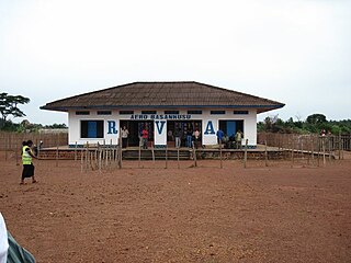
Basankusu Airstrip is an airport serving Basankusu, a city on the Lulonga River in Équateur Province, Democratic Republic of the Congo.
Inongo Airport is an airstrip serving Inongo, a city on the eastern shore of Lake Mai-Ndombe in Mai-Ndombe Province, Democratic Republic of Congo.

Gbadolite Airport is an airport serving Gbadolite, the capital of the Nord-Ubangi Province in the Democratic Republic of the Congo. The airport is at the village of Moanda, 6 kilometres (3.7 mi) southwest of Gbadolite.
Kotakoli Air Base is a military airport at Kotakoli, a town in the Nord-Ubangi Province, Democratic Republic of the Congo.
Lombo Airport was an airstrip serving Lombo, a hamlet in the Nord-Ubangi Province of the Democratic Republic of the Congo.
Pepa Airport is an airstrip 3 kilometres (2 mi) east of the village of Pepa in Tanganyika Province, Democratic Republic of the Congo.
Abumumbazi Airport is an airport serving the town of Abumumbazi, in the Nord-Ubangi Province of the Democratic Republic of the Congo. The runway is on the north side of the town.
Bibanga Airport is an airstrip serving the village of Bibanga in Kasai-Oriental Province, Democratic Republic of the Congo.
Bosondjo Airport was an airstrip serving Bosondjo, a town in Mongala Province, Democratic Republic of the Congo.
Goyongo Airport is an airstrip serving Goyongo, a hamlet in Nord-Ubangi Province, Democratic Republic of the Congo.
Gwaka Airport is an airport serving Gwaka in Sud-Ubangi Province, Democratic Republic of the Congo.
Ingende Airport is an airstrip serving Ingende, a village on the Ruki River in Équateur Province, Democratic Republic of the Congo. The runway is 2 kilometres (1.2 mi) west of Ingende.
Karawa Airport is an airport serving the town of Karawa in Nord-Ubangi Province, Democratic Republic of the Congo.
Libenge Airport is an airport serving the Ubangi River town of Libenge in the Sud-Ubangi Province of the Democratic Republic of the Congo. The Ubangi is locally the border with the Central African Republic.
Mpaka Airport is an airport serving the village of Mpaka in Sud-Ubangi Province, Democratic Republic of the Congo.
Tandala Airport is an airport serving the town of Tandala in Sud-Ubangi Province, Democratic Republic of the Congo.
Kempa Airport was an airstrip serving the village of Kempa in Mai-Ndombe Province, Democratic Republic of the Congo.
Kasonga Airport was a rural airstrip near Kasonga in Kasaï-Central Province, Democratic Republic of the Congo.
Mwadingusha Airport is an airstrip serving the city of Mwadingusha in Haut-Katanga Province, Democratic Republic of the Congo. Aerial images of the runway show little sign of recent use.
