
Osmaniye Province is a province in south-central Turkey. It was named Cebel-i Bereket in the early republic until 1933, when it was incorporated into Adana Province. It was made a province again in 1996. Its area is 3,320 km2, and its population is 559,405 (2022). The province is situated in Çukurova, a geographical, economical and cultural region. The capital of the province is Osmaniye. Other major towns include Kadirli and Düziçi.

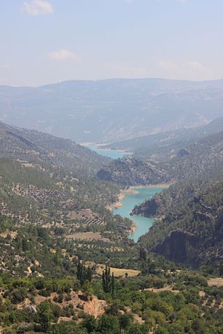
Aslantaş Dam is an embankment dam on Ceyhan River in Osmaniye Province, southern Turkey, built between 1975 and 1984.
Çamgazi Dam is a dam in Adıyaman, Turkey. The development was backed by the Turkish State Hydraulic Works. Construction began in 1990, and finished in 1999. The dam is still in use.
Çavdır Dam is a dam in Burdur, Turkey. The development was backed by the Turkish State Hydraulic Works. The dam was constructed from 1993 to 1996.
Çayboğazı Dam is a dam in Turkey. The development was backed by the Turkish State Hydraulic Works.

Çine Dam is a dam in Aydın province in western Turkey, about 15 km (9 mi) SSE of the town of Çine. The development was backed by the Turkish State Hydraulic Works. It is the first major roller compacted concrete dam in Turkey. At its height of 136.5 m, Çine Dam is one of the highest dams in the world.
Deliçay Dam is a dam in Turkey. The development was backed by the Turkish State Hydraulic Works.
Derebucak Dam is a dam in Turkey. The development was backed by the Turkish State Hydraulic Works.
Dumluca Dam is a dam in Turkey. The development was backed by the Turkish State Hydraulic Works.
Gazibey Dam is a dam in Turkey. The development was backed by the Turkish State Hydraulic Works.
Gezende Dam is an arch dam on the Ermenek River in Mersin Province, Turkey. The development was backed by the Turkish State Hydraulic Works.
Geyik Dam is a dam in Muğla Province, Turkey, built between 1986 and 1988 by the State Hydraulic Works.
Gödet Dam is a dam in Turkey. The development was backed by the Turkish State Hydraulic Works.
Gökpınar Dam is a dam in Denizli Province, Turkey, built between 1995 and 2002. The development was backed by the Turkish State Hydraulic Works.
Hacıhıdır Dam is a rock-filled dam in Turkey. The development was backed by the Turkish State Hydraulic Works.
Hancağız Dam is a dam in Turkey. The development was backed by the Turkish State Hydraulic Works.
İkizdere Dam is a dam in Aydın Province, Turkey, which began construction in 1999. The development was backed by the Turkish State Hydraulic Works.
İvriz Dam is a dam in Turkey. The development was backed by the Turkish State Hydraulic Works.

Korkuteli Dam is a dam in Turkey. The development was backed by the Turkish State Hydraulic Works.
Osmaniye City Museum is a museum in Osmaniye, Turkey. It is in Osmaniye at 37°04′23″N36°14′49″E on Karaoğlan Street.