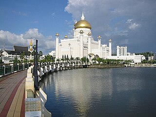
Bandar Seri Begawan is the capital and largest city of Brunei. It is officially a municipal area with an area of 100.36 square kilometres (38.75 sq mi) and an estimated population of 100,700 as of 2007. It is part of Brunei-Muara District, the smallest yet most populous district which is home to over 70 per cent of the country's population. It is the country's largest urban centre and nominally the country's only city. The capital is home to Brunei's seat of government, as well as a commercial and cultural centre. It was formerly known as Brunei Town until it was renamed in 1970 in honour of Sultan Omar Ali Saifuddien III, the 28th Sultan of Brunei and the father of the current Sultan Hassanal Bolkiah.
Brunei-Muara District or simply Brunei-Muara is one of the four districts of Brunei. It has the smallest area among the four districts, with 571 square kilometres (220 sq mi), yet is the most populous, with 289,630 people as of 2016. Bandar Seri Begawan, the country's capital, is located in this district, which is also de facto the district's capital. It is also home to Brunei International Airport, the country's only international airport, as well as Muara Port, the main and only deep-water port in the country. The Brunei River flows within this district and is home to Kampong Ayer, the traditional historic settlement on stilts above the river.

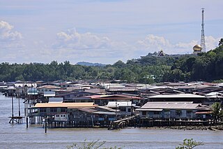
Kampung Ayer is a prominent traditional settlement in Bandar Seri Begawan, the capital of Brunei. It comprises neighbourhoods of traditional houses, schools and mosques built on stilts above the Brunei River near the capital's city centre. It has an area of about 10 square kilometres (3.9 sq mi); the total population was 10,250 in 2016. It has been historically nicknamed 'Venice of the East'. Kampung Ayer has been historically the principal settlement of Brunei; it was the de facto capital, in particular social and economic centre, of the Bruneian Empire for a few centuries, but also extending into the early period during British imperialism in Brunei.

Mukim Kilanas is a mukim in Brunei-Muara District, Brunei. The population was 22,492 in 2016.
Mukim Tamoi is a mukim in Brunei-Muara District, Brunei. It is part of Kampong Ayer, the traditional stilt settlements on the Brunei River in the country's capital Bandar Seri Begawan. The population was 1,389 in 2016.
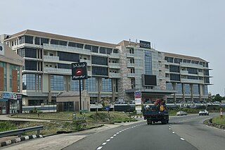
Mukim Gadong 'B' is a mukim in Brunei-Muara District. Brunei. The population was 33,637 in 2016.

Kampong Sengkurong is a village in the west of Brunei-Muara District, Brunei. The total population was 5,003 in 2016.

Kampong Pandan or simply known as Pandan, is a residential area in Kuala Belait, the principal town of Belait District, Brunei. It has a population of around 16,200 in 2016. It encompasses a housing estate of the country's National Housing Scheme.

Kampong Beribi or commonly known as Beribi, is a village in Brunei-Muara District, Brunei, as well as a neighbourhood in the capital Bandar Seri Begawan. The population was 5,679 in 2016. It is one of the villages within Mukim Gadong 'B'. The postcode is BE1118.

Kampong Tungku is a village in Brunei-Muara District, Brunei, about 10 kilometres (6.2 mi) from the capital Bandar Seri Begawan. The population was 1,689 in 2016. It is one of the villages within Mukim Gadong 'A'. The postcode is BE2119.
Kampong Mata-Mata or commonly known as Mata-Mata, is a village in Brunei-Muara District, Brunei, and a neighbourhood in the capital Bandar Seri Begawan. The population was 6,126 in 2016. It is one of the villages within Mukim Gadong 'B'. The postcode is BE1718.

Kampong Kiarong or commonly known as Kiarong, is a village in Brunei-Muara District, Brunei, as well as a neighbourhood in the country's capital Bandar Seri Begawan. It has an area of 383.43 hectares ; the population was 4,530 in 2016.
Kampong Perpindahan Mata-Mata or simply known as Perpindahan Mata-Mata, is a public housing estate and designated village in Brunei-Muara District, Brunei, on the outskirts of the capital Bandar Seri Begawan. The population was 2,385 in 2016. It is one of the villages within Mukim Gadong 'B'. The postcode is BE1918.

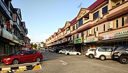
Kampong Menglait or simply known as Menglait, is a village in Brunei-Muara District, Brunei, as well as a neighbourhood and commercial area in the capital Bandar Seri Begawan. The population was 2,262 in 2016. It is one of the villages within Mukim Gadong 'B'. The postcode is BE3919.

Kampong Pengkalan Gadong is a village in Brunei-Muara District, Brunei, as well as a neighbourhood and commercial area in the capital Bandar Seri Begawan. The population was 3,147 in 2016. It is one the villages within Mukim Gadong 'B'. The postcode is BE3719.

Kampong Kumbang Pasang, or simply Kumbang Pasang, is a village within Mukim Kianggeh in Brunei-Muara District, Brunei. It is also part of the municipal area of the capital Bandar Seri Begawan. The population was 563 in 2016. It has the postcode BA1511. The village formerly hosts a rubber plantation and was named Kumbang Pasang Estate. Notably the village was once its own Mukim, known as Mukim Kumbang Pasang.

Kampong Pengiran Siraja Muda Delima Satu is a village in Brunei-Muara District, Brunei, and a neighbourhood in the capital Bandar Seri Begawan. The population was 2,354 in 2016. It is one of the villages within Mukim Berakas 'A'. The postcode is BB5113.

RPN Kampong Rimba or Kampong Rimba National Housing Scheme is a public housing area in Brunei-Muara District, Brunei, on the northern outskirts of the capital Bandar Seri Begawan. The total population was 15,658 in 2016. It is part of Mukim Gadong 'A', a mukim in Brunei-Muara District.

Kampong Belimbing or silly known as Belimbing, is a village in Brunei-Muara District, Brunei. It is also a neighbourhood in the capital Bandar Seri Begawan. The population was 2,721 in 2016. It is one of the villages within Mukim Kota Batu. The postcode is BD2917.

Kampong Bolkiah is a village and housing estate in Kampong Ayer, the traditional riverine settlement in Bandar Seri Begawan, the capital of Brunei. The total population was 2,143 in 2016.