Related Research Articles

Labuan, officially the Federal Territory of Labuan, is a Federal Territory of Malaysia. Its territory includes Labuan Island and six smaller islands, off the coast of the state of Sabah in East Malaysia. Labuan's capital is Victoria and is best known as an offshore financial centre offering international financial and business services via Labuan IBFC since 1990 as well as being an offshore support hub for deepwater oil and gas activities in the region. It is also a tourist destination for people travelling through Sabah, nearby Bruneians and scuba divers. The name Labuan derives from the Malay word labuhan which means harbour.

Bukit Beruang is a town in Melaka Tengah District, Malacca, Malaysia named after its eponymous hill with a height of 116.3 metres (382 ft), a famous spot for hiking. The most famous landmark in Bukit Beruang is the state branch of Multimedia University, a private university owned by Telekom Malaysia, a Malaysian telecommunication company.

Paloh is a mukim in Kluang District, Johor, Malaysia.
Pengkalan Hulu, formerly known as Kroh or Keroh, is a town and a mukim in Hulu Perak District, Perak, Malaysia, bordering Thailand and Kedah. The nearest town on the Thailand side is Betong in Yala province.

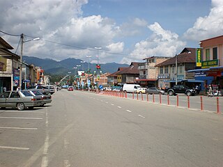
Air Kuning Selatan is a small town in Tampin District, Negeri Sembilan in Malaysia.

Rasah is a mukim in Seremban District, Negeri Sembilan, Malaysia.
Bukit Bunga is a village in Tanah Merah District, Kelantan, Malaysia. It is located at the Malaysia-Thailand border and is the latest border crossing between Malaysia and Thailand with the opening of the Bukit Bunga-Ban Buketa Bridge on December 21, 2007.
Patau-Patau is a fishing village in Labuan, Malaysia, that is principally inhabited by descendants of Brunei Malays who settled in the 1930s. Patau-Patau was destroyed by bombing during World War II but was rebuilt afterwards. The village's houses are built on stilts over water in its bay, and connected by wooden or concrete walkways. It is one of two such "water villages" on Labuan, the other being Kampung Bebuloh. In addition to fishing and general tourism activities, the village runs a homestay programme.
Federal Route 201, or Jalan Nibong-Jakar-Bukit Nangka, is a federal road in Kelantan, Malaysia. The route connects town of Bukit Bunga in the west and Kampung Nibong in the east.
Kampung Bukit Lanchong is a small village in Subang Jaya, Selangor, Malaysia. The village is located between Puchong, UEP Subang Jaya (USJ), Putra Heights, Alam Megah (HICOM), Kota Kemuning and Bandar Saujana Putra. It is currently administered by the Subang Jaya City Council (MBSJ).
Bahau is a state constituency in Negeri Sembilan, Malaysia, that has been represented in the Negeri Sembilan State Legislative Assembly.
Kampung Batu Arang is a village in Federal Territory of Labuan, Malaysia.
Kampung Durian Tunjong is a village in Federal Territory of Labuan, Malaysia.
Kampung Ganggarak is a village in Federal Territory of Labuan, Malaysia.
Kampung Kerupang is a village in Federal Territory of Labuan, Malaysia.
Kampung Merinding is a village in Federal Territory of Labuan, Malaysia.
Kampung Nagalang is a village in Federal Territory of Labuan, Malaysia.
Kampung Pantai is a village in Federal Territory of Labuan, Malaysia.
Kampung Bukit Kuda is a village in Federal Territory of Labuan, Malaysia.
References
- ↑ "Kampung Bukit Kalam, Wilayah Persekutuan Labuan, Malaysia - Maps and Local Information". www.citymaphq.com. Retrieved 2019-05-20.
- ↑ "Kampung Bukit Kalam, Labuan, Malaysia - current time, map". www.citipedia.info. Retrieved 2019-05-20.
| Topics | |||||||
|---|---|---|---|---|---|---|---|
| Society | |||||||
| Administrative divisions |
| ||||||
Coordinates: 5°18′25.2″N115°11′46.2″E / 5.307000°N 115.196167°E
| | This Malaysian location article is a stub. You can help Wikipedia by expanding it. |