Holalkere is a town and taluk headquarters located near Chitradurga in the Indian state of Karnataka.

Anaimalai is a Town Panchayat in Coimbatore district in the Indian state of Tamil Nadu.
Arkalgud, also known as Arakalagudu is a panchayat town and is one among the eight taluks of Hassan district in the state of Karnataka, India. It is situated 30 km from Hassan, 181 km from Mangalore and 195 km from Bangalore. The river Hemavati forms the entire northern boundary of the Taluk; river Kaveri runs through a portion of the south. It is well connected by road to many towns and cities of Karnataka. Hassan Junction railway station is the nearest major railway station and Kannur International Airport is the nearest airport at 150 kilometres.
Chikkanayakanahalli is a town in Tiptur sub-division of Tumakuru district, in the state of Karnataka, India. It is 30 km away from Tiptur and 132 km from Bangalore.

Chittur-Thathamangalam is a town and municipality in Palakkad district of Kerala State, India. It is the headquarters of Chittur taluk, 13 km (8.1 mi) south-east of Palakkad, on the banks of the Kannadipuzha, a major headstream of the Bharathapuzha, the second longest river in Kerala. A Mini Civil Station is also located here which provides government related services. It consists of two areas, Chittur and Thathamangalam which together form the municipality.

Gonikoppal is a census town in the Kodagu district of the Indian state of Karnataka.
Kushtagi is a panchayat town in Koppal district in the Indian state of Karnataka. Kushtagi is a taluk center of Koppal district. This taluk has a population of 353,142 as per the 2021 census estimate. In this taluk, pomegranate fruits are popularly grown.There is a Durga devi temple in heart of the town. To its North lies Ilkal, Gajendragad to the West, Hospet to the South and Sindhanur to the East. Red and black soil can be found in this taluk. A big lake 4kms away from the city is the main source of drinking water is situated in west side and covering the area of more than 300 acres.
Lingasugur is a municipal town in Raichur district in the Indian state of Karnataka. There are many Temples, hills and forts (Quila). The festivals of Muharram and Maha Shivaratri are important here. Mudgal in Lingasugur taluk has a very ancient fort. It has often been mentioned in the autobiography of Philip Meadows Taylor. Lingasugur, then known as Chavani was the site of a major British cantonment in the region.

Nagamangala is a PuraSabhe and a taluk in Mandya district, in the Indian state of Karnataka.
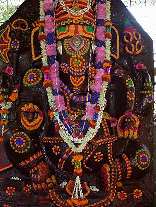
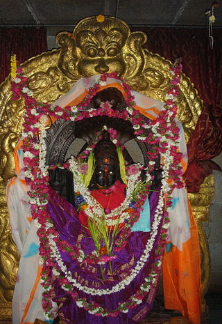
Pavagada is a town and a taluk in the Tumkur district of Karnataka, India. Historically it was part of the Mysore kingdom. Though it is geographically connected to Chitradurga district inside state of Karnataka, it comes under Tumkur district. It is 157.8 km from state capital of Bengaluru. Uttara Pinakini river flows into this Taluk. Pavagada Taluk falls on the border of Karnataka, hence a majority of the population are bilingual speaking Kannada and Telugu. The town is famous for its fort located on the hill, Kote Anjaneya temple at the foothills and also the temple of Sri Shani Mahatma.
Tarikere is a town, a taluk and is one of the two Subdivisional headquarter in the Chikmagalur district of Karnataka state, India. It is popularly known as gateway of Malnad because the Malnad area starts from here. The town's name is derived from the number of water tanks which surround it.

Thipatooru (Tiptur) is a city in the southern part of the state of Karnataka, India. It is one of the three sub-divisional headquarters of Tumkur district in Karnataka. Capital city Bangalore is 140 km from Thipatooru. Thipatooru city is known for its coconut plantations.

Turuvekere is a panchayat town and Taluk in Tumakuru district in the Indian state of Karnataka.
Nonavinakere is located in Tumkur District of Karnataka. It is around 64 km south-west of Tumkur and 12 km west of Turuvekere. Its Pincode is 572224.
Malayinkeezhu is a suburb of Trivandrum, the largest city and capital of the Indian state of Kerala. It is located at the south-eastern side of Thiruvananthapuram Metropolitan Area, and is at a distance of 13 km from the heart of the city. The town is famous for the religious festival named Malayinkeezhu Aarattu. Neyyar Wildlife Sanctuary, one of the major tourist destinations in Thiruvananthapuram district is situated 17 km away from the town. The nearest airport is Trivandrum International Airport (16 km) and Balaramapuram Railway Station (9.1 km) is the nearest Railway Station. The Pincode of Malayinkeezhu Post Office is 695571 which comes under the postal circle of Neyyattinkara region.
Huliyar is a town in the southern state of Karnataka, India. It is located in the Chiknayakanhalli taluk of Tumakuru district in Karnataka. It is 42 km (26 mi) from its sub-divisional headquarters, Tiptur and 90 km (56 mi) from district headquarter Tumakuru.
Bajagur is a village in Tiptur Taluk in Tumkur district of Karnataka, India. It is situated on the southern side of the state of Karnataka.
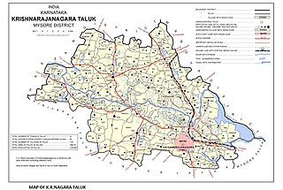
Saligrama is a new sub-district of Mysore district, situated on the northern bank of the river Cauvery [Kaveri]. This place is esteemed as sacred by the Shri Vaishnavas on account of its having been the residence of Sri Ramanujacharya. It is the headquarters of Saligrama Taluk. It was established as a new taluk carving out of K.R.Nagar taluk with effect from 31.12.2020 and become ninth taluk of Mysore district of Karnataka, India.
Mudigere is a village in Gubbi taluk in the Tumkur district in the Indian state of Karnataka.
Kammanahalli is a small village located in Tumkur District, Turuvekere Taluk, Mayasandra Hobli and Vittalapura Post in India's Karnataka State. The village is about 12 km from Yadiyur which is famous for the Lord Siddalingeshwara Temple and is about 100 km from Bangalore.

