Related Research Articles

Mandasa is a village in Srikakulam district of the Indian state of Andhra Pradesh. Mandasa is also known by the name Manjusha in Odia. It was ruled by erstwhile odia zamindar Rajamani royal family during British Raj. Srinivasa Rajamani was the famous Ruling chief Rajah of this estate.

Chittoor district is one of the eight districts in the Rayalaseema region of the Indian state of Andhra Pradesh. It had a population of 18,72,951 at the 2011 census of India. It is a major market centre for mangoes, grains, sugarcane, and peanuts. The district headquarters is at Chittoor City. The major cities/towns in the district are Chittoor, Punganur, Nagari, Palamaner, and Kuppam.

Srikakulam district is one of the twenty-six districts of the Indian state of Andhra Pradesh, located in the Uttarandhra region of the state, with its headquarters located at Srikakulam. It is one of the six districts, located in the extreme northeastern direction of the state. It was formerly known as Chicacole, and was under Ganjam district till 1 April 1936, then merged under Vizagapatam district. Srikakulam district forms the core area of Kalinga where most of its historical capitals like Kalinganagari, pithunda, Dantapuram are located.

Ichchapuram is a town in the Srikakulam district of the Indian state of Andhra Pradesh. The town is located nearly 142 km from the district capital, Srikakulam. It is located on the border of Odisha and Andhra Pradesh. Ichchapuram municipality is the largest urban local body in the Srikakulam district. It had a population of 36,493 as of 2011.
{{Infobox settlement | name = Kandukur | native_name = | native_name_lang = | other_name = | settlement_type = Town | image_skyline = | image_alt = | image_caption = | nickname = | pushpin_map = India Andhra Pradesh#India | pushpin_label_position = right | pushpin_map_alt = | pushpin_map_caption = Location in Andhra Pradesh, India | pushpin_mapsize = 200 | coordinates = 15.2166650°N 79.9042°E | subdivision_type = Country | subdivision_name = India | subdivision_type1 = State | subdivision_type2 = District | subdivision_name1 = Andhra Pradesh | subdivision_name2 = SPSR Nellore | established_title = | established_date = | founder = | named_for = | government_type = Municipal Council | governing_body = Kandukuru Municipal Council | leader_title1 = Chairman | leader_name1 = Vacant | leader_title2 = Deputy Chairman | leader_name2 = Vacant | leader_title3 = MLA | leader_name3 = Inturi Nageswar Rao (TDP) | leader_title4 = MP | leader_name4 = [[Vemireddy Prabakar reddy]{TDP}]] | unit_pref = Metric | area_footnotes = | area_total_km2 = 33.06 | area_rank = | elevation_footnotes = | elevation_m = | population_total = 57,246 | population_as_of = 2011 | population_footnotes = | population_density_km2 = auto | population_rank = 26th (Towns in AP) | population_demonym = | timezone1 = IST | utc_offset1 = +5:30 | postal_code_type = PIN | postal_code = 523 105 | registration_plate = | website = | footnotes = | image_map = | map_alt = Dynamic map of village | map_caption = Dynamic map }} Kandukur or Kandukuru is a town in SPSR Nellore district of the Indian state of Andhra Pradesh. It is a municipality and the headquarters of Kandukur mandal as well as Kandukur revenue division. Kandukur Mandal is located at the south-east side of the Prakasam District having geographical area around 225 km2.There is only 1 city in the Kandukur Mandal, which is Kandukur Municipality having an area of 37.63 km2.
Vuyyuru is a town in Krishna district of the Indian state of Andhra Pradesh. It is a Nagar panchayat and the headquarters of Vuyyuru Mandal. It is emerging as neighbourhood of Vijayawada, India situated 30 km away.

Pakala is a town in Tirupati district of the Indian state of Andhra Pradesh. It is the mandal headquarters of Pakala mandal. It comes under Tirupati revenue division.

Narasannapeta is a census town in Srikakulam district of the Indian state of Andhra Pradesh. It is the mandal headquarters of Narasannapeta mandal in Srikakulam revenue division. 43 villages are there under the administrative division of Narasannapeta.

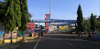
Palasa is one of the twin towns located in the Srikakulam district of Andhra Pradesh, India. The town is situated between Srikakulam and Berhampur. It is categorized as the second grade municipality. Also the town serves as the headquarters of Palasa Mandal.

Pathapatnam is a town in Srikakulam district of the Indian state of Andhra Pradesh. It is located in Pathapatnam mandal of Tekkali revenue division. Telugu is the major spoken language in the town and in entire mandal. Pathapatnam is located on the border of Srikakulam district of Andhra Pradesh and Gajapati district of Odisha. Parlakhemundi, the headquarters of Gajapati District, can be considered as twin town of Pathapatnam because of its close proximity. It is located around 65 km from srikakulam. It was the old capital of Paralakhemundi Gajapati Maharajah of his erstwhile kingdom.

Tekkali is a census town in Srikakulam district of the Indian state of Andhra Pradesh. It is the mandal headquarters of Tekkali mandal and Tekkali revenue division and is located at a distance of 51 km from the district headquarters.
Harichandapuram is an Indian village and panchayat, located in Kotabommali mandal in Srikakulam district, Andhra Pradesh, India.
Kanigiri is a town in Prakasam district of the Indian state of Andhra Pradesh. It is a municipality and the headquarters of Kanigiri mandal in Kanigiri revenue division.

Podili is a Municipality Town in Prakasam district of the Indian state of Andhra Pradesh. It is the mandal headquarters of Podili mandal. Podili is also known as Prudulapuri. Before British rule its name was "Prudulapuri" meaning "Head quarters of the universe". There is purana reference to this related to Prudhu Chakravarthi.
Haripuram is a village in Mandasa mandal of Srikakulam district, Andhra Pradesh, India.

Kasibugga is a twin-town in Srikakulam district of the Indian state of Andhra Pradesh. It is a municipality and the part in mandal of Palasa.
Badagam is a small village in the Rayagada Block and Parlakhemundi municipality in Gajapati district in the Indian state of Odisha. The major languages spoken in this place are Kui and Oriya.
Anakapalli mandal is one of the mandals in located in Anakapalli district of the state of Andhra Pradesh, India. It is administered under Anakapalli revenue division and its headquarters are located at Anakapalli. It is bounded by Kasimkota Mandal towards west, Munagapaka Mandal towards South, Paravada Mandal towards East, Achutapuram Mandal towards South.

Jarjangi is a Panchayath village in Kotabommali mandal, Srikakulam district, in the Indian state of Andhra Pradesh. The Postal Index Code of this village is 532195.

Annamayya district is one of the eight districts in the Rayalaseema region of Andhra Pradesh, established in 2022. Rayachoti serves as the district's administrative headquarters, while Madanapalle is the most populous city in the district.
References
- ↑ "Railway station". indianrailways. Retrieved 25 October 2017.
- ↑ "National Highways Development Project Map". National Highways Authority of India. Archived from the original on 22 April 2017. Retrieved 21 April 2017.