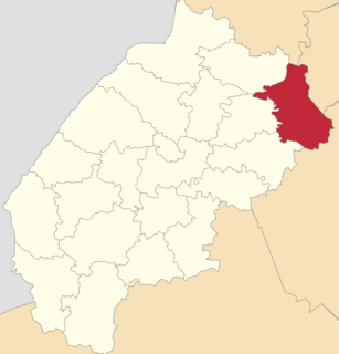
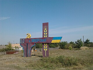
Kapustyntsi, Boryspil Raion, Kyiv Oblast

Last updated

Kapustyntsi is an old Cossack village in Boryspil Raion of Kyiv Oblast, in Ukraine. It belongs to Yahotyn urban hromada, one of the hromadas of Ukraine. [1]

Contents

Until 18 July 2020, Kapustyntsi belonged to Yahotyn Raion. The raion was abolished that day as part of the administrative reform of Ukraine, which reduced the number of raions of Kyiv Oblast to seven. The area of Yahotyn Raion was merged into Boryspil Raion. [2] [3]

History

The region where the village is situated has a history which has links with the cultures of Scythia, Eurasian Steppe, Reuss, Great Horde, and Cossack culture (which emerged in region in that times).

Kapustyntsi on a map of Boplan in 1650 Kapustynci-Boplan-1650.jpg
Kapustyntsi on a map of Boplan in 1650

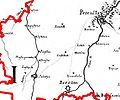
The village's earliest mention was in the mid-17th Century, in the map of Boplan (left).

Russian Empire

During the time of the Russian Empire, Kapustyntsi was registered as a cossack village a village, where registry cossacks constituted most part of population and simple, registry Christians (serfs) - minority.

Beginnings of Ukrainian Republic, 1917-1923

Mykola Vasyl's son Chalenko (1902 - 1921) - Kapustynci citizen, partisan and policeman of Ukrainian Christian Cossack origin, killed by village gang in 1921 in Berezan near Pereiaslav city, Ukraine Chalenko-Mikola-Vasil'ovich-1917-2.jpg
Mykola Vasyl's son Chalenko (1902 - 1921) - Kapustynci citizen, partisan and policeman of Ukrainian Christian Cossack origin, killed by village gang in 1921 in Berezan near Pereiaslav city, Ukraine

After the abdication of czar and formal transformation of Russian Empire into Republic, Ukrainian Republic was proclaimed. The struggle for freedom and democracy, for new forms of government continued. This period of the village history is described in the book of Ivan Kozub "Doba i dolya" ("Epoch and destiny") of local origin.

During the civil war and struggle for democracy on the territories of former Russian Empire and new Ukrainian Republic of 1917-1923, many citizens of the village were murdered by different bandits and bandit gangs, almost all of whom claimed themselves revolutionaries.

In 1917-1923 the region and localities of the village became arena of struggle between different political and military forces, emerged on the territory of former Russian Empire. Among others - armies of Ukrainian Republic, Insurgentary Army of Ukraine of Nestor Makhno, local armies of village atamans, army of "white" general Denikin, formations of Red Army etc.

During Denikin occupation some citizens of the village were killed for supporting Ukrainian Republic and soviet government and others took arms and began to fight with forces of Denikin army for freedom and democracy in the region under yellow-blue and red flags or even flags yellow-blue from one side and red from another (see book of Kozub).

But step by step new soviet, more democratic than previous, forms of government emerged, soviet police (militia) began to work and during 1919-1923 those gangs disappeared in some or other ways. During this period some citizens of the village were killed. One for participating in gangs, while others for their service in new police (militia), among them for example Mykola Chalenko (1902-1921).

Ukrainian Republic before Great Patriotic War, 1921-1941

During 1921-1941 newly born Ukrainian Republic became part of Soviet Union, state and union of states emerged in the Central Eurasia, on the territories of former Russian Empire.

It was period of intensive development of seeking and building of new forms of government and management in state, economic, military, cultural, education spheres. Many originees of the village took active part in this social processes. They began to serve society in all possible ways - established collective economies and farms, built schools and hospitals, studied in schools, universities and institutes, served in army. But during this period there were a lot of troubles, sins and crimes - Great Famine caused first of all by ineffective management and inadequate social and economic policy of new soviet leaders, destruction of ancient churches and temples, which constituted important part of historical-cultural heritage of Ukrainian Soviet people, prohibition of social activities of religious communities etc.

Prominent people born in Kapustyntsi

Among the notable births in Kapustyntsi are:

Notable residents

Among the notable residents in Kapustyntsi are:

Monuments

There are three monuments in Kapustyntsi, they are:

Photo

Related Research Articles

<span class="mw-page-title-main">Baturyn</span> Urban locality in Chernihiv Oblast, Ukraine

Batúryn, is a historic town in Chernihiv Oblast (province) of northern Ukraine. It is located in Nizhyn Raion (district) on the banks of the Seym River. Baturyn lost its city status in 1923 and received it back only in 2008. It hosts the administration of Baturyn urban hromada, one of the hromadas of Ukraine. Population: 2,458

<span class="mw-page-title-main">Kozelets</span> Urban locality in Chernihiv Oblast, Ukraine

Kozelets is an urban-type settlement in Chernihiv Raion, Chernihiv Oblast (province) of northern Ukraine. It hosts the administration of Kozelets settlement hromada, one of the hromadas of Ukraine. Kozelets is located on the Oster River, a tributary of the Dnieper. Population: 7,646

<span class="mw-page-title-main">Dvirkivshchyna</span>

Dvirkivshchyna is a small Ukrainian village located in Boryspil Raion of Kyiv Oblast, 130 km east of the Ukrainian capital. It lays close to the city of Yahotyn. Dvirkivshchyna belongs to Yahotyn urban hromada, one of the hromadas of Ukraine. It also is an administrative seat of local rural community (silrada) which includes four village including Dvirkivshchyna. The community was formed in 1984 out of a state farm.

<span class="mw-page-title-main">Zboriv</span> City in Ternopil Oblast, Ukraine

Zboriv is a town in Ternopil Raion of Ternopil Oblast, west Ukraine. It is located in the historical region of Galicia. Local government is administered by Zboriv town council. Zboriv hosts the administration of Zboriv urban hromada, one of the hromadas of Ukraine. Population: 6,664

<span class="mw-page-title-main">Kopychyntsi</span> City in Ternopil Oblast, Ukraine

Kopychyntsi is a small city in Chortkiv Raion, Ternopil Oblast, Ukraine. It hosts the administration of Kopychyntsi urban hromada, one of the hromadas of Ukraine. Kopychyntsi is the birthplace of Vasyl Ivanchuk, a chess grandmaster; Israel Jacob Kligler, who led the effort of eradicating malaria in Mandatory Palestine; and Pinhas Lavon, an Israeli politician. Population: 6,587

<span class="mw-page-title-main">Monastyryska</span> City in Ternopil Oblast, Ukraine

Monastyryska is a town in Chortkiv Raion, Ternopil Oblast, Ukraine. In 2001, the population was 6,344. The town is situated on the river Koropets, 15 km (9.32 mi) from Buchach, 140 km (86.99 mi) south-east from Lviv, on the road between Ternopil or Berezhany and Ivano-Frankivsk. The river Koropets forms a wide lake. Monasteryska borders Hryhoriv and Bertnyky on the east, Ozekhiv on the south, Vycholky and Stara Huta on the west, Nova Huta, Shveykiv and Kovalivka on the north. It hosts the administration of Monastyryska urban hromada, one of the hromadas of Ukraine. Population: 5,492

<span class="mw-page-title-main">Yahotyn</span> City in Kyiv Oblast, Ukraine

Yahotyn is a city in Boryspil Raion, Kyiv Oblast (region) of Ukraine. It hosts the administration of Yahotyn urban hromada, one of the hromadas of Ukraine. In 2001, population was 23,659. The current population is 19,270

<span class="mw-page-title-main">Pomichna</span> City in Kirovohrad Oblast, Ukraine

Pomichna is a city in Novoukrainka Raion, Kirovohrad Oblast (region) of Ukraine. It hosts the administration of Pomichna urban hromada, one of the hromadas of Ukraine. Population: 8,750

<span class="mw-page-title-main">Baryshivka Raion</span> Former subdivision of Kyiv Oblast, Ukraine

Baryshivka Raion was a raion in east-central Kyiv Oblast (province) of Ukraine. Its administrative center was the urban-type settlement of Baryshivka. The raions area totaled 957.6 km². The raion was formerly known as Baryshivska Rairada from 1923 to 1963. The raion was abolished on 18 July 2020 as part of the administrative reform of Ukraine, which reduced the number of raions of Kyiv Oblast to seven. The area of Baryshivka Raion was merged into Brovary Raion. The last estimate of the raion population was 34,577 .

<span class="mw-page-title-main">Bila Tserkva Raion</span> Subdivision of Kyiv Oblast, Ukraine

Bila Tserkva Raion is a raion (district) in Kyiv Oblast of Ukraine. Its administrative center is the city of Bila Tserkva. Population: 436,115 .

<span class="mw-page-title-main">Boryspil Raion</span> Subdivision of Kyiv Oblast, Ukraine

Boryspil Raion is an administrative raion (district) in east-central Kyiv Oblast of Ukraine. Its administrative center is the city of Boryspil. Population: 203,273 .

<span class="mw-page-title-main">Yahotyn Raion</span> Former subdivision of Kyiv Oblast, Ukraine

Yahotyn Raion was a raion (district) in Kyiv Oblast of Ukraine. Its administrative center was the town of Yahotyn. The raion was abolished on 18 July 2020 as part of the administrative reform of Ukraine, which reduced the number of raions of Kyiv Oblast to seven. The area of Yahotyn Raion was merged into Boryspil Raion. The last estimate of the raion population was 31,624 .

<span class="mw-page-title-main">Brody Raion</span> Former subdivision of Lviv Oblast, Ukraine

Brody Raion was a raion (district) of Lviv Oblast (region) of Western Ukraine. Its administrative center was Brody. The raion was abolished on 18 July 2020 as part of the administrative reform of Ukraine, which reduced the number of raions of Lviv Oblast to seven. The area of Brody Raion was merged into Zolochiv Raion. The last estimate of the raion population was 57,457 .

<span class="mw-page-title-main">Sambir Raion</span> Subdivision of Lviv Oblast, Ukraine

Sambir Raion is a raion in Lviv Oblast in western Ukraine. Its administrative center is Sambir. Population: 224,126 . It was established in 1965.

<span class="mw-page-title-main">Novi Strilyshcha</span> Urban locality in Lviv Oblast, Ukraine

Novi Strilyshcha is an urban-type settlement in Stryi Raion, Lviv Oblast (region) of western Ukraine. It belongs to Bibrka urban hromada, one of the hromadas of Ukraine. Local government is administered by Novi Strilyshcha settlement council. Population: 780 .

<span class="mw-page-title-main">Boryspil</span> City in Kyiv Oblast, Ukraine

Boryspil is a city and the administrative center of Boryspil Raion in Kyiv Oblast (region) in northern (central) Ukraine. It hosts the administration of Boryspil urban hromada, one of the hromadas of Ukraine. The population was estimated as 63,674

<span class="mw-page-title-main">Bohuslav</span> City in Kyiv Oblast, Ukraine

Bohuslav is a city on the Ros River in Obukhiv Raion, Kyiv Oblast (province) of Ukraine. Population: 15,975 . It hosts the administration of Bohuslav urban hromada, one of the hromadas of Ukraine. The population in 2001 was 17,135.

<span class="mw-page-title-main">Zaporizke, Sofiivka settlement hromada, Kryvyi Rih Raion, Dnipropetrovsk Oblast</span> Village in Dnipropetrovsk Oblast, Ukraine

Zaporizke is a village in Ukraine, in Kryvyi Rih Raion of Dnipropetrovsk Oblast (region). The local body is the Zaporizke village council. Zaporizke belongs to Sofiivka settlement hromada, one of the hromadas of Ukraine. The population is 629 residents.

Bohdanivka is a village in Boryspil Raion in the east of Kyiv Oblast, Ukraine. It belongs to Yahotyn urban hromada, one of the hromadas of Ukraine.

Glanyshiv is a Ukrainian village in Boryspil Raion, Kyiv Oblast. It belongs to Pereiaslav urban hromada, one of the hromadas of Ukraine. As of 2001, it had a population of 855.

References

  1. "Яготинская городская громада" (in Russian). Портал об'єднаних громад України.
  2. "Про утворення та ліквідацію районів. Постанова Верховної Ради України № 807-ІХ". Голос України (in Ukrainian). 2020-07-18. Retrieved 2020-10-03.
  3. "Нові райони: карти + склад" (in Ukrainian). Міністерство розвитку громад та територій України.

Coordinates: 50°04′22″N31°52′38″E / 50.07278°N 31.87722°E / 50.07278; 31.87722