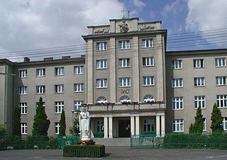
Gmina Ożarów Mazowiecki is an urban-rural gmina in Warsaw West County, Masovian Voivodeship, in east-central Poland. Its seat is the town of Ożarów Mazowiecki, which lies approximately 14 kilometres (9 mi) west of Warsaw.
Gołaszew is a village in the administrative district of Gmina Ożarów Mazowiecki, within Warsaw West County, Masovian Voivodeship, in east-central Poland. It lies approximately 6 kilometres (4 mi) west of Ożarów Mazowiecki and 20 km (12 mi) west of Warsaw.

Konotopa is a village in the administrative district of Gmina Ożarów Mazowiecki, within Warsaw West County, Masovian Voivodeship, in east-central Poland. It lies approximately 3 kilometres (2 mi) south-east of Ożarów Mazowiecki and 13 km (8 mi) west of Warsaw.
Koprki is a village in the administrative district of Gmina Ożarów Mazowiecki, within Warsaw West County, Masovian Voivodeship, in east-central Poland. It lies approximately 5 km (3 mi) west of Ożarów Mazowiecki and 19 km (12 mi) west of Warsaw.
Kręczki is a village in the administrative district of Gmina Ożarów Mazowiecki, within Warsaw West County, Masovian Voivodeship, in east-central Poland. It lies approximately 3 kilometres (2 mi) north-west of Ożarów Mazowiecki and 15 km (9 mi) west of Warsaw.
Macierzysz is a village in the administrative district of Gmina Ożarów Mazowiecki, within Warsaw West County, Masovian Voivodeship, in east-central Poland. It lies approximately 5 kilometres (3 mi) east of Ożarów Mazowiecki and 10 km (6 mi) west of Warsaw.
Michałówek is a village in the administrative district of Gmina Ożarów Mazowiecki, within Warsaw West County, Masovian Voivodeship, in east-central Poland. It lies approximately 6 kilometres (4 mi) west of Ożarów Mazowiecki and 19 km (12 mi) west of Warsaw.
Myszczyn is a village in the administrative district of Gmina Ożarów Mazowiecki, within Warsaw West County, Masovian Voivodeship, in east-central Poland. It lies approximately 9 kilometres (6 mi) west of Ożarów Mazowiecki and 22 km (14 mi) west of Warsaw.
Ołtarzew is a village in the administrative district of Gmina Ożarów Mazowiecki, within Warsaw West County, Masovian Voivodeship, in east-central Poland. It lies approximately 2 kilometres (1 mi) west of Ożarów Mazowiecki and 15 km (9 mi) west of Warsaw.
Ożarów is a village in the administrative district of Gmina Ożarów Mazowiecki, within Warsaw West County, Masovian Voivodeship, in east-central Poland. It lies approximately 3 kilometres (2 mi) east of Ożarów Mazowiecki and 12 km (7 mi) west of Warsaw.
Pilaszków is a village in the administrative district of Gmina Ożarów Mazowiecki, within Warsaw West County, Masovian Voivodeship, in east-central Poland. It lies approximately 9 kilometres (6 mi) west of Ożarów Mazowiecki and 23 km (14 mi) west of Warsaw.
Piotrkówek Duży is a village in the administrative district of Gmina Ożarów Mazowiecki, within Warsaw West County, Masovian Voivodeship, in east-central Poland. It lies approximately 2 kilometres (1 mi) east of Ożarów Mazowiecki and 13 km (8 mi) west of Warsaw.
Pogroszew is a village in the administrative district of Gmina Ożarów Mazowiecki, within Warsaw West County, Masovian Voivodeship, in east-central Poland. It lies approximately 5 kilometres (3 mi) west of Ożarów Mazowiecki and 19 km (12 mi) west of Warsaw.
Pogroszew-Kolonia is a village in the administrative district of Gmina Ożarów Mazowiecki, within Warsaw West County, Masovian Voivodeship, in east-central Poland. It lies approximately 6 kilometres (4 mi) west of Ożarów Mazowiecki and 19 km (12 mi) west of Warsaw.
Strzykuły is a village in the administrative district of Gmina Ożarów Mazowiecki, within Warsaw West County, Masovian Voivodeship, in east-central Poland. It lies approximately 3 kilometres (2 mi) north-east of Ożarów Mazowiecki and 13 km (8 mi) west of Warsaw.
Święcice is a village in the administrative district of Gmina Ożarów Mazowiecki, within Warsaw West County, Masovian Voivodeship, in east-central Poland. It lies approximately 8 kilometres (5 mi) west of Ożarów Mazowiecki and 21 km (13 mi) west of Warsaw.
Szeligi is a village in the administrative district of Gmina Ożarów Mazowiecki, within Warsaw West County, Masovian Voivodeship, in east-central Poland. It lies approximately 5 kilometres (3 mi) east of Ożarów Mazowiecki and 10 km (6 mi) west of Warsaw.
Umiastów is a village in the administrative district of Gmina Ożarów Mazowiecki, within Warsaw West County, Masovian Voivodeship, in east-central Poland. It lies approximately 5 kilometres (3 mi) north-west of Ożarów Mazowiecki and 17 km (11 mi) west of Warsaw.
Wieruchów is a village in the administrative district of Gmina Ożarów Mazowiecki, within Warsaw West County, Masovian Voivodeship, in east-central Poland. It lies approximately 3 kilometres (2 mi) north-east of Ożarów Mazowiecki and 13 km (8 mi) west of Warsaw.
Wolica is a village in the administrative district of Gmina Ożarów Mazowiecki, within Warsaw West County, Masovian Voivodeship, in east-central Poland. It lies approximately 8 kilometres (5 mi) west of Ożarów Mazowiecki and 22 km (14 mi) west of Warsaw.

