
Osh Region is a region (oblast) of Kyrgyzstan. Its capital is Osh, which is not part of the region. It is bounded by (clockwise) Jalal-Abad Region, Naryn Region, China (Xinjiang), Tajikistan, Batken Region, and Uzbekistan. Its total area is 28,934 km2 (11,171 sq mi). The resident population of the region was 1,391,649 as of January 2021. The region has a sizeable Uzbek minority.

Ak-Tash is a village in Osh Region of Kyrgyzstan. It is part of the Kara-Suu District. Its population was 5,148 in 2021. It is on the border with Uzbekistan, 7 km southwest of Kara-Suu.
Chauvay is a village in Kadamjay District of Batken Region of Kyrgyzstan. It was established in regard with the extraction of mercury and antimony in 1947. Its population was 1,636 in 2021. Until 2012 it was an urban-type settlement.
Jangy-Kyshtak is a village in Osh Region of Kyrgyzstan. It is part of the Kara-Suu District. Its population was 11,647 in 2021.
Kyrgyz-Chek is a village in Osh Region of Kyrgyzstan. It is part of the Kara-Suu District. Its population was 6,196 in 2021.
Kashgar-Kyshtak is a village, center of Kashgar-Kyshtak rural community in Kara-Suu District of Osh Region of Kyrgyzstan. Its population was 20,334 in 2021. Ancient settlement Kashgar-Kyshtak is located in proximity to the village.
Jangy-Aryk is a village in the Osh Region of Kyrgyzstan. It is part of the Kara-Suu District. Its population was 6,693 in 2021.
Kara-Kulja is the center of Kara-Kulja District in Osh Region of Kyrgyzstan.
Kara-Köl is a city in Jalal-Abad Region of Kyrgyzstan. It is a city of regional significance, not part of a district. Its area is 1,050 square kilometres (410 sq mi), and its resident population was 26,901 in 2021. Kara-Köl consists of the town proper, the urban-type settlement Ketmen-Töbö and the village Jazy-Kechüü.

Batken is a district of Batken Region in south-western Kyrgyzstan. Its area is 5,948 square kilometres (2,297 sq mi), and its resident population was 91,983 in 2021. The administrative seat lies at the city Batken, itself not part of the district.

Toktogul is a district of Jalal-Abad Region in western Kyrgyzstan. The administrative seat lies at Toktogul. Its area is 7,815 square kilometres (3,017 sq mi), and its resident population was 103,310 in 2021.

At-Bashy is a district of Naryn Region in Kyrgyzstan. The administrative center is at At-Bashy. Its area is 15,354 square kilometres (5,928 sq mi), and its resident population was 55,771 in 2021. The mountain lake Chatyr-Kul lies in the southwestern part of the district.

Kochkor is a district of Naryn Region in northern-central Kyrgyzstan. The administrative seat lies at Kochkor. Its area is 5,868 km2 (2,266 sq mi), and its resident population was 67,363 in 2021.
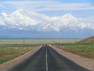
Alay is a district of Osh Region in south-western Kyrgyzstan. The capital lies at Gülchö. The Alay District borders with China in the east, Tajikistan in the south, Chong-Alay District in the west, Nookat District in the north-west, Kara-Suu District and Özgön District in the north, and Kara-Kulja District in the north-east. Its area is 6,821 square kilometres (2,634 sq mi), and its resident population was 87,398 in 2021.

Kara-Kulja is a district of Osh Region in south-western Kyrgyzstan. Its area is 5,813 square kilometres (2,244 sq mi), and its resident population was 100,320 in 2021. The administrative seat lies at Kara-Kulja.

Kara-Buura is a district of Talas Region, in north-western Kyrgyzstan. Its area is 4,216 square kilometres (1,628 sq mi), and its resident population was 69,180 in 2021. The administrative seat lies at Kyzyl-Adyr.
Jiydalik is a village in Osh Region of Kyrgyzstan. It is part of the Kara-Suu District. Its population was 5,422 in 2021.
Kyzyl-Shark is a village in Osh Region of Kyrgyzstan. It is part of the Kara-Suu District. Its population was 6,102 in 2021.
Kirov is a village in Osh Region of Kyrgyzstan. It is part of the Kara-Suu District. Its population was 8,719 in 2021.
Shark is a village in Osh Region of Kyrgyzstan. It is part of the Kara-Suu District. Its population was 21,120 in 2021.

