Coromandel, also called Coromandel Town to distinguish it from the wider district, is a town on the Coromandel Harbour, on the western side of the Coromandel Peninsula, which is in the North Island of New Zealand. It is 75 kilometres east of the city of Auckland, although the road between them, which winds around the Firth of Thames and Hauraki Gulf coasts, is 190 km long. The population was 1,890 as of June 2021.

Pukekohe is a town in the Auckland Region of the North Island of New Zealand. Located at the southern edge of the Auckland Region, it is in South Auckland, between the southern shore of the Manukau Harbour and the mouth of the Waikato River. The hills of Pukekohe and nearby Bombay Hills form the natural southern limit of the Auckland region. Pukekohe is located within the political boundaries of the Auckland Council, following the abolition of the Franklin District Council on 1 November 2010.

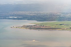
Waiuku is a rural town in the Auckland Region in the North Island of New Zealand. It is located at the southern end of the Waiuku River, which is an estuarial arm of the Manukau Harbour, and lies on the isthmus of the Āwhitu Peninsula, which extends to the northeast. It is 40 kilometres southwest of Auckland city centre, and 12 kilometres north of the mouth of the Waikato River.

Ngāpuhi is a Māori iwi associated with the Northland region of New Zealand and centred in the Hokianga, the Bay of Islands, and Whangārei.

Ngāti Whātua is a Māori iwi (tribe) of the lower Northland Peninsula of New Zealand's North Island. It comprises a confederation of four hapū (subtribes) interconnected both by ancestry and by association over time: Te Uri-o-Hau, Te Roroa, Te Taoū, and Ngāti Whātua-o-Ōrākei. The four hapū can act together or separately as independent tribes.
Ruatoria is a town in the Waiapu Valley of the Gisborne Region in the northeastern corner of New Zealand's North Island. The town was originally known as Cross Roads then Manutahi and was later named Ruatorea in 1913, after the Māori Master female grower Tōrea who had some of the finest storage pits in her Iwi at the time. In 1925 the name was altered to "Ruatoria", although some texts retain the original spelling.

Kawhia Harbour is one of three large natural inlets in the Tasman Sea coast of the Waikato region of New Zealand's North Island. It is located to the south of Raglan Harbour, Ruapuke and Aotea Harbour, 40 kilometres southwest of Hamilton. Kawhia is part of the Ōtorohanga District Council and is in the King Country. It has a high-tide area of 68 km2 (26 sq mi) and a low-tide area of 18 km2 (6.9 sq mi). Te Motu Island is located in the harbour.
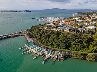
Ōrākei is a suburb of Auckland city, in the North Island of New Zealand. It is located on a peninsula five kilometres to the east of the city centre, on the shore of the Waitematā Harbour, which lies to the north, and Hobson Bay and Ōrākei Basin, two arms of the Waitematā, which lie to the west and south. To the east is the suburb of Mission Bay. Takaparawhau / Bastion Point is a coastal piece of land in Ōrākei. Between Takaparawhau and Paritai Drive is Ōkahu Bay and Reserve.

Māngere or Mangere is one of the largest suburbs in Auckland, in northern New Zealand. It is located on mainly flat land on the northeastern shore of the Manukau Harbour, to the northwest of Manukau City Centre and 15 kilometres south of the Auckland city centre. It is the location of Auckland Airport, which lies close to the harbour's edge to the south of the suburb.
Taipa-Mangonui or Taipa Bay-Mangonui is a string of small resort settlements – Taipa, Cable Bay, Coopers Beach, and Mangōnui – that lie along the coast of Doubtless Bay and are so close together that they have run together to form one larger settlement.
Waikato Tainui, Waikato or Tainui is a group of Māori iwi based in Waikato Region, in the western central region of New Zealand's North Island. It is part of the larger Tainui confederation of Polynesian settlers who arrived to New Zealand on the Tainui waka. The tribe is named after the Waikato River, which plays a large part in its history and culture.
Ngāti Mahuta is a sub-tribe of the Waikato tribe of Māori in the North Island of New Zealand. The territory (rohe) of Ngāti Mahuta is the Kawhia and Huntly areas of the Waikato region.

Ahipara is a town and locality in Northland, New Zealand at the southern end of Ninety Mile Beach, with the Tauroa Peninsula to the west and Herekino Forest to the east. Ahipara Bay is to the north west. Kaitaia is 14 km to the north east, and Pukepoto is between the two.

Whangape Harbour is a harbour on the west coast of Northland, New Zealand. There is a settlement called Whangape on the northern side of the harbour. Another, called Pawarenga, is located on the southern side. Kaitaia is 42 km north east.

Te Aitanga-a-Mahaki is one of the three principal Māori iwi of the Tūranga district; the others being Rongowhakaata and Ngai Tamanuhiri. It is numerically the largest of the three, with 6,258 affiliated members as of 2013.
Onewhero is a village and rural community in the Waikato District and Waikato region of New Zealand's North Island. The village had a population of about 390 in the 2018 New Zealand census;

Ngāti Tamaoho is a Māori iwi (tribe) of Auckland and the Waikato District of New Zealand. It is part of the Waiohua confederation of tribes. They have three marae, which are at Karaka, Mangatangi and Pukekohe. The tribe is a strong supporter of the Māori King Movement.

Tāmaki Māori are Māori iwi and hapū who have a strong connection to Tāmaki Makaurau, and whose rohe was traditionally within the region. Among Ngā Mana Whenua o Tāmaki Makaurau, also known as the Tāmaki Collective, there are thirteen iwi and hapū, organised into three rōpū (collectives), however Tāmaki Māori can also refer to subtribes and historical iwi not included in this list.
Hihi or Hihi Beach is a village and rural community in the Far North District and Northland Region of New Zealand's North Island.
Ngā Oho, also known as Ngā Ohomatakamokamo-o-Ohomairangi, is the name of a historical iwi (tribe) of Māori who settled in the Auckland Region. In the 17th century, Ngā Oho and two other tribes of shared heritage, Ngā Riki and Ngā Iwi, formed the Waiohua confederation of tribes.