Karlovy Vary District Okres Karlovy Vary | |
---|---|
Coordinates: 50°14′N12°59′E / 50.233°N 12.983°E | |
Country | Czech Republic |
Region | Karlovy Vary |
Capital | Karlovy Vary |
Area | |
• Total | 1,510.73 km2 (583.30 sq mi) |
Population (2024) [2] | |
• Total | 115,183 |
• Density | 76/km2 (200/sq mi) |
Time zone | UTC+1 (CET) |
• Summer (DST) | UTC+2 (CEST) |
Municipalities | 55 |
* Cities and towns | 15 |
* Market towns | 0 |
Karlovy Vary District (Czech : okres Karlovy Vary) is a district in the Karlovy Vary Region of the Czech Republic. Its capital is the city of Karlovy Vary.
Karlovy Vary District is divided into two administrative districts of municipalities with extended competence: Karlovy Vary and Ostrov.
Towns are marked in bold:
Abertamy - Andělská Hora - Bečov nad Teplou - Bochov - Boží Dar - Božičany - Bražec - Březová - Černava - Chodov - Chyše - Čichalov - Dalovice - Děpoltovice - Doupovské Hradiště – Hájek - Horní Blatná - Hory - Hroznětín - Jáchymov - Jenišov - Karlovy Vary - Kolová - Krásné Údolí - Krásný Les - Kyselka - Merklín - Mírová - Nejdek - Nová Role - Nové Hamry - Ostrov - Otovice - Otročín - Pernink - Pila - Potůčky - Pšov - Sadov - Šemnice - Smolné Pece - Stanovice - Štědrá - Stráž nad Ohří - Stružná - Teplá - Teplička - Toužim - Útvina - Valeč - Velichov - Verušičky - Vojkovice - Vrbice - Vysoká Pec - Žlutice
Part of the district area belongs to Hradiště Military Training Area.
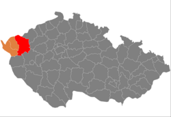
Karlovy Vary District borders Germany in the north. The character of the terrain is very diverse, the landscape alternates between mountainous, hilly and slightly undulating. The territory extends into six geomorphological mesoregions: Ore Mountains (north), Doupov Mountains (east), Sokolov Basin (west), Slavkov Forest (west), Teplá Highlands (south) and Rakovník Uplands (small part in the southeast). The highest point of the district and the entire Karlovy Vary Region is the Klínovec Mountain in Jáchymov with an elevation of 1,244 metres (4,081 ft). The lowest point is the river bed of the Ohře in Stráž nad Ohří at 305 m (1,001 ft).
From the total district area of 1,510.7 km2 (583.3 sq mi), agricultural land occupies 534.5 km2 (206.4 sq mi), forests occupy 651.3 km2 (251.5 sq mi), and water area occupies 26.5 km2 (10.2 sq mi). Forests cover 43.1% of the district's area. [1]
The most important river is the Ohře, which flows across the territory from west to northeast. Its longest tributaries within the district are the rivers Teplá and Rolava. The southern part of the district is drained by the Střela. The district is also crossed by the Černá in the north. There are no significant bodies of water. The largest body of water is the Žlutice Reservoir.
There is one protected landscape area, located in the west of the district: Slavkovský les.
|
|
| ||||||||||||||||||||||||||||||||||||||||||||||||||||||
Source: Censuses [3] [4] |
Name | Population [2] | Area (km2) |
---|---|---|
Karlovy Vary | 49,353 | 59 |
Ostrov | 15,825 | 50 |
Nejdek | 7,785 | 52 |
Nová Role | 4,244 | 14 |
Toužim | 3,492 | 99 |
Jáchymov | 2,361 | 51 |
Žlutice | 2,202 | 53 |
Hroznětín | 2,107 | 24 |
Dalovice | 1,993 | 6 |
Bochov | 1,897 | 96 |
The largest employers with headquarters in Karlovy Vary District and at least 500 employees are: [5]
Economic entity | Location | Number of employees | Main activity |
---|---|---|---|
Regional Hospital Karlovy Vary | Karlovy Vary | 2,000–2,499 | Health care |
Witte Nejdek | Nejdek | 1,500–1,999 | Manufacture of locks and hinges |
Léčebné lázně Jáchymov | Jáchymov | 500–999 | Health care |
Mattoni 1873 | Karlovy Vary | 500–999 | Manufacture of beverages |
Vodárny a kanalizace Karlovy Vary | Karlovy Vary | 500–999 | Water collection, treatment and supply |
Thun 1794 | Nová Role | 500–999 | Manufacture of porcelain |
Witte Access Technology | Ostrov | 500–999 | Manufacture of door handles |
The I/6 road, which is the unfinished section of the D6 motorway from Prague to Karlovy Vary and Cheb (part of the European route E48), passes through the district. The I/20 road (part of the European route E49) leads from Karlovy Vary to Plzeň.
Karlovy Vary Airport is located in the district. It is one of the six public international airports in the country.
The Red Tower of Death in Ostrov, the mining cultural landscape Jáchymov and the mining cultural landscape Abertamy – Boží Dar – Horní Blatná were designated UNESCO World Heritage Sites in 2019 as parts of the transnational Ore Mountain Mining Region. [6]
The historic city centre of Karlovy Vary with the spa cultural landscape was designated a UNESCO World Heritage Site in 2021 as part of the transnational Great Spa Towns of Europe because of its springs and architectural testimony to the popularity of spa towns in Europe during the 18th through 20th centuries. [7]
The most important monuments in the district, protected as national cultural monuments, are: [8]
The best-preserved settlements and landscapes, protected as monument reservations and monument zones, are: [9]
The most visited tourist destinations are the Motýlí dům tropical garden in Karlovy Vary, Bečov nad Teplou castle and chateau, Klínovec observation tower, Becherovka visitor's centre in Karlovy Vary, and botanical garden in Bečov nad Teplou. [10]
Jáchymov is a spa town in Karlovy Vary District in the Karlovy Vary Region of the Czech Republic. It has about 2,400 inhabitants.
Cheb District is a district in the Karlovy Vary Region of the Czech Republic. Its capital is the town of Cheb. It is the westernmost district of the Czech Republic.
Žďár nad Sázavou District is a district in the Vysočina Region of the Czech Republic. Its capital is the town of Žďár nad Sázavou.
Pernink is a municipality and village in Karlovy Vary District in the Karlovy Vary Region of the Czech Republic. It has about 600 inhabitants.
This is a list of German language place names in Bohemia, now exonyms for towns and villages in the Karlovy Vary Region of the Czech Republic.
Teplice District is a district in the Ústí nad Labem Region of the Czech Republic. Its capital is the city of Teplice.
Mělník District is a district in the Central Bohemian Region of the Czech Republic. Its capital is the town of Mělník.
České Budějovice District is a district in the South Bohemian Region of the Czech Republic. Its capital is the city of České Budějovice.
Plzeň-North District is a district in the Plzeň Region of the Czech Republic. Its capital is the city of Plzeň. The most populated town of the district is Nýřany.
Plzeň-South District is a district in the Plzeň Region of the Czech Republic. Its capital is the city of Plzeň. The most populated town of the district is Přeštice.
Boží Dar is a town in Karlovy Vary District in the Karlovy Vary Region of the Czech Republic. It has about 300 inhabitants. Situated in the Ore Mountains at 1,028 m (3,373 ft) above sea level, it is considered the highest town in the Czech Republic. The town is part of the Abertamy – Boží Dar Mining Landscape, which is a UNESCO World Heritage Site as part of Ore Mountain Mining Region.
Horní Blatná is a town in Karlovy Vary District in the Karlovy Vary Region of the Czech Republic. It has about 400 inhabitants. The town is historically associated with tin mining and is located in the Ore Mountain Mining Region, which is a UNESCO World Heritage Site. The historic town centre is well preserved and is protected by law as an urban monument zone.
Toužim is a town in Karlovy Vary District in the Karlovy Vary Region of the Czech Republic. It has about 3,500 inhabitants. The historic town centre is well preserved and is protected by law as urban monument zone.
Krásný Les is a municipality and village in Karlovy Vary District in the Karlovy Vary Region of the Czech Republic. It has about 300 inhabitants.
Žlutice is a town in Karlovy Vary District in the Karlovy Vary Region of the Czech Republic. It has about 2,200 inhabitants. The historic town centre is well preserved and is protected by law as urban monument zone.
The Ore Mountain Mining Region is an industrial heritage landscape, over 800 years old, in the border region of the Ore Mountains between the German state of Saxony and North Bohemia in the Czech Republic. It is characterised by a plethora of historic, largely original, monuments to technology, as well as numerous individual monuments and collections related to the historic mining industry of the region. On 6 July 2019, the Erzgebirge/Krušnohoří Mining Region was inscribed as a UNESCO World Heritage Site, because of its exceptional testimony to the advancement of mining technology over the past 800 years.
The Slavkov Forest is a highland and geomorphological mesoregion of the Czech Republic. It is located in the Karlovy Vary Region. Slavkov Forest is also the name of a protected landscape area, partially located within the highland.
The Teplá is a river in the Czech Republic, a right tributary of the Ohře River. It flows through the Karlovy Vary Region. It is 65.1 km (40.5 mi) long. The basin of the river is known for thermal springs.
Goethe's Lookout is a tower located in Karlovy Vary in the Czech Republic. It is considered an architectural folly and was built in the late 19th century.